Download
1 / 43
430 likes | 446 Views
Discover the treacherous history of the Strait of Juan de Fuca, known as the "graveyard of the Pacific," where hundreds of major marine tragedies occurred. Learn about the powerful winds, surges, and storms that have claimed numerous ships and even destroyed landmarks along the coast.

E N D
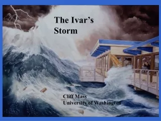
The Ivar’s Storm Cliff Mass University of Washington
The Strait of Juan de Fuca is the key water conduit between Puget Sound and the Pacific But with the convenient water passage has come great dangers…
During the days of sail, 1830 - 1925, 137 major marine tragedies occurred in the immediate vicinity of the western entrance to the Straits of Juan de Fuca
During the winter, with a low center approaching the coast and higher pressure inland, air accelerates to the west producing powerful easterly winds, reaching 60-80 mph near Tatoosh Island. High Strong Winds Low Pressure
In these situations, with higher pressure over the ocean, winds can accelerate to the east Low Pressure High Pressure
Under these conditions, Whidbey Island, Everett, and Mukilteo can be hit by fierce winds approaching hurricane force.
To get a strong Strait Surge requiresgetting several features exactly right • The passage of a strong upper level trough embedded within northwesterly flow. • Intense northwesterly winds aloft that are aligned with the axis of the Strait. • A strong front associated with low pressure and a big pressure rise behind it.
The Set up • Strong winds alofted aligned with the Strait help strengthen the surface winds, as the strong winds mix down toward the surface. E W
The Set Up • Higher pressure along the coast and lower pressure over the western interior contributes to acceleration of winds down the Strait. High Low
December 17, 1990 The Elwha Surge Washington State Ferry Elwha
The Elwha Surge • Severe westerly winds struck Everett Harbor, where some ship anemometers measured 70-80 mph winds. • The Washington State ferry Elwha was thrown against the pier by increasing wave action, destroying a wooden barrier and snapping off pilings. • Subsequently, the ferry beat against a concrete pier until the vessel’s car deck crumbled.
December 17, 1990 Seattle Times and The Snohomish County Daily Herald
The event was so noteworthy (141,000 lost power) that the local utility district even published a newspaper about it.
On October 28, 2003 another major Strait Surge occurred The Ivar’s Storm
October 28, 2003 Ivar’s Mukilteo Landing Restaurant was destroyed by wind-produced, large waves
Winds gusted to 50-70 mph over the eastern portion of the Strait for 6-9 hours
UW MM5 24-h forecast Computer models correctly forecast the winds the day before.
The strong winds, even with a limited fetch, where able to produce the wave action that destroyed the restaurant
An exciting tale By the time they came to Point No Point, the winds were hitting the Martle at 60 mph. All of a sudden, it was serious. …But then, making the turn around the point, three big swells in a row hit the Martle from the side, jolting her and sending her off course. Ed went to reduce the throttle and steady her, but the throttle didn't respond.
Soon the down throttle failed as well, and all Ed could do was to push her harder, revving the engine past stability. The floor was rising and dropping, throwing them across the cabin. And then, with his hands gripping the wheel, she felt funny. She wasn't responding like she should. That was when he knew.
The Martle had come to the flashing light buoy at Foulweather Bluff. Not half a mile from land. There were houses on the beach. A giant set of swells rose and arched toward them from the port side. "Get in the skiff, Jerry!" Ed yelled. "The Martle rolled over! Get your gear on!"
When Ed last saw the Martle, her rudder rose like a shark's fin out of the water. He turned his head and let her go. The wreck floated ghostly like that for a while and then disappeared beneath the waves. She drifted back toward Point No Point, sinking. It's guessed that the Martle rests on the clay floor of Puget Sound, somewhere in 200 feet of water, never to move, never to rise.