Hawaiian Islands High-Resolution Wind Modeling & Wave Forecast
300 likes | 390 Views
Explore daily wind models over the Hawaiian Islands and wave hindcast/forecast utilizing advanced oceanographic data. Benefit from enhanced wind fields around the island topography and wave characteristics for maritime applications.

Hawaiian Islands High-Resolution Wind Modeling & Wave Forecast
E N D
Presentation Transcript
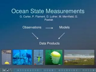
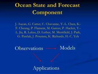
Ocean State and Forecast Component J. Aucan, G. Carter, C. Chavanne, Y.-L. Chen, K.-F. Cheung, P. Flament, M. Garces, P. Hacker, Y.-L. Jia, R. Lukas, D. Luther, M. Merrifield, J. Park, G. Pawlak, J. Potemra, K. Richards, H.-C. Yeh Models Observations Applications
Daily High-Resolution Wind Modeling over the Hawaiian Islands Yi-Leng Chen and Hsi-Chyi Yeh, Meteorology
Wind fields and interisland shipping MM5 wind speed (a) and wind direction (b) around the Hawaiian Islands (color-coded) with tugboat route (black line) between Oahu and the Big Island. Note very enhanced winds in main Alenuihaha channel Tug
Models for Wave Hindcast & Forecast Global WaveWatch 3 Regional WaveWatch3 Boussinesq Model SWAN – Littoral Wave Model K-F Cheung, ORE
Directional Wave Buoys J. Aucan, M. Merrifield, Oceanography ACE, CDIP
Kaumalapau Harbor, Lanai Harbor Conditions
Barbers Point Harbor M. Merrifield, D. Luther, J. Aucan - Oceanography
Kilo Nalu: Real-time Wave/Current Data G. Pawlak - ORE Waves(via ADCP at 10m, 20m, 20 min avg) Directional wave spectra, wave characteristics Currentsvs depth (10m, 20m, 20 min avg) Stratification Temperature vs depth (10m, 20m), Salinity (10m) KN web site products: www.soest.hawaii.edu/OE/KiloNalu
ISLA Kona Ocean Monitoring Network – KOMNet d=30m Hydrophone 3 Hydrophone + ADCP + T-Chain 100m d=30m d=80m 150m 100m Shore Station 150m ISLA 20m Hydrophone Node d=20m 100m Hydrophone d=30m
Regional Navy models: Sea surface height & temperature J. Potemra & P. Hacker, IPRC, HIGP 5/20/08 SSH 5/20/08 SST
Ocean circulation model comparisons Oahu Region, 17 Sep. 2007 • Note: • Coastline resolution • Channel resolution • Open-ocean and near-shore currents • Enhanced resolution model captures eddies. • Model output need to be • evaluated with observations.
Island of Oahu Oahu South Shore 0.02° 0.01° Y.-L. Jia, K. Richards - IPRC, Oceanography
HF Radio Currents X P. Flament, C. Chavanne - Oceanography RX antennas Ko’Olina
HF Radio currents P. Flament, C. Chavanne - Oceanography
Ocean Gliders G. Carter, Oceanography
Tidal currents G. Carter, Oceanography
Tidal elevation G. Carter, Oceanography