Download
1 / 17
170 likes | 304 Views
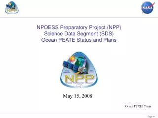
NPOESS Preparatory Project (NPP) Science Data Segment (SDS) Ocean PEATE Status and Plans. May 15, 2008. Ocean PEATE Team. SDS Level 1 Requirements.

E N D
NPOESS Preparatory Project (NPP) Science Data Segment (SDS) Ocean PEATE Status and Plans May 15, 2008 Ocean PEATE Team
SDS Level 1 Requirements • 2.1.2.1 The SDS shall be designed with the assumption that the operational IPO IDPS generated NPP EDRs do not require reprocessing or re-computation in order to support climate research needs. Consequently, the SDS will not be designed to routinely generate climate data products which require long-term archival in the ADS. • 2.1.2.3 In developing the SDS, the Project shall assume that EDRs produced by the IDPS are climate quality and put in place the capability to test that hypothesis in order to contribute to improving the quality of future EDRs. The SDS shall provide suggested algorithm improvements to the IDPS.
Primary Tasks of the Ocean PEATE • Acquire VIIRS RDRs, SDRs, and Ocean EDRs from the SD3E and ADS/CLASS • Assess the quality of the NPP Ocean EDRs for accomplishing NASA’s climate research requirements • Provide suggested algorithm improvements to the IDPS via the Project Science Working Group (PSWG) • Process selected data subsets in support of Evaluation and Validation activities
VIIRS Ocean Products for Evaluation • All VIIRS Ocean products to be evaluated will be acquired from the IDPS, ADS/CLASS, or the mini-IDPS. • Testing and evaluation of algorithm changes will require regenerating product time series in the mini-IDPS, to be downloaded to the Ocean PEATE. • The Ocean PEATE will design changes to the code in the mini-IDPS for the purpose of algorithm improvement or problem resolution, develop appropriate test cases and request runs to verify and evaluate the changes.
IDPS VIIRS Ocean EDR Data Flow Processing Module VIIRS Product VIIRS RDR Dynamic Ancillary Data Previous VIIRS Gridded Products Static Ancillary Data Previous VIIRS Gridded Products NAAPS TOD MODIS Land/Water Mask NCEP Geopotential Height Ancillary Files Ancillary Files DEM NDT
IDPS VIIRS Ocean EDR Data Flow VIIRS Geolocation VIIRS SDR Processing Module VIIRS_SDR_01 RDR Decompression VIIRS_GEO_01 Geolocation VIIRS_SDR.MOD 750m SDR VIIRS_SDR.IM 375m SDR VIIRS SDR VIIRS Product VIIRS RDR Dynamic Ancillary Data Previous VIIRS Gridded Products Static Ancillary Data Previous VIIRS Gridded Products NAAPS TOD MODIS Land/Water Mask NCEP Geopotential Height Ancillary Files Ancillary Files DEM NDT
IDPS VIIRS Ocean EDR Data Flow VIIRS Geolocation VIIRS SDR Processing Module VIIRS_SDR_01 RDR Decompression VIIRS_GEO_01 Geolocation VIIRS_SDR.MOD 750m SDR VIIRS_SDR.IM 375m SDR VIIRS SDR VIIRS Product VIIRS RDR Dynamic Ancillary Data Previous VIIRS Gridded Products Static Ancillary Data Previous VIIRS Gridded Products VIIRS_GD_08 750m Granulation NAAPS TOD MODIS Land/Water Mask VIIRS_GD_25 NAAPS Granulation NCEP Geopotential Height VIIRS_GD_27 L/W Mask Granulation Ancillary Files Ancillary Files VIIRS_GD_11 Ancillary Profile VIIRS_GD_09 GFS Granulation ALL_GD_01 Time Interpolation VIIRS_GD_28 Surface Pressure Adjustment DEM VIIRS_GD_12 Bathymetry Granulation NDT VIIRS_GD_13 Temperature Granulation
IDPS VIIRS Ocean EDR Data Flow VIIRS Geolocation VIIRS SDR Processing Module VIIRS_SDR_01 RDR Decompression VIIRS_GEO_01 Geolocation VIIRS_SDR.MOD 750m SDR VIIRS_SDR.IM 375m SDR VIIRS SDR VIIRS Product VIIRS RDR Dynamic Ancillary Data Previous VIIRS Gridded Products Static Ancillary Data Previous VIIRS Gridded Products VIIRS_GD_08 750m Granulation NAAPS TOD MODIS Land/Water Mask VIIRS_GD_25 NAAPS Granulation VIIRS_LN_06 Active Fires VIIRS_CM_01 Cloud Mask NCEP Geopotential Height VIIRS_GD_27 L/W Mask Granulation Ancillary Files Ancillary Files VIIRS_GD_11 Ancillary Profile VIIRS_GD_09 GFS Granulation ALL_GD_01 Time Interpolation VIIRS_GD_28 Surface Pressure Adjustment DEM VIIRS_GD_12 Bathymetry Granulation NDT VIIRS_GD_13 Temperature Granulation
IDPS VIIRS Ocean EDR Data Flow VIIRS Geolocation VIIRS SDR Processing Module VIIRS_SDR_01 RDR Decompression VIIRS_GEO_01 Geolocation VIIRS_SDR.MOD 750m SDR VIIRS_SDR.IM 375m SDR VIIRS SDR VIIRS Product VIIRS_SN_02 Ice Quality VIIRS RDR Dynamic Ancillary Data Previous VIIRS Gridded Products Static Ancillary Data VIIRS_CL_01 Cloud Optical Properties Previous VIIRS Gridded Products VIIRS_GD_08 750m Granulation VIIRS_ST_02 Surface Temp NAAPS TOD VIIRS_SN_03 Ice Concentration MODIS Land/Water Mask VIIRS_GD_25 NAAPS Granulation VIIRS_LN_06 Active Fires VIIRS_CM_01 Cloud Mask NCEP Geopotential Height VIIRS_GD_27 L/W Mask Granulation Ancillary Files Ancillary Files VIIRS_ST_01 Sea Surface Temperature SST EDR VIIRS_GD_11 Ancillary Profile VIIRS_GD_09 GFS Granulation VIIRS_AR_01 Aerosol Type ALL_GD_01 Time Interpolation VIIRS_GD_28 Surface Pressure Adjustment VIIRS_OC_01 Ocean Color / Chlorophyll DEM VIIRS_GD_12 Bathymetry Granulation OCC EDR NDT VIIRS_GD_13 Temperature Granulation
Evaluation Vs. Product Level • Level-1 (SDR) Evaluations • Onboard calibration analyses • Vicarious calibration • Level-2 (EDR) Evaluations • Matchup analyses • Residual detector (striping) and scan (RVS) dependence • Level-3 Product Evaluations • Sensor cross-comparisons • Algorithm comparisons • Temporal anomaly evaluations
Level-3 Product Generation • Sensor cross-comparisons and interannual comparisons require Level-3 binned (equal-area) products. The IDPS does not produce the equivalent of Level-3 Ocean products. • The Ocean PEATE is implementing software to process VIIRS EDRs to Level 3 binned products in current ODPS (SeaWiFS-like) format. • Use current binning code with new input functions to read EDRs • This will automatically provide the additional capabilities to produce multi-temporal composites, standard mapped image (SMI) products and Level-3 browse files.
Ocean PEATE Design • The NPP Ocean PEATE will be implemented within the framework and facilities of the current NASA Ocean Data Processing System (ODPS) • This system has been successfully supporting operational, satellite-based remote-sensing missions since 1996, and its capabilities continue to evolve and expand to meet the demands and challenges of future missions.
Ocean PEATE Gap Analysis • Acquire, ingest and catalog NPP VIIRS data products: RDRs, SDRs and Ocean EDRs (Data Acquisition & Ingest and Data Cataloging). • Status: Initial testing of acquisition and ingest scripts has been completed based on sample products in SD3E. • Process Ocean EDRs (SST and OCC) to Level-3 to support data product and algorithm evaluations (Level-3 Scheduler, VDC and Level-3 binner). • Status: Level-3 processing software modification is in progress using sample IDPS Build 1.5 OCC and SST EDRs. • Perform VIIRS EDR matchups with Ocean CARS in situ data (extract code). • Status: Pending completion and testing of product acquisition and ingest capabilities.
Ocean PEATE Gap Analysis (cont). • Incorporate VIIRS SDR processing for vicarious calibration analysis. • Status: Work to be scheduled. • Produce VIIRS proxy data using VOST-developed software (Schedule and VDC). • Status: Pending completion of VIIRS FU1 testing. • Acquire SST in situ data from RSMAS and perform matchups with SST EDRs • Status: Pending completion and testing of product acquisition and ingest capabilities. • Support browse and distribution of data products for team members (Data Distribution). • Status: Pending completion and testing of product acquisition and ingest capabilities.
Initial Capability (L-18 months) All interfaces fully implemented and tested (subject to external Project schedules) Verify initial versions of operational code running in I&TSE L-3 product code developed and tested Prelaunch VIIRS test data storage and SDS interface testing support with existing ODPS storage capacity Initial test products acquired for review by VIIRS Ocean Science Team Schedule Full Mission Capability (L-12 months) • Routine exercise of interfaces to acquire proxy, surrogate (Aqua?) and/or simulated data • Verify pre-launch version of operational code running in I&TSE • Browse and distribution capability developed and tested • Test products routinely acquired based on simulated data and posted for access by VIIRS Ocean Science Team • Data storage for 1 year
Conclusion • Ocean PEATE requirements will be supported using the proven capabilities of the ODPS, which will support EDR evaluation strategies successfully employed on current missions. • Our approach provides progressive stages of evaluation for Level-1B (SDR), Level-2 (EDR) and Level-3 products. • Evaluation methodologies and tools are already established for data sets cataloged within the ODPS. • Additional development effort (Level-3 products) leverages existing software.