Discovering the Wilderness: National Parks and Nature in Acadia and Shenandoah
290 likes | 308 Views
Explore the beauty and serenity of Acadia and Shenandoah National Parks. Dive into the rich biodiversity, stunning landscapes, and vibrant wildlife. Discover the hidden gems of nature and embark on unforgettable adventures.

Discovering the Wilderness: National Parks and Nature in Acadia and Shenandoah
E N D
Presentation Transcript
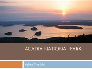
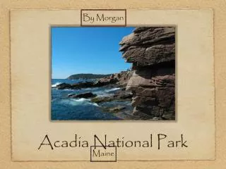
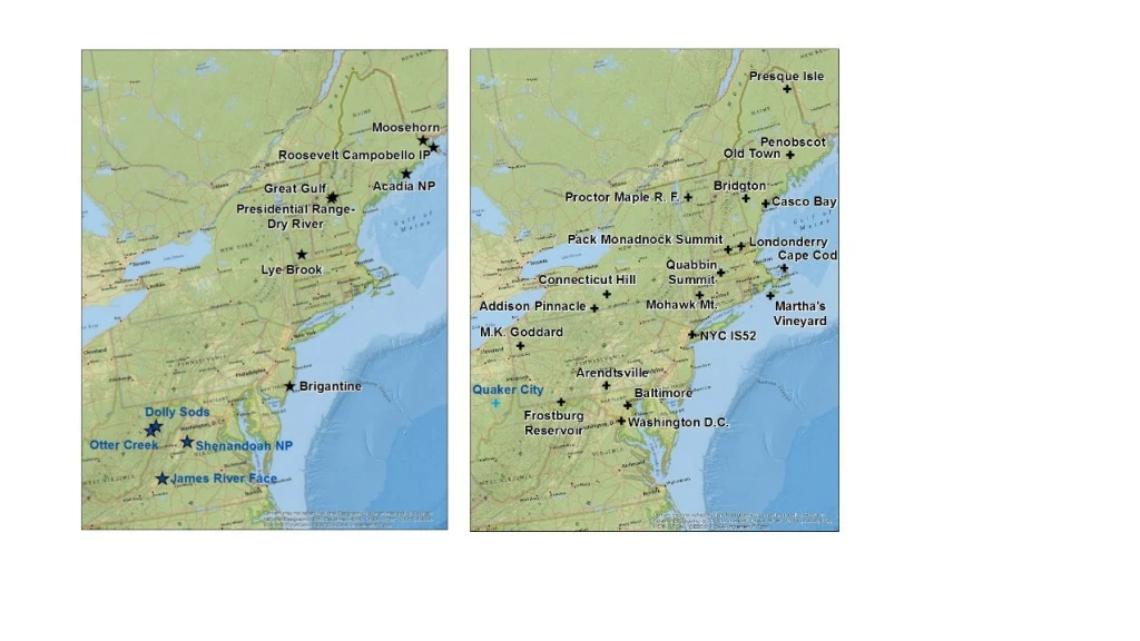
Acadia NP Size – 7.4 Horiz – 2.0 Vert – 0.1
Moosehorn Size – 7.4 Horiz – 2.0 Vert – 0.1
Great Gulf Size – 7.4 Horiz – 2.0 Vert – 0.1
Lye Brook Size – 7.4 Horiz – 2.0 Vert – 0.1
Brigantine Size – 7.4 Horiz – 2.0 Vert – 0.1
Dolly Sods Size – 7.4 Horiz – 2.0 Vert – 0.1
Shenandoah Size – 7.4 Horiz – 2.0 Vert – 0.1
James River Size – 7.4 Horiz – 2.0 Vert – 0.1
(b) 20% Worst Days (a) 20% Clearest Days SIZE – 5.1 Position – 0.1 / 6.40 Horizontal - 0.1 / 0.1 Vertical Acadia NP
(b) 20% Worst Days (a) 20% Clearest Days SIZE – 5.1 Position – 0.1 / 6.40 Horizontal - 0.1 / 0.1 Vertical Moosehorn
(b) 20% Worst Days (a) 20% Clearest Days SIZE – 5.1 Position – 0.1 / 6.40 Horizontal - 0.1 / 0.1 Vertical Great Gulf
(b) 20% Worst Days (a) 20% Clearest Days SIZE – 5.1 Position – 0.1 / 6.40 Horizontal - 0.1 / 0.1 Vertical Lye Brook
(b) 20% Worst Days (a) 20% Clearest Days SIZE – 5.1 Position – 0.1 / 6.40 Horizontal - 0.1 / 0.1 Vertical Brigantine
(b) 20% Worst Days (a) 20% Clearest Days SIZE – 5.1 Position – 0.1 / 6.40 Horizontal - 0.1 / 0.1 Vertical Dolly Sods
(b) 20% Worst Days (a) 20% Clearest Days SIZE – 5.1 Position – 0.1 / 6.40 Horizontal - 0.1 / 0.1 Vertical Shenandoah NP
(b) 20% Worst Days (a) 20% Clearest Days SIZE – 5.1 Position – 0.1 / 6.40 Horizontal - 0.1 / 0.1 Vertical James River Face
a) 20% Best Visibility Days b) 20% Worst Visibility Days SIZE – 4.85 Position – 0.09 / 6.65 Horizontal - 1.15 / 1.15 Vertical
(b) Nitrate (a) Sulfate Acadia National Park (c) Carbonaceous Matter (d) Coarse Mass SIZE 3.7 POSITIONS 0.1 - 0.05 5.31 - 0.05 0.1 - 3.75 5.31 - 3.75
(b) Nitrate (a) Sulfate Moosehorn (c) Carbonaceous Matter (d) Coarse Mass SIZE 3.7 POSITIONS 0.1 - 0.05 5.31 - 0.05 0.1 - 3.75 5.31 - 3.75
(b) Nitrate (a) Sulfate Great Gulf (c) Carbonaceous Matter (d) Coarse Mass SIZE 3.7 POSITIONS 0.1 - 0.05 5.31 - 0.05 0.1 - 3.75 5.31 - 3.75
(b) Nitrate (a) Sulfate Lye Brook (c) Carbonaceous Matter (d) Coarse Mass SIZE 3.7 POSITIONS 0.1 - 0.05 5.31 - 0.05 0.1 - 3.75 5.31 - 3.75
(b) Nitrate (a) Sulfate Brigantine (c) Carbonaceous Matter (d) Coarse Mass SIZE 3.7 POSITIONS 0.1 - 0.05 5.31 - 0.05 0.1 - 3.75 5.31 - 3.75
(b) Nitrate (a) Sulfate Shenandoah NP (c) Carbonaceous Matter (d) Coarse Mass SIZE 3.7 POSITIONS 0.1 - 0.05 5.31 - 0.05 0.1 - 3.75 5.31 - 3.75
(b) Nitrate (a) Sulfate Dolly Sods (c) Carbonaceous Matter (d) Coarse Mass SIZE 3.7 POSITIONS 0.1 - 0.05 5.31 - 0.05 0.1 - 3.75 5.31 - 3.75
(b) Nitrate (a) Sulfate James River Face (c) Carbonaceous Matter (d) Coarse Mass SIZE 3.7 POSITIONS 0.1 - 0.05 5.31 - 0.05 0.1 - 3.75 5.31 - 3.75