Download
1 / 47
470 likes | 494 Views
Explore the seamless integration of GIS and GPS technology for efficient data collection, analysis, and mapping, showcasing the benefits and methodologies. Learn about the significance of geographic data in various fields and the evolution of GPS technology.

E N D
The Use of GIS and Handheld GPS Integration for the Preparation of Quick Plans Can AydaySatellite and Space Sciences Research InstituteAnadolu UniversityEskisehir-TURKEY e–mail: cayday@anadolu.edu.tr Erman AydayElectrical and Electronic Engineering DepartmentMiddle East Technical UniversityAnkara-TURKEY e–mail: e124386@metu.edu.tr GIS Ostrava 2005
Contents • GIS and GPS Integration • Definition of GIS • Definition of GPS • Methodology • The aim of the study • Studied Areas • Equipment, Software and Data Collection • Preparation of Maps and Plans • Preparation of quick GIS map of touristic area • Preparation of quick GIS map of industrial area • Results and Recommendations GIS Ostrava 2005
GIS and GPS Integration GIS Ostrava 2005
Definition of GIS • The glossary of GIS books generally describes the GIS as “An organized collection of computer hardware, software, geographic data, and personnel designed to efficiently capture, store, update, manipulate, analyze, and display all forms of geographically referenced information”. • Every interested person can find different GIS definitions which might be useful for their purpose. • Each data for GIS must have geographic reference value and identify the location of it on the ground. GIS Ostrava 2005
… con’t. • Many users have been using computers for manipulation of spatial data since 1960’s. • During the 1980’s, advances in computer hardware, particularly processing speed and data storage, catalyzed the development of GIS software for handling spatial data. • GIS is filling a very real need in the face of the rapid growth of digital spatial data in a wide application fields, from social to technical studies. GIS Ostrava 2005
… con’t. • Data capture and storage is the most vital component of GIS. • Collect and capture data from many different sources; • Especially by using GPS technology, • Aerial photographs, • Scanned maps, • Conventional surveys, • Digitized maps, • By remote sensing technology GIS Ostrava 2005
… con’t. • The GIS manager can organize this data and assign different layer names and define different feature classes. • GIS combines layers of information about a place to give you a better understanding of that place. • One of the main benefits of GIS is improved management of your organization and resources. GIS Ostrava 2005
… con’t. GIS Ostrava 2005
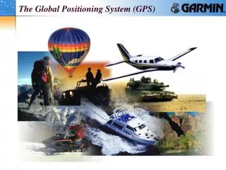
Definition of GPS • All navigators including Magellan, Marco Polo and Piri Reis (who is known as very famous old Turkish sailor) had tried to find their positions more quickly and accurately. • The most important way for the navigation whether it is for land or sea, is getting information about the location and finding the best route between the target and the destination. • Today with the help of GPS this problem was solved. • Today Global Positioning System (GPS) is known the most advanced technology in the navigation technology. GIS Ostrava 2005
… con’t. • GPS is also defined as an aerospace technology that uses satellites and ground receiver to determine position anywhere on the earth. • Many years ago walking pace and some famous natural indicators, landmarks were used to find locations. • In the 19th century the sextant is used for accurate position definition by measuring height of stars, sun and planets. GIS Ostrava 2005
… con’t. • In recent years the availability of global positioning system technology has permitted convenient, inexpensive, and accurate measurement of absolute location. • GPS, another increasing useful form of GIS technology, was initially developed by the U.S. military but now is widely used for both military and civilian applications around the world, often in conjuction with GIS. • Global Positioning System (GPS) refers to the group of 24 geosynchronous satellites owned and maintained by the U.S. Department of Defense (USDoD). GIS Ostrava 2005
… con’t. • The first GPS satellite put into orbit in 1978, then second generation satellites was launched in 1989. The GPS system became fully operated in 1995. GPS Satellite GPS Constellation GIS Ostrava 2005
... con’t. • These GPS satellites have been launched on six different orbits around the world, and each orbit has four satellites. • The altitude of the satellites orbit is 20.200 kms and each satellite revolves in every 12 hours at this altitude. • Each satellite with atomic clocks in it and each satellite transmits a unique signal that is received by a GPS receiver on earth. • A high precision quartz clock in a GPS receiver is calibrated to a satellite’s atomic clock via information imbedded in the GPS signal. GIS Ostrava 2005
... con’t. • Each GPS receiver on the earth generates the same code at the same time as satellite, this property which GPS has the ability to measure the time difference between the signals transmitted and received. • It is known that these radio signals travel at a constant speed, 299,460 km/s in the atmosphere. • So, it is possible to locate the precise location of the standing point with the GPS, for the intersection of four spheres with the known distance between GPS receivers and GPS satellites as radii. GIS Ostrava 2005
... con’t. Dash lines, actual intersection points, Buffer zone, area of uncertainty, Due to no atomic clock in the receiver Solid lines indicates where the GPS receiver are located on the spheres. Because of the errors in the receiver’s internal clock, the spheres do not intersect at one point. Determining Position The GPS receiver must change the size of the spheres until the intersection point is determined. GIS Ostrava 2005
... con’t. • Theoretically a minimum of four distance measurements is needed to find the precise X, Y and even Z location of the given point on the ground. • It is possible to see at least four satellites on the ground at any time. • At least 3 satellites are needed for 2-dimensional horizontal navigation. • At least 4 satellites are needed for altitude (elevation) measurements. • In the old days 95 % of all positions were accurate to within 25-100 meters. • Nowadays, civilian users can expect 15 meters of horizontal accuracy or better 95 % of the time. GIS Ostrava 2005
... con’t. • Some new advanced systems in GPS, Wide Area Augmentation System (WAAS) have the ability to pick up correction signals and reduce the position error up to a couple of meters. • Differential GPS can produce 1-2 cm of horizontal accuracy for property and cadastral surveys. • In spite of the fact that all systems depend on high or low positional accuracy, all these data are used for mapping and GIS data collection applications. • GPS can be used as a data capture tool for features, attributes and attribute values in GIS environment. GIS Ostrava 2005
Methodology GIS Ostrava 2005
Aim of the study • Nowadays the data from cheap GPSs can be used to make plans and maps and the GPS data can be converted into the GIS environment more easily. • GIS and GPS integration systems have some useful applications for the rapid preparation of plans and maps of small areas. • The main aim of the study is try to explain GIS-GPS integrated systems and apply this methodology for two different aplication fields. GIS Ostrava 2005
Studied Areas • Two different areas were selected as the studied areas. • One of the areas belongs to industrial area and the other belongs to touristic area according to land use classification. • Industrial area of Eskisehir, which is located in the middle of Anatolia was selected as for the preparation of quick GIS map of industrial area, • The second area, Gundogan, located in the north part of Bodrum is selected for the preparation of quick GIS map of touristic area. GIS Ostrava 2005
Location maps of the studied areas GIS Ostrava 2005
Aerial photos of the industrial area of Eskisehir from S to N from W to E GIS Ostrava 2005
General view of Gundogan touristic area GIS Ostrava 2005
Equipment, Software and Data Collection • The Global Positioning System (GPS) has become an essential tool for GIS users, • Low cost, Magellan 315 type handheld GPS is used for collecting GPS data, • There is a wide variety of free and low cost software packages on the market which allows data communications between GPS receivers and your computer, including full data editing and storage options. Handheld GPS used for this study GIS Ostrava 2005
... con’t. • GPS TrackMaker is one of them and it is used in this study. • GeoMedia Pro. 4.0 is used for GIS software in this study. • More than 50 waypoints were collected at the Gundogan touristical area. • The UTM coordinates of the waypoints were recorded in the GPS and the attributes of the hotel, restraurant and private site were obtained at the same time. • More than 100 waypoints were collected in the industrial Area of Eskisehir. • Factories and common utility buildings were selected as feature class. GIS Ostrava 2005
Preparation of Maps and Plans GIS Ostrava 2005
Preparation of quick GIS map of touristic area • The waypoints which define the feature classes were collected for industrial and touristic areas, • Registered Landsat ETM satellite image was used as background for Gundogan touristic area, • Hotel classes and restaurant types were selected as attributes for tourist site, • All the collected waypoints were imported in the GIS GeoMedia Pro software and it is seen that there is a good match between the collected GPS waypoints and registered satellite image, • Non-graphic data which are the attributes of the touristic places were prepared in a simple database environment and jointed with the graphic objects. GIS Ostrava 2005
Collected waypoints of touristic locations as feature classes on the satellite image of Bodrum region GIS Ostrava 2005
GIS based map of the studied area by using GPS GIS Ostrava 2005
Selected feature class (hotels)from the GIS based map GIS Ostrava 2005
Attribute query according to the name of the hotel (Hotel Baia) GIS Ostrava 2005
Attribute query for the Galimera Restaurant GIS Ostrava 2005
Attribute query according to the name of the hotel (Hotel Catamaran) GIS Ostrava 2005
Selection of common place (mosque) by using attribute query GIS Ostrava 2005
Selection of common place (beach) by using attribute query GIS Ostrava 2005
Preparation of quick GIS map of industrial area • Types and categories of factories are selected as the main attributes for industrial site, • Aerial photograph and satellite images were registered to the UTM coordinates before overlapping operation, • The waypoints which were collected from the industrial area were overlapped on the aerial photograph and satellite images, • At the end of these two applications it is seen that, good match was reached between the background registered images and the collected GPS data, • Non-graphic data which are the attributes of the factories were prepared in a simple database environment and jointed with the graphic objects. GIS Ostrava 2005
Collected waypoints as feature classes from industrial area on the satellite image GIS Ostrava 2005
GIS based map of the industrial area by using GPS GIS Ostrava 2005
Selected category (food indst.) of feature class (firm) from the GIS based map (aerial photo is used as registered background) GIS Ostrava 2005
Selection of administrative and common places by attribute query GIS Ostrava 2005
Attribute query of the selected food industry (Yasin Cakir Flour Factory) GIS Ostrava 2005
Attribute query of the selected food industry (Eti Biscuit and Craker Factory) GIS Ostrava 2005
Different direction views of the selected junction GIS Ostrava 2005
Query result link between map and data windows (Kilicoglu Tile and Brick Factory) GIS Ostrava 2005
Query result link between map and data windows (Clothes factories) GIS Ostrava 2005
Results and Recommendations GIS Ostrava 2005
At the end of these studies it is seen that, the collected waypoints by using handheld GPS receiver can be used easily for rapid data collection, • These data have the ability to transfer rapidly from the GPS environment to the GIS environment, • The maps and plans which are obtained by using handheld GPS and GIS softwares can be used effectively for getting information, querying and analysing the feature classes. • Maps are used by the municipalities of these touristic places for giving information to the tourists and for planning and also for the interested person to find the factories which he is interested in. GIS Ostrava 2005