Download
1 / 28
280 likes | 422 Views
Dynamic Generation of Hurricane Evacuation Routes. By Jon Jones. Overview. Background Data and Applications The Dynamic Algorithm Expected Results Challenges Real-World Application. Background. Routing is one of the most well-known GIS functions. The expected products are usually a map….

E N D
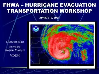
Dynamic Generation of Hurricane Evacuation Routes By Jon Jones
Overview • Background • Data and Applications • The Dynamic Algorithm • Expected Results • Challenges • Real-World Application
Routing is one of the most well-known GIS functions. The expected products are usually a map…
… and driving directions. The directions usually include time and distance for each segment of the route.
GeoDecisions • IRRIS – www.irris.com • Currently 2 routing engines – DTOD and ArcIMS Route Service. Plans for ArcGIS Server. • Offers more functionality than Google, such as fastest/shortest, toll avoidance, and HAZMAT
Polygon Barrier Routing • The proposed next level – routing functionality that imports predicted weather phenomena in a GIS format, analyzes it based on predetermined criteria, creates barriers on roads where the data indicates danger or closure, and attempts to route the user out of the predicted hurricane path. It is dynamic because it will poll data sources at set intervals and change its predictions. Also, the data is group into time intervals, so the user can use the latest prediction to not only route in real-time, but analyze future availability of routes.
Data and Applications – Current Resources • The routing (network analysis) will be delivered via ESRI’s Network Analyst extension of ArcGIS. ESRI’s default base layers will provide the necessary cartography, and the network data will be NAVTEQ’s 2007 SDC North America.
The NOAA website provides downloadable GIS data for the projected path of the storm and storm surge.
NOAA also provides the NDFD GRIB2 Decoder, a Windows desktop application that can download a wide array of predicted values, including • Maximum wind speeds • Wave height • Weather conditions • Watches and warnings • Total rainfall • Predictions fall in 3,6,or 12 hour segments depending on data
Visual Studio.NET 2005 will be used to program all components where possible. • Any web portions will be hosted on Internet Information Services (IIS)
Data and Applications – User Inputs The user would provide the following data as input parameters • Location from which to begin evacuation • Time of evacuation • Wind speed for bridge closure (default) • Wind speed for ferry closure (default)
Data and Applications - Other Data Needs • I need to find a reliable source of flood zones, or try to derive flooded areas by combining rainfall and elevation data. • I need to find layers that would represent adequate places of refuge, based on type or elevation. • I would like to explore using some sort of vegetation or ground cover data to predict high likelihood of fallen trees.
Dynamic Routing Algorithm – Data Processing • The newest data is downloaded from sources as soon as available • For periods divided into 3 hour segments, the data is analyzed for values that would create barrier conditions • These areas are selected and intersected with the network data to form blockage points. • The blockage points are stored under the time window for which they are relevant
Dynamic Algorithm – Plotting the Route • The user selects a location and time. • The application first determines if the location is in the projected path of the hurricane at the time proposed. • If so, using the relevant barrier point set, the app creates a service area showing the distance the user can travel in 3 hours.
Dynamic Algorithm – Plotting the Route • The service area polygon is analyzed to see if it is completely contained in the path polygon. If not, points in the service area not in the path are selected and single routes are calculated and presented.
If the service area has not exited the path, intersections of major roads with the service area are calculated (minor roads aren’t likely to get the user much farther). These points are stored.
The algorithm then selects the next set of barrier points (because it is now three hours later) and begins to run and analyze service areas from the points generated by the first go round.
If a route is found to escape the path, a new route is generated from the beginning and presented to the user. Some sort of additional processing will have to be done to preserve and use time-relevant barrier points when calculating the final route.
If no polygons escape the path, the user will be advised to chose an earlier departure time, and routes will be calculated to nearby hurricane shelter areas.
Expected Results • So far my work has shown that when polygons are used to create barriers routing products honor these barriers • In cases where it is feasible, I expect the analysis to yield a route to an area that is outside the path of the hurricane and is reachable in the time given. • The routes will be the quickest way to escape the path and avoid barriers, while obeying traffic rules.
Challenges • For the scope of this project, I will have to use Desktop ArcGIS, thus ArcObjects, which I have very little experience coding in. • The NDFD GRIB2 Decoder and the libraries it is based on has the classic look of software created by amateurs. It might be very difficult to use programmatically and I will probably rely on manual downloads.
The processing of the data and the repeated route algorithm are resource-intensive, and may result in a process that overwhelms the machine. • Realistic travel times will be difficult to project without traffic congestion modeling. • The algorithm will lead the user out of the path of the storm, but not necessarily to a place that is good or safe to be.
Real-World Application • To be incorporated into my work project, this project would need to run on ArcGIS Server. However, the algorithm should remain the same, and much of the code could be reused. • The project will provide me with experience introducing downloaded data into an application and analyzing it prior to mash-up
The ability to use predicted storm data in routing can be used by our logistics customers both for shipping (i.e., getting their cargo out of the way of the storm) and by government customers to advise in planning evacuation routes. • I will gain experience in handling dynamic data to extend the out-of-the-box capabilities of Network Analysis in an automated fashion.
Acknowledgments • Frank Hardisty, Penn State University, Advisor • Staff of GeoDecisions