Earth Science Notes
Earth Science Notes. Landforms. Landforms. Why do different landforms exist? Earth Processes Weathering Erosion Forces within the Earth (plate movement) Climate Other?. Landforms. Plains – large flat areas usually have thick abundant soil ideal for farming. Landforms.

Earth Science Notes
E N D
Presentation Transcript
Earth Science Notes Landforms
Landforms Why do different landforms exist? Earth Processes • Weathering • Erosion • Forces within the Earth (plate movement) • Climate • Other?
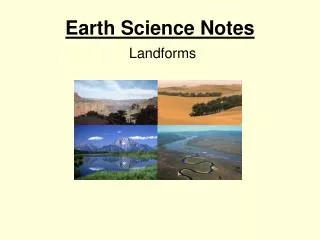
Landforms • Plains – large flat areas usually have thick abundant soil ideal for farming
Landforms • Interior plains – found in the middle of a continent • Ex: Iowa, Nebraska, the Dakotas • Have a higher elevation than coastal plains
Landforms • Coastal plains – found on the edge of the continent • Ex: Florida, Georgia, the Carolinas • Formed as a result of collecting sediment on the seafloor and dropping water levels.
Landforms • Plateaus – flat raised areas of land made up of nearly horizontals rocks that have been lifted up by forces with in the earth. • Ex: Colorado plateau
Landforms Four Mountain Types • Folded • Upwarped • Fault Block • Volcanic
Mountains • Folded Mountains – comprised of folded rock layers like a rug that has been pushed up against a wall. • Forces occur on rock in a horizontal direction • Ex: Appalachian mountains • Believed to be at one time higher than the Rocky Mountains but years of weathering and erosion have worn the mountains down.
Mountains • Upwarped Mountains – formed when the forces within the earth push up blocks of the earth’s crust. Soil is worn away and the hard rock underneath is exposed. • Ex: Adirondack mountains (New York), Black Hills (South Dakota)
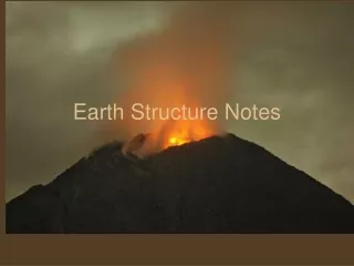
Unwarped Mountains Forces with in the Earth
Mountains • Fault-Block Mountains – made of huge, tilted blocks of rock that are separated from the surrounding rock by faults. Some rocks move up some move down. • Faults are fractures in rocks • Ex: Grand Tetons (Wyoming)
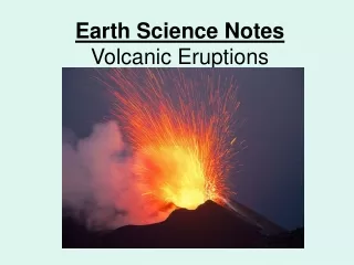
Mountains • Volcanic Mountains – form from molten rock that reaches the surface of the earth’s crust through a crack or fissure. The molten rock accumulates on top of itself forming a cone shaped structure. • Ex: Mount ST. Helens (Washington)
Landforms How can topography aid us in describing landforms?
Topography Topographical Maps – show change in elevation
Topography Features on a Topographical Map • Contour lines – connect equal points of elevation • Contour intervals – distance between contour lines • Index contours – contour line with elevation
Topography Reading a contour Map • Close contour lines = steep change in elevation • Distant contour lines = gradual change in elevation
Landforms Summary • Why do different landforms exist? • Three types of landforms • Plains – coastal / interior • Plateaus • Mountains – folded / upwarped / fault-block / volcanic • Topographical maps describe landforms