Download
1 / 15
180 likes | 384 Views
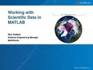
Working with Scientific Data in MATLAB. Nick Haddad Software Engineering Manager MathWorks. The leading environment for technical computing. The i ndustry-standard, high-level programming language for algorithm development Numeric computation

E N D
Working with Scientific Data in MATLAB Nick Haddad Software Engineering Manager MathWorks
The leading environment for technical computing • The industry-standard, high-level programming language for algorithm development • Numeric computation • Parallel computing, with multicore andmultiprocessor support • Data analysis and visualization • Toolboxes for signal and imageprocessing, statistics, optimization,symbolic math, and other areas • Tools for application development and deployment • Foundation of MathWorks products
Go Farther with MATLAB and Toolboxes Signal Processing Toolbox Mapping Toolbox Statistics Toolbox Image Processing Toolbox Database Toolbox Image Acquisition Toolbox MATLAB Compiler
Mapping Toolbox • Geospatial data access • Map projections • 2-D and 3-D map displays • Manipulation of map display • Geospatial data analysis Access, visualize, and analyze geographic data
Geospatial Applications Aerospace and Defense Earth and Ocean Science Natural Resources Energy Communications • Other Applications: • Finance • Transportation • Government • Agriculture
MATLAB and Scientific Data • Scientific data formats: • HDF5, HDF4, HDF-EOS • NetCDF(with OPeNDAP!) • FITS, CDF, BIL, BIP, BSQ • Image file formats: • TIFF, JPEG, HDR, PNG, JPEG2000, and more • Vector data file formats: • ESRI Shapefiles, KML, GPSand more • Raster data file formats: • GeoTIFF, NITF, USGS and SDTS DEM, NIMA DTED, and more • Web Map Service (WMS)
HDF5 • High Level Interfaces (h5read, h5write, h5disp,h5info) h5disp('example.h5','/g4/lat'); data = h5read('example.h5','/g4/lat'); • Low Level Interfaces(Wraps HDF5 C APIs) fid = H5F.open('example.h5'); dset_id= H5D.open(fid,'/g4/lat'); data = H5D.read(dset_id); H5D.close(dset_id); H5F.close(fid);
NetCDF • High Level Interface (ncdisp, ncread, ncwrite, ncinfo) url = 'http://oceanwatch.pifsc.noaa.gov/thredds/ dodsC/goes-poes/2day’; ncdisp(url); data = ncread(url,'sst'); • Low Level Interface (Wraps C APIs) ncid= netcdf.open(url); varid= netcdf.inqVarID(ncid,'sst'); netcdf.getVar(ncid,varid,'double'); netcdf.close(ncid);
Mapping Toolbox andWeb Map Service (WMS) • Find and download data • Custom queries by layer name, server name, location, and other terms • Prequalified database of WMS servers and data layers • WMS servers available from: • NASA, ESA, USGS, NOAA, ESRI, Microsoft® and more
Web Map Service Example % Find layers that may contain global temperature data % and return a WMSLayerarray. layers = wmsfind('global*temperature'); % Display the first layer layers(1) WMSLayer Properties: Index: 1 ServerTitle: 'WMS for GHRSST Global 1-km Sea Surface Temperature (G1SST), Global, 0.01 Degree, Daily' ServerURL: 'http://coastwatch.pfeg.noaa.gov/erddap/wms/jplG1SST/request?' LayerTitle: 'GHRSST Global 1-km Sea Surface Temperature (G1SST), Global,0.01 Degree, Daily - SST' LayerName: 'jplG1SST:SST' Latlim: [-79.9950 79.9950] Lonlim: [-179.9950 179.9950]
Web Map Service Example % Show a map from the first layer [A,R] = wmsread(layers(1)); geoshow(A,R); title(layers(1).LayerTitle);
Example Exploring Sea Surface Temperature with WMS and NetCDF data.
MATLAB’s MAT File Format • Version 7.3 of MAT file format is HDF5 based save('bigFile.mat',bigMatrix,'-v7.3'); • Support for partial saving and loading of MAT files % Create a MAT-file matObj = matfile('myfile.mat’) % Find the size of a variable in the file [nrows, ncols]=size(matObj,'bigMatrix'); % Load data from a variable in the file loadVar = matObj.bigMatrix(nrows-19:nrows, 86:95);
Questions?? • www.mathworks.com • Examples: • Using the high-level HDF5 functions to Import Data • Importing NetCDFFiles and OPeNDAP Data • Compositing and Animating Web Map Service (WMS) Meteorological Layers • Performing a Numerical Simulation of an Oil Spill • Product documentation • Feel free to ask questions afterwards