Download
1 / 52
530 likes | 611 Views
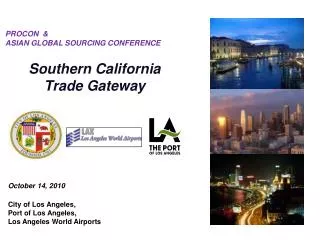
The Southern Gateway IH 35E/US 67 Transportation Study. The Southern Gateway IH 35E/US 67 Transportation Study. Public Meetings. November 18 & 21, 2002. Study Area. Ongoing Major Projects. East Corridor. Loop 12/IH 35E. Project Pegasus/ Trinity Parkway. IH 35E. Loop 9.

E N D
The Southern GatewayIH 35E/US 67 Transportation Study The Southern GatewayIH 35E/US 67 Transportation Study Public Meetings November 18 & 21, 2002
Ongoing Major Projects East Corridor Loop 12/IH 35E Project Pegasus/ Trinity Parkway IH 35E Loop 9
Project Development Process Identify Need Major Investment Study (MIS) Focus of our project Schematic Design Environmental Assessment 2 to 5 years Final Design Right-of-Way Purchase 4 to 15 years Construction
Project Goals • Solutions for 2025 and beyond • Improve mobility in southern Dallas County • Enhance safety on IH 35E and US 67 • Maximize positive environmental and socio-economic opportunities • Minimize negative environmental and socio-economic effects • Provide affordable and cost-effective transportation solutions
Public Involvement - Goals • Inclusive • Open communication • Focus on solutions • Many ways to get information • Many ways to provide comments • Maintain an aggressive schedule
Work Groups and Meetings Policy Work Group Elected officials and transportation leaders Community Work Group Residents, businesses, institutions, commuters, environmental org’s Staff Work Group Technical staff from governmental and regulatory agencies Public Meetings Open to all interested parties Public Hearings Open to all interested parties Public Involvement
Public Involvement Tools • Work Group Meetings • Public Meetings/Hearings • Newsletters • Web site • Information packet • Presentations • Print and BroadcastMedia www.thesoutherngateway.org
IH 35E/US 67 Study Corridor Study Area Map
Traffic Volumes - Existing 190,000 vpd 80,000 vpd 100,000 vpd 60,000 vpd 120,000 vpd vpd: vehicles per day
Freeway Accidents 379 accidents/year 180 accidents/year 119 accidents/year 68 accidents/year These accident rates are similar to the regional averages. Note: Average reported accidents per year, 1997-1999
Population and Employment Growth Metropolitan Planning Area % 1999 2025 Change Population 4,536,000 6,671,000 47 % Employment 2,691,000 3,907,400 45 % Note: The Metropolitan Planning Area consists of Dallas, Collin, Tarrant, Denton, Rockwall Counties and parts of Ellis, Johnson, Parker, Kaufman Counties
Transportation Solutions • Bicycle & pedestrian facilities • City street improvements • Bus transit • Rail transit • Transportation System Management • Travel Demand Management • Freeway and HOV improvements Every Piece Helps
Transportation Solutions Non-Freeway/HOV Alternatives • Bicycle & pedestrian facilities • City street improvements • Bus transit • Rail transit • TSM • TDM
Traffic Volumes - 2025 Total Demand 340,000 vpd 180,000 vpd 140,000 vpd 170,000 vpd 150,000 vpd vpd: vehicles per day
Traffic Volumes - Existing and 2025 Demand 1999: 190,000 vpd 2025: 340,000 vpd 1999: 80,000 vpd 2025: 180,000 vpd 1999: 100,000 vpd 2025: 140,000 vpd 1999: 60,000 vpd 2025: 170,000 vpd 1999: 120,000 vpd 2025: 150,000 vpd vpd: vehicles per day
Freeway and HOV Alternatives • Demand exceeds what can be accommodated using non-freeway alternatives • Mobility focus is on moving people, not necessarily vehicles • HOV alternatives provide additional person-capacity • Freeway/HOV alternatives constrained by adjacent land uses - minimize or eliminate ROW impacts
Finding Balance Transportation Needs vs. Right-of-Way Requirements Environment Economic Development Aesthetic Designs
Evaluation Criteria • Mobility and Safety • Environmental Impacts • Flexibility and Compatibility with other Projects • Cost Effectiveness • Engineering Feasibility Significant Some No Some Significant Negative Negative Effect Positive Positive Effect Effect Neutral Effect Effect - - - 0 + + +
Environmental Analysis • Extensive data collection effort ongoing • Documented environmental constraints • Critical issues identified to date: • Noise impacts • Visual impacts • Historic districts • Parks (including Dallas Zoo) • Cemeteries • Creeks and wetlands • Community cohesion • Air quality impacts
Historic District McAdams Cemetery Dallas Zoo ThurgoodMarshall Rec Center Laurel Land Cemetery Boulder Park Noise impacts Visual impacts Air quality impacts Creeks & wetlands
Freeway and HOV Alternatives IH 35E North, North of Marsalis IH 35E North, South of Marsalis US 67 North IH 35E South US 67 South
Transportation SYSTEM IH 35E North Project Pegasus/ Trinity Parkway
IH 35E North - Alternatives • No-Build • Freeway General Purpose Lanes - 4 in each direction - 5 in each direction - 6 in each direction • HOV or Special Use Lanes - None - 1 in each direction - 1 reversible - 2 reversible - 3 reversible • At-Grade and Elevated were considered
IH 35E North – Draft Preferred Alternative 5 Mainlanes + 2 Reversible Lanes + 5 Mainlanes
IH 35E South - Alternatives • No-Build • Freeway General Purpose Lanes - 3 in each direction - 4 in each direction • HOV or Special Use Lanes - None - 1 in each direction - 1 reversible - 2 reversible • At-Grade and Elevated were considered
IH 35E South – Draft Preferred Alternative 3 Mainlanes + 1 Reversible Lane + 3 Mainlanes
US 67 North - Alternatives • No-Build • Freeway General Purpose Lanes - 2 in each direction - 3 in each direction - 4 in each direction • HOV or Special Use Lanes - None - 1 in each direction - 1 reversible - 2 reversible • At-Grade and Elevated were considered
US 67 North – Draft Preferred Alternative 3 Mainlanes + 2 Reversible Lanes + 3 Mainlanes
US 67 South - Alternatives • No-Build • Freeway General Purpose Lanes - 2 in each direction - 3 in each direction - 4 in each direction • HOV or Special Use Lanes - None - 1 in each direction - 1 reversible - 2 reversible • At-Grade and Elevated were considered
US 67 South – Draft Preferred Alternative 3 Mainlanes + 1 Reversible Lane + 3 Mainlanes
New Frontage Roads? • Existing frontage roads will not be removed • No existing frontage roads from 12th Street to Saner • Should new frontage roads be added? • Do the benefits outweigh the costs?
Frontage RoadsBenefits and Costs Note: This analysis is limited to IH 35E from 12th Street to Saner
New Frontage Roads? Recommendation New frontage roads should not be constructed between 12th Street and Saner.
Design Standards • Design Standards have changed over time- Inadequate vertical clearances- Inadequate lane and shoulder widths- Substandard ramps and merge lanes- Tight curves on freeway lanes- Problems primarily on IH 35E North segment
Preferred AlternativePresentations • Cities- Dallas - Cedar Hill - DeSoto - Duncanville - Lancaster • Dallas County • DART • North Texas Tollway Authority • NCTCOG These presentations will take place over the next two to four months and the Work Groups will be briefed on the presentations at future meetings.
Project Development Process Identify Need Major Investment Study (MIS) Focus of our project Schematic Design Environmental Assessment Final Design Right-of-Way Purchase Construction
Project Schedule Final design, right-of-way purchase and construction begin after final environmental approval
Aesthetics Landscape- Plantings- Edge treatments- Blending Hardscape- Bridge design- Retaining walls- Sound walls- Light structures- Cross streets Community Planning Community cohesion Context sensitive design Land use impacts Bike & pedestrian access Economic development Urban Design
For More Information • Visit the project web site:www.thesoutherngateway.org • Timothy M. Nesbitt, P.E.Project ManagerTexas Department of TransportationP.O. Box 133067Dallas, Texas 75313-3067Phone: 214-320-6100Fax: 214-320-4470