Download
1 / 34
350 likes | 386 Views
Learn about Esri Enterprise Advantage Program to drive your GIS vision, from software to support, training, and consultancy. Transform your organization's technical capabilities and enable your workforce with Esri's services.

E N D
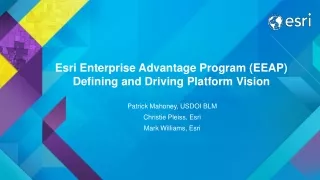
Esri Enterprise Advantage Program (EEAP)Defining and Driving Platform Vision Patrick Mahoney, USDOI BLM Christie Pleiss, Esri Mark Williams, Esri
People Software Content
Software Maintenance Technical Advisor Tech Support Analyst Esri Enterprise Latest software and technical support Advantage Program Reach your GIS vision Project Manager Projects Training Premium Support Prioritized incident management Enabling the workforce Transforming business Technical Consultant Training Consultant Technical Account Manager Ready to help you successfully leverage the ArcGIS Platform for your organization Esri Services Jumpstarts Rapid productivity
Provide continuity Lead planning Understand requirements Technical Advisor Develop technical work plan Coordinate activities Give ongoing advice
Bureau of Land Management Organization Background
Managing this Land Requires Maps Landscape Management Requires New Tools and Approaches
Landscape Approach Greater Sage Grouse
The Changing State of GIS in the Bureau State GIS Center GIS One GIS Architecture EGIS Local/State GIS Others Field GIS Autonomous GIS Diverse solutions One BLM Corporate Architecture GSSP Approved Enterprise Concept 2008 2015 2016 Desktops Desktops Client-Server Web Services
Challenges How to Enable an Organization in a Strong Controlling Culture? • Moving away from traditional approach to meeting business needs with IT investments (documentation, design, budget, staffing, etc.) • Adapting to rapidly evolving technology • Improving field data collection workflows • Conveying data management responsibilities within the organization
Vision and Direction EEAP Alignment
EEAP Activity Timeline 2015 2014 Cadence and Continuity System Architecture Workshop Training 3 Classes Training 3 Classes Training 8 Classes Start of Year 3 Cloud POC Scoping Begin Cloud POC Cloud POC Setup Complete Cloud POC Metadata Wokshop Training 1 Class Monthly Call Monthly Call Monthly Call Monthly Call Monthly Call Monthly Call Monthly Call Monthly Call Monthly Call Monthly Call Monthly Call Monthly Call EEAP Quarterly Webcast EEAP Quarterly Webcast EEAP Quarterly Webcast EEAP Quarterly Webcast UC Meeting Imagery Workshop
BLM EEAP Activities Consulting & Subject Matter Expertise • Detailed Software Demonstrations • Portal • Collector • Story Maps • GeoPortal • AGOL Landscape Decision • AGOL SocioEconomics • Web (ArcServer) Services • Technical Advisor Support • Treatment Application • Attribute Updates via Web Services • Web Streaming Services • System Assessments • Citrix Configurations • Database Configurations • Imagery Delivery Configurations
BLM EEAP Activities 253 Class Seats Training Instructor Lead • Intro to GIS • Essential Workflows • Performing Analysis • Sharing Content on the Web • Building Geodatabases • Designing Maps w/ArcGIS • Distributing Data Using Geodatabase Replication • Editing Data w/ArcGIS Desktop • Implementing Versioned Workflows in a Multiuser Geodatabase • Introduction to Geoprocessing Scripts Using Python • Managing Imagery using ArcGIS • ArcGIS for Server: Sharing GIS Content on the Web Virtual Campus • 1000 classes/year Conferences • International, Federal GIS, Developer Summit, Regional 58 Days of Instruction 4960 Classroom Hours
Successes Through Effective Use of EEAP Resources • Sponsored a DOI Portal Instructor-led Training Session • In 2014 trained over 100 people in 12 different classes • Implemented Portal for ArcGIS • Improved data management at the NOC • Improved infrastructure in Citrix Farms • Story Maps (REAs, and NLCS) • Utilizing the COTS software to be effective • New GIS Users (1875 Portal Users)
ArcGIS Online for Organizations What? • Same as Portal except: • Cloud-hosted • Can share w/ PUBLIC! • Restricted BLM access only Why? • See data & maps! • BLM National, State, Project • Create a map w/o ArcGIS • Upload data from your computer/network • Share existing map services (BLM or external) • Create a StoryMap • Share with , all BLM, Group • Or keep private How? • Go to AGOL for BLM • Request login from Patrick Mahoney (pmmahone@blm.gov)
ePlanning – find NEPA documents - https://eplanning.blm.gov/epl-front-office/eplanning/lup/lup_register.do
Apps within ArcGIS Online / Portal for ArcGIS What? • Web map application • Interactive map • Audio, images, text, video, links, etc. • Publish through: • AGOL for BLM (public!) • BLM EGIS Portal (internal) Why? • Tell a story in a geographic context • Allow users to interact, read, listen, watch… How? • AGOL for BLM or EGIS Portal • To create a Story Map, contact Duane Dippon (ddippon@blm.gov)
ArcGIS Online – External - http://www.blm.gov/az/st/en/prog/NLCS.html
Portal for ArcGIS What? • Internally-hostedsoftware for creating & sharing web maps & apps • DOI only Why? • See data & maps! • BLM National, State, Project • Create a map w/o ArcGIS • Upload data from national projects • Share existing map services (BLM or external) • Create a StoryMap • Share with all DOI, all BLM, Group • Or keep private How? • Go to BLM EGIS Portal(no login) • User’s Manual on Geospatial Gateway
Portal for ArcGIS Where industry is going, is where we need to go!
Geoportal Server What? • Public web-based catalog • Data, maps, models, reports, etc. • BLM & external products Why? • Search for geospatial products across programs& agencies • BLM (REAs) • USGS, USFWS, LCC’s • ArcGIS.com • BLM (AIM, GRSG, REA Step-Down …coming in late 2015/early 2016) How? • Go to Geoportal Server(no login) • Contact Megan Walz (mwalz@blm.gov)
Portal for ArcGIS http://www.landscape.blm.gov/geoportal/catalog/main/portal.page
What’s Next Activities: 2015 and Beyond • Just starting 4 cloud based proof of concepts utilizing Esri Managed Services • Redefining how data is stored, accessed, and managed • Learning how to operate in a cloud environment to enable development of requirements • Imagery management workshop for National Operations Center • Mobile data collection (Collector, AppStudio) • Defining roles, and training plan for the future “One GIS” • Lots more training… • Lots more enabling…
Maximize your investment with Esri • Reach your enterprise GIS vision • Collaboratewith Esri experts • Proactive adviceand advocacy • Enableyour organization http://www.esri.com/services/eeap
Thank you… • Please fill out the session survey in your mobile app • Select [enter session title here] in the Mobile App • Use the Search Feature to quickly find this title • Click “Technical Workshop Survey” • Answer a few short questions and enter any comments