Download
1 / 16
160 likes | 329 Views
Use and Evaluation of Total Lightning Data in the GOES-R Proving Ground and Experimental Warning Program. Kristin Kuhlman (CIMMS/NSSL) Geoffrey Stano (NASA/SPORT) Chris Siewert (CIMMS/SPC) Scott Rudlosky (NOAA/NESDIS) Eric Bruning (TTU) Greg Stumpf (CIMMS/MDL)

E N D
Use and Evaluation of Total Lightning Data in the GOES-R Proving Ground andExperimental Warning Program Kristin Kuhlman (CIMMS/NSSL) Geoffrey Stano (NASA/SPORT) Chris Siewert (CIMMS/SPC) Scott Rudlosky (NOAA/NESDIS) Eric Bruning (TTU) Greg Stumpf (CIMMS/MDL) Travis Smith (CIMMS/NSSL)
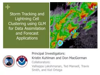
The Hazardous Weather Testbed and Experimental Warning Program • Mission: to improve the nation's hazardous weather warning services by bringing together forecasters, researchers, trainers, developers, and user groups to develop, test and evaluate new techniques, applications, observing platforms, and technologies. • Goal:Improve decision support for the prediction of high impact severe weather hazards at the WFO “warning scale” (0-2 hours).
The Forecaster’s Operational Week: • The 2011 weekly shift schedule: • Mon 10a-6p Orientation and Training (includes 3 hr WES case) • Tue-Thu 10a-6p Early “forecast” shift • Tue-Thu 1p-9p Late “warning” shift • Fri 10a-1p Debriefing and optional seminars • Early forecast shift: Issue Target Area Forecast Discussion • GOES-R Nearcast and CI forecasts • High Resolution Model Evaluation • Late Warning Shift: Issue nowcasts/warnings using experimental data • GOES-R pGLM product evaluation • 3D-Var product evaluation
Creation of the PGLM product • Flash sorting – real-time - WDSSII • Flash Extent Density – Flash Footprint
Cases from Spring/Summer 2011 • 19 May 2010 – archive event (OK - supercells) • 11 May 2011 (OK – isolated cells & MCS) • 12 May 2011 (OK – severe multicell) • 17 May 2011 (DC – multicell storms) • 19 May 2011 (OK – multicell storms & clusters) • 23 May 2011 (OK – multicell, short-lived storms) • 24 May 2011 (OK – supercells) • 26 May 2011 (DC – developing squall line) • 9 June 2011 (OK – multicell)
Real-time Product Integration: “Ultimate CI” • Interrogation preferences
Real-time Product Integration: Storm Tracks • Interrogation preferences
Forecaster Feedback • “The total lightning data is an excellent tool for monitoring convection, I see much promise for such data in the future, especially since CG strikes may be only a small fraction of the total lightning strikes within a given storm. “ • “I utilized it as a situational awareness product and then kept a watch on my tried and true radar practices to issue the warning. The PGLM data gave me more confidence in my warning. Which is always something that is positive.”
Forecaster Feedback • “Total lightning data preceded the CG network anywhere from 10-40 minutes. I was able to quickly determine when flash rate was significantly increasing, and then compare with satellite and updraft/downdraft parameters for a nice big picture.” • “Coming into the day, I wasn't quite sure when or where to or why to use the data, but after using it. I really think it has a lot of functionality and is useful in warning operations. I look forward to it as a product from the GOES-R.”
Forecaster Feedback • Lightning Safety • “We have a lot of users like golf courses and parks that we may not be paying attention to, especially for lightning safety in stratiform rain regions where people may think that it's just light rain… When I'm in warning operations, I get engaged in the base radar data and pay less attention to everything else. This may help a lot in those situations” • “Lightning danger for first and last flash and stratiform rain regions… Provides details on which anvils well downstream of main core are electrically active.” • Integration with other products: • “When we saw cell mergers there was a rapid increase in flash rate over a 5 minute time period and updraft intensity from the 3D-VAR analysis” • Aviation & Fire Wx – Increased operational efficiency • PGLM data can help fill the holes by radar and NLDN. There won’t be as much surprise by lightning starts • Reduced FAR for airport shutdown – (e.g., Demetriades, Holle, Hembury)
Changes & Additions for future testing • Some type of IC/CG ‘ratio’ or ‘fraction’ product • Trend display: both gridded and time series (storm tracking) • Color Scale • An additional DRT/WES case focused specifically on lightning applications: Aviation? Flooding? Lightning Safety? Fire or Winter Weather? • Development of “proxy” data from WTLN for increased real-time coverage for CONUS? • "Need more research on the forecasting applications of this data."