Download
1 / 1
20 likes | 201 Views
Progress in Community Radiative Transfer Model for Satellite Radiance Assimilation Quanhua (Mark) Liu 1,2 , Paul van Delst 1,3 , Ming Chen 1 , David Groff 1,3 , Yong Chen 2 , Andrew Collard 3 , Sid-Ahmed Boukabara 1 , Fuzhong Weng 4 , John Derber 3

E N D
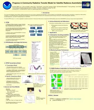
Progress in Community Radiative Transfer Model for Satellite Radiance Assimilation Quanhua (Mark) Liu1,2, Paul van Delst1,3, Ming Chen1, David Groff1,3,Yong Chen2, Andrew Collard3, Sid-Ahmed Boukabara1, Fuzhong Weng4, John Derber3 1 Joint Center for Satellite Data Assimilation; 2 ESSIC, University of Maryland, College Park, MD 3 NOAA/NCEP; 4 NOAA/NESDIS Center for Satellite Applications and Research; 1. Introduction The Community Radiative Transfer Model (CRTM), developed at the Joint Center for Satellite Data Assimilation, has been applied to the NOAA/NWS operational radiance assimilation in supporting of daily weather forecasting, to the NOAA Microwave Integrated Retrieval System for operational satellite products, and to international remote sensing community for remote sensing sensor calibration, air quality application, and others including projects at CICS/ESSIC. The latest CRTM version 2.1.3, which is applicable for passive microwave, infrared and visible sensors. It supports all NOAA satellite instruments, NASA MODIS, and many foreign meteorological satellites. 6. Surface Emissivity and Reflectance • 2. CRTM • The surface is divided as Water, Land, Ice, and Snow. • CRTM computes emissivity and reflectance internally. • CRTM accepts user defined emissivity data. • CRTM uses Ocean BRDF IR model. Other • BRDF is under development. • CRTM was initially proposed to support primarily the JCSDA partners to assimilate satellite radiance data into global/regional forecast systems • It is now also supporting the US satellite program developments through generating a high quality proxy data for algorithm tests, developments and integrations • It has been used in the NOAA/NESDIS microwave sounding product system • It can be used to generate the synthetic satellite radiances from NWP nature runs for observation system simulation experiments (OSSE) • It is linked to other key projects such as climate reanalysis and satellite cal/val Joint Center for Satellite Data Assimilation (JCSDA) Partner Organizations Using the CRTM IR BRDF model, simulations over oceans agree with measurements. 7. Applications 5 hPa 7.1 Stratosphere Sounding Unit(SSU) SSU mission was started onboard TIROS-N in October 1978 ended onboard NOAA-14 in 2007. Using the CRTM, we removed the effects of atmospheric and cell CO2 for a long-term data record of stratospheric temperatures. SSU showed that stratospheric temperatures may gradually recovered after 1996. Microwave sound unit (MSU) data supported the finding. Liu, Q., and F. Weng, 2009: Recent stratospheric temperature observed from satellite measurements, SOLA, 5, 53-56, doi:10.2151/sola.2009-014. 15 hPa • 3. CRTM Modules and Supported Sensors Support more than 100 Sensors GOES-R ABI TIROS-N to NOAA-19 AVHRR TIROS-N to NOAA-19 HIRS GOES-8 to 14 Imager GOES-8 to 14 sounder Terra/Aqua MODIS METEOSAT-SG1 SEVIRI Aqua AIRS, AMSR-E, AMSU-A, HSB NOAA-15 to 19 AMSU-A NOAA-15 to 17 AMSU-B NOAA-18, 19 MHS TIROS-N to NOAA-14 MSU, DMSP F13 to 15 SSM/I DMSP F13,15 SSM/T1 DMSP F14,15 SSM/T2 DMSP F16-20 SSMIS Coriolis Windsat TiROS to NOAA-14 SSU METOP-A IASI AMSUA, MHS, HIRS, AVHRR FY-3 IRAS, MWTS, MWHS, MWRI SNPP CrIS/ATMS/VIIRS AMSR2, AMSR-E, TMI others public interfaces Forward model Tangent-linear model Adjoint model Jacobian model CRTM Clearance CRTM Initialization 7.2 Monitoring Sensor Performance SfcOptics (Surface Emissivity Reflectivity Models) AerosolScatter (Aerosol Absorption Scattering Model) CloudScatter (Cloud Absorption Scattering Model) Molecular scattering AtmAbsorption (Gaseous Absorption Model) Using the CRTM simulation, we identified that VIIRS M12 image striping over oceans at daytime was caused by the difference among 16 detectors. Liu, Q., C. Cao, and F. Weng, 2013: Striping in the Suomi NPP VIIRS Thermal Bands through Anisotropic Surface Reflection, J. Atmos. Oceanic. Technol., 30, 2478–2487. doi: http://dx.doi.org/10.1175/JTECH-D-13-00054.1 RTSolution (RT Solver) Source Functions CRTM main modules • 4. CRTM Transmittance Model Strong absorption above 20 hPa for NOAA-16 because of out-of-band. 4.1 Transmittance Model • The transmittance model is to compute atmospheric transmittance from absorbing gases • In addition to ODAS model, a new transmittance model ODPS (Optical Depth in Pressure Space) has been implemented in version 2. • Variable absorbing gases: H2O, CO2, O3, CO, N2O and CH4 7.3 SSMIS Radiance Assimilation for Hurricane Prediction The SSMIS measures radiances in 24 channels covering a wide range of frequencies (19 – 183 GHz) conical scan geometry at an earth incidence angle of 53 degrees maintains uniform spatial resolution, across the entire swath of 1700 km. CRTM simulated IASI, AIRS and CrIS spectrum 4.2 Specific Transmittance Model • Zeeman-splitting effect into account for affected microwave channels • Stratospheric sounder unit transmittance for accounting for onboard CO2 cell pressure leaking. • NLTE Model Zeeman effect: The O2 transition line is split into many sublines, which can change transmittance. SSU 5. Aerosol and Cloud Models Aerosols: Global Model, GOCART Dust, Sea Salt, Organic carbon, Black carbon, Sulfate Regional Model CMAQ is under implementation. Aerosol are assumed to be spherical particles. Spheroid shape for dust is under consideration. Clouds: Liquid, Rain, Snow, Ice, Graupel, and Hail Non-spherical particles for ice cloud are used for Visible and IR bands. Impact studies. Control the operational result; Test using SSMIS radiance assimilations. Liu and Weng, 2006: GRL, V33, L22811. Satellite information contents: SSMIS brightness temperature varies as Hurricane developed and degraded. Liu and Weng, 2006: GRL,V33, L06817 CRTM 2.1 Release Effect of non-spherical particles. Ding, et al. TAMU CRTM 2.1.3 release is available from ftp.emc.ncep.noaa.gov at jcsda/CRTM/REL-2.1.3