Download
1 / 40
400 likes | 426 Views
This project aims to assess flora, fauna, and abiotic factors in peatlands to understand their role in climate change adaptation. Survey methods include intensive site surveys and extensive site sampling across Wisconsin. Results from 2005 surveys show a diverse range of species studied.

E N D
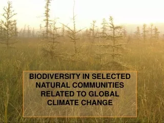
BIODIVERSITY IN SELECTED NATURAL COMMUNITIES RELATED TO GLOBAL CLIMATE CHANGE
Funding & Participants • A 5-year grant awarded through the Wisconsin Focus on Energy program • Natural Heritage Inventory and the Ecosystem Inventory and Monitoring sections “This presentation is the property of the State of Wisconsin, Department of Administration, Division of Energy, and was funded through the WISCONSIN FOCUS ON ENERGY Program.”
Project goals • Provide baseline data on presence, abundance, and distribution of selected taxon groups associated with peatlands • Document selected biotic and abiotic variables that could influence the organisms being studied • Determine status of selected peatland obligate animals and plants • Replicable such that it can be repeated in 10-20 years
pH very acidic acidic circumneutral neutral to alkaline alkaline poor fen shore fen boreal rich fen calcareous fen open bog Canopy Cover muskeg n. wet forest black spruce - tamarack s. tamarack swamp n. hardwood swamp n. wet-mesic forest (cedar swamp)
Species groups • All small mammals • Breeding passerine birds • Selected terrestrial & aquatic invertebrates • All amphibians • Rare vascular plants • Selected rare birds (e.g., yellow rails) • Selected rare herps (e.g.,northern ribbon snakes) • Bryophytes at several sites
Intensive site surveys provide: • Both a volume of data and repetition over time • A “normal” range of variation; for example, there was little precipitation for much of the 2005 field season • Wide taxonomic resolution through a combination of intensive and extensive surveys
Ecological Sections in Wisconsin
Extensive site surveys provide: • Broad scale spatial resolution should occur through extensive site surveys. Each extensive site will be surveyed once over the course of the grant, but we will survey many (200-400) sites across Wisconsin. • Wide taxonomic resolution through a combination of intensive & extensive surveys
Randomly Selected Points from WISCLAND “Peats” 200 points (not weighted by Province) 149 (includes several on the line) 51
212 Laurentian Mixed Forest (29,238 sq mi.) 222 E. Broadleaf Forest (26,840 sq mi.)
WBBA Grid Intersected with WISCLAND “Peats” 200 Random Points Weighted by Section • 136 in 212 • 64 in 222
Criteria (1) • Exclude existing Intensive Sites. • All taxa groups will sample within the core area and may sample outside the core area as time permits. • No special degree of protection so sites could be on public or private land • Land owner contact specialist
Criteria (2) • 40 acres of contiguous peat • within 100 acres of contiguous wetland (can extend outside of grid block) • potentially suitable habitat based on WISCLAND, soils, and/or WWI data. • Open, closed, or both (preferred)
“New”grid • In the Southern Province (222), only about one out of five Extensive sites evaluated in the field were found be suitable for this project. We had selected all possible potential sites using the WBBA grid (461 squares in 222) during spring 2004 and ran out of acceptable sites. • We needed to identify more potential sites in 222 and possibly in 212
“New” grid possible approaches • One approach would be to develop a second grid and continue identifying sites the way we had previously, i.e., random grid selection followed by interpretation of the various GIS layers and aerial photographs. • A second approach would be to develop a second grid based on a universe of known potential peat sites derived from the Natural Heritage Inventory (NHI) database.
“New” grid Dark blocks intersect with natural communities in the NHI database
Potential extensive sites in Province 222 selected from the “new” grid
Potential extensive sites evaluated in 2005. 80+ sites
Number of Potential Extensive Sites • Combined WBBA & “new” grid = 612 sites • Includes animal sites • Includes sites on private land • 249 sites were delineated in Province 222 • 363 sites were delineated in Province 212
Extensive sites surveyed by the different taxa groups in 2005. Note that some sites were surveyed by >1 taxa group. 130 sites in all.
Rare Invertebrates - 2005 • Macroinvertebrates: 76 visits were made to 60 sites including 56 Extensive Sites; 46 taxa including 6 target species have been recorded. Identification of specimens was recently completed. • Terrestrial invertebrates: 106 visits were made to 72 sites including 64 Extensive Sites for orthopterans and lepidopterans; 19 taxa (Lepidoptera and Orthoptera), including 10 target species. Data entry continues.
Rare Bird Surveys • In 2005, 39 sites were surveyed: 28 Extensive, 10 Intensive, 1 non-peatland • 2006 focused on repeated surveys at 21 sites • Target species: American bittern, LaConte’s sparrow, Nelson's Sharp-tailed Sparrow, Yellow Rail. Each species was found at 1 or more sites.
Products/Conclusions • Heritage working list revisions • Passerine breeding bird habitat model • Contributions to the revision of Mammals of Wisconsin • Replicable set of data for future surveys • The utility but faults of GIS layers • Development & populating of a site database