Download
1 / 11
110 likes | 234 Views
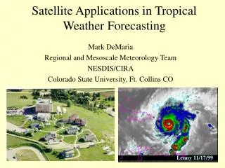
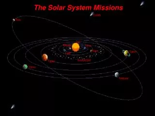
NASA’s Decadal Survey Satellite Missions Doug Alsdorf, Ohio State University funded by: NASA and OSU’s Climate, Water, & Carbon Program. Global Precipitation Measurement (launches in 2013 and 2014). GPM.

E N D
NASA’s Decadal Survey Satellite Missions Doug Alsdorf, Ohio State University funded by: NASA and OSU’s Climate, Water, & Carbon Program
Global Precipitation Measurement (launches in 2013 and 2014) GPM • GPM centers on the deployment of a NASA-JAXA Core Observatory in 2013 carrying an advanced radar-radiometer system to serve as a “precipitation physics observatory” and as a “calibration reference” for all constellation radiometers. • A Constellation spacecraft is a broadly encompassing term that include any spacecraft that contributes rainfall measurements to the GPM Program. • GPM is a science mission with integrated applications goals to provide uniform constellation-based global precipitation measurements to improve understanding of the Earth’s water/energy fluxes and extend current capabilities in weather/climate forecasting, natural hazard prediction, and freshwater resource management. • The Core spacecraft will be launched into a 65° high inclination orbit at a 407-kilometer altitude. Measures rainfall, globally every 3 hours (i.e., relies on a constellation). • A microwave imager (GMI, 4 high frequencies, and 9 microwaves, 800km swath width) and a dual frequency precipitation radar (DPR, Ku-band 13.6-GHz 245 km swath width, and a Ka-band 35.5-GHz 100 km swath width). • The DPR, will have the capability to make detailed, three-dimensional measurements of cloud structure, rainfall, and rain rates. Will have a 4km horizontal resolution and a 250m vertical resolution. http://www.eorc.jaxa.jp/GPM http://gpm.gsfc.nasa.gov/
Released: 15 Jan 07 NRC Decadal Survey Tier 1 Missions • 17 missions selected • 14 are exclusively NASA • 7 Missions selected by Congress,Dec. 26, 2007, to share initial funding of $40M in 2008 • 100+ submitted mission ideas • 115 people involved • committee members and referees www.nap.edu/catalog/11820.html
NRC Decadal Survey Tier 2 Missions http://science.nasa.gov/earth-science/decadal-surveys
NRC Decadal Survey Tier 3 Missions
Climate Absolute Radiance and Refractivity Observatory CLARREO • CLARREO provides new solar reflected and infrared emitted high spectral resolution benchmark radiance climate data records that can be used to test climate model predictions, improve climate change fingerprinting, and attribution. • CLARREO provides an orbiting calibration observatory that can be used to calibrate other solar and infrared space-borne sensors • Key climate variable decadal records impacted by CLARREO include: atmospheric temperature and water vapor profiles, land and sea surface temperatures, cloud properties, radiation budget including Earth’s albedo, vegetation, surface snow and ice properties, ocean color, and aerosols. • Is a spectrometer in the 0.38 to 2.5mm spectral range with 5-10 nm spectral resolution • Spatial sampling will be 1-km IFOV over a 100-km swath (instant. field of view) • Nadir to 70 degree off-nadir pointing. • Calibrate at equatorial-to-polar latitudes; precess across all hours of the day every 3 months • 600km altitude • Essentially, is an instrument for collecting new solar radiation measurements and especially for cross-calibrating with other satellites and products (e.g., MODIS, VIIRS, etc.). http://map.nasa.gov/clarreo.html
Soil Moisture Active Passive SMAP • SMAP will provide global measurements of soil moisture and its freeze/thaw state. These measurements will be used to enhance understanding of processes that link the water, energy and carbon cycles, and to extend the capabilities of weather and climate prediction models. • The SMAP instrument includes a radiometer and a synthetic aperture radar operating at L-band (1.20-1.41 GHz). The instrument is designed to make coincident measurements of surface emission and backscatter, with the ability to sense the soil conditions through moderate vegetation cover. The antenna scan has a swath width of 1000 km providing global coverage within 3 days at the equator and 2 days at boreal latitudes (>45 degrees N). • The L-band SAR will have a spatial resolution of 1 to 3 km; the radiometer will be 40km. Soil moisture will be estimated optimally at a resolution of 10 km and freeze-thaw state at a resolution of 1-3 km. • Radar polarizations include: VV, HH, HV http://smap.jpl.nasa.gov/
Hyperspectral Infrared Imager HyspIRI • Global imaging measurements for surface reflectance, water leaving radiance, thermal emissivity, and surface radiance and temperature that will enable science and applications users to advance the current understanding of the Earth’s ecology, biogeochemistry, biodiversity, coastal and inland waters, geology, natural hazards, hydrology, climate, and studies of the carbon cycle. • What is the global distribution and status of terrestrial and shallow–aquatic ecosystems and how are they changing? • The HyspIRI mission includes two instruments mounted on a satellite in Low Earth sun-synchronous Orbit. There is an imaging spectrometer measuring from the visible to short wave infrared (VSWIR) and a multispectral thermal infrared (TIR) imager. • The VSWIR will have a temporal revisit of of approximately 3 weeks and the TIR will have a temporal revisit of approximately 1 week. • VSWIR: 380 to 2500 nm in the solar reflected spectrum with 10nm sampling. • VSWIR: 145 km wide swath, 60m to 70m spatial resolution, repeated every 19 days • TIR: 8 bands from 3.98 μm to 12.05 μm (microns) • TIR: 600 km wide swath 60m spatial resolution, repeated every 5 days http://hyspiri.jpl.nasa.gov/
Surface Water & Ocean Topography SWOT • SWOT mission brings together two communities focused on a better understanding of the world's oceans and its terrestrial surface waters. U.S. and French oceanographers and hydrologists have joined forces to develop this new space mission to make the first global survey of Earth's surface water, observe the fine details of the ocean's surface topography, and measure how water bodies change over time. • Unfortunately, our knowledge of the global dynamics of terrestrial surface waters and their interactions with coastal oceans in estuaries is very limited. By measuring water storage changes in all wetlands, lakes, and reservoirs and making it possible to estimate discharge in rivers more accurately, SWOT will contribute to a fundamental understanding of the terrestrial branch of the global water cycle. • Non sun-synchronous polar orbit at about 900km • 140 km wide swath with spatial resolutions between 2mx10m to 2mx70m for land and 1km for oceans. • Measures the elevation of water surface to accuracy of +/-50cm per pixel. Spatial averaging reduces error by sqrt(n) so that 1km samples are +/- 1cm. • Global coverage every 11 days, more often toward poles http://swot.jpl.nasa.gov/
KaRIN: Ka-Band Radar Interferometer • Ka-band SAR inter-ferometricsystem with 2 swaths, each 60 km wide • WSOA and SRTM heritage • Produces heights and co-registered all-weather imagery required by both communities • No land data compression onboard (+/-50 cm height accuracy per pixel) • Onboard data compression over the ocean (1km resolution) • Because looking near nadir, height accuracy improved by more than an order of magnitude over SRTM. • Noise is uncorrelated, thus averaging further improves height accuracy by sqrt(n). Graphics: Karen Wiedman
Overarching Issues and Questions • For at least the next decade, NASA will focus on building and launching the “Decadal Survey” missions. Not all 14+ missions will be launched, but perhaps as many as 7 will be launched. • Great Lakes science should be connected to these missions, but how should we do this connection? Connection end-members range from attending mission planning meetings to requesting Great Lakes design criteria. • Which Decadal Survey missions are of greatest interest to Great Lakes science and applications? We should focus on these missions. • What is the exact wording of the Great Lakes science and application questions to be presented to the Decadal Survey missions?