Download
1 / 47
470 likes | 685 Views
Arc Hydro and HSPF by David R. Maidment Center for Research in Water Resources University of Texas at Austin. Arc Hydro and hydrologic models “Map to Map” application using Model Builder Interfacing HEC Models and the Geodatabase. Aquaterra, Decatur GA 12 July 2004. Arc Hydro and HSPF.

E N D
Arc Hydro and HSPFby David R. MaidmentCenter for Research in Water ResourcesUniversity of Texas at Austin • Arc Hydro and hydrologic models • “Map to Map” application using Model Builder • Interfacing HEC Models and the Geodatabase Aquaterra, Decatur GA 12 July 2004
Arc Hydro and HSPF • Arc Hydro and hydrologic models • “Map to Map” application using Model Builder • Interfacing HEC Models and the Geodatabase
Modeling Geodatabase Hydrologic Information System A hydrologic information system is a combination of geospatial and temporal hydrologic data with hydrologic models that supports hydrologic practice, science and education
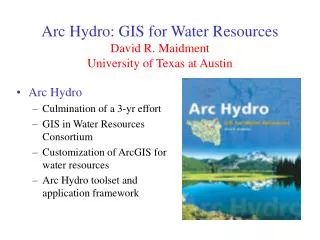
Arc Hydro An ArcGIS data model for water resources Arc Hydro toolset for implementation Framework for linking hydrologic simulation models Arc Hydro: GIS for Water Resources The Arc Hydro data model and application tools are in the public domain
Drainage System Hydro Network Flow Time Time Series Hydrography Channel System Arc Hydro Components
Arc Hydro Framework Data Model
Arc Hydro Framework For South Florida Basins Waterbody (NHD) Hydro Points National Hydrography Dataset, NHD
Nexrad over South Florida • Real-time radar rainfall data calibrated to raingages • Data received each 15 minutes • 2 km grid • Stored by SFWMD in Arc Hydro format
Nexrad data in Arc Hydro Attribute series Display as a temporal layer in ArcGIS Tracking Analyst
GIS Preprocessors for Hydrologic Models GIS InterfacePrograms HMS Geo HMS Database HSPF Basins RAS Geo RAS
Geographically Integrated Hydrologic Models GIS Interfacedata models HMS HMS IDM Geo Database HSPF Arc Hydro data model HSPF IDM RAS RAS IDM
Arc Hydro and HSPF • Arc Hydro and hydrologic models • “Map to Map” application using Model Builder • Interfacing HEC Models and the Geodatabase
Regional Storm Water Modeling Program and Master Plan for San Antonio City of San Antonio
San Antonio Regional Watershed Modeling System Geospatial Data: City, County SARA, other “Bring the models together” Modeling System Rainfall Data: Rain gages Nexrad Calibration Data: Flows Water Quality Floodplain Management Capital Improvement Planning Water quality planning Integrated Regional Water Resources planning Flood Forecasting
Sources of Rainmap data • Historical Nexrad data – NWS and TNRIS archive • Design rainfall maps – 2, 5, 10, 25, 50, 100 year design rainfalls as used for FEMA floodplain studies • Real-time Nexrad data using web services (Tom Wesp)
NEXRAD WSR-88D Radars in Central Texas(Weather Surveillance Radar-1988 Doppler)scanning range = 230 km NEXRAD Products: Stage I: Just Radar Stage II: gages, satellite, and surface temperature Stage III: Continuous mosaic from radar overlaps EWX – NEXRAD Radar in New Braunfels Source: PBS&J, 2003
Reading Historical Archives of NEXRAD Datasets from Internet FTP Server Internet Local
Design Rainfall Maps 100yr 06h 100yr 12h 100yr 24h
Regional Watershed Modeling System Case Study Salado Creek watershed Components: • Arc HydroGeodatabase • for whole watershed • HEC-HMShydrology model • for whole watershed • HEC-RAShydraulic model • for Rosillo Creek Bexar County Rosillo Creekwatershed
Arc Hydro and HEC-HMS HEC-HMS Hydrologic Model Arc Hydro Schematic Network Calculates Flows
Arc Hydro and HEC-RAS HEC-RAS Hydraulic Model Calculates Water Surface Elevations Arc Hydro Channel Cross Sections
HEC Data Storage System (DSS)(binary data file system shared by HEC models) • An exact replica of the binary DSS files is stored in the ArcGIS geodatabase • An Arc 9 Toolbox exchanges data between DSS and the geodatabase Time series catalog Many time series
Flow Change Points Models communicate with one another through Arc Hydro at designated points
FLOODPLAIN MAP Nexrad Map to Flood Map in Arc 9 Model Builder Flood map as output Model for flood flow HMS Model for flood depth Nexrad rainfall map as input
Arc Hydro and HSPF • Arc Hydro and hydrologic models • “Map to Map” application using Model Builder • Interfacing HEC Models and the Geodatabase
GeoRAS Connecting Arc Hydro and Hydrologic Models GIS Interfacedata models HMS HMS IDM GeoHMS Geo Database Arc Hydro data model RAS RAS IDM
IDM Data Transfer Goal • To store data in a manner so that it is readily transferable from geodatabase to HMS files, and visa versa. HMS files HMS geodatabase
IDM Arc Hydro Compliance Goal • Arc Hydro connectivity and naming conventions Arc Hydro Geodatabase IDM Geodatabase HEC-HMS Program files HydroID FeatureID HMSCode Element Names
Flow Network Connection between HMS feature classes and parameter tables Connection between HMS and IDM elements The HMSCode .basin HMS text file HMSSubbasin attribute table HMSInitialConstant table IDM
Importing HMS Data Use Visual Basic to develop codes for transferring data.
Constant Loss Rate (inches/hour) Llano at Junction Model Rainfall lost to infiltration
Snyder Time to Peak (hours) Llano at Junction Model Time to Peak
Modified Puls Storage (ac-ft) Llano at Junction Model Storage required to produce 5000 cfs flow
Geodatabase – Model Data Exchange GIS Interfacedata models HMS HMS IDM Geo Database Arc Hydro data model RAS RAS IDM
XML-Based Data Exchange • Platform Independent • Application Independent • Ready to share with many third party applications • Updates do not require code recompilation
XML Transformations Input XML to be Transformed Input XSLT stylesheet (template rules) XSLT Processor • HTML pages • XML docs • Text files External Apps
FEMA Map Modernization • Redoing Floodplain maps of the nation over the next 5 years • Storing all data and models permanently in digital form on a server farm in North Carolina • Using a “Management Information Portal” to enter information • Spending $1.5 billion • This will create a digital hydraulic information infrastructure for the whole nation
Conclusions • An interface data model provides a convenient way of storing and visualizing the content of a hydrologic model • Combination of interface data models and ArcGIS Model Builder provides a very efficient means of work flow automation • How to integrate with HSPF?