Download
1 / 25
250 likes | 273 Views
Enhancing data accessibility and exchange for better understanding of water resources under climate challenges and droughts. Focus on incorporating real-time monitoring, modeling, and deriving useful water information for various applications.

E N D
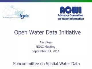
June 26, 2014 Steering Committee Meeting Open Water Data Initiative Kevin T. Gallagher USGS, Associate Director, Core Science Systems
Open Water Data Ad Hoc Working Group • Anne Castle, Department of Interior, Assistant Secretary for Water and Science • Lori Caramanian, Department of the Interior, Deputy Assistant Secretary for Water and Science • Jerry Johnston, Department of the Interior, Geospatial Information Officer, Managing Partner representative for the Geospatial Platform • Bill Werkheiser, USGS, Associate Director for Water • Jerad Bales, USGS Chief of Research and Science for Water and representative to IWRSS • Nate Booth, USGS, Chief - Office of Water Information • Don Cline, NOAA, National Weather Service, Chief-Hydrology Laboratory, NWS representative to IWRSS • James Dalton, US Army Corps of Engineers, Chief of Engineering and Construction, USACE representative to IWRSS • David Maidment, University of Texas, Professor of Civil Engineering • Kevin T. Gallagher, USGS, Associate Director for Core Science Systems • Ivan DeLoatch, USGS, Executive Director, FGDC Secretariat
Background & Motivation • Quantifying the availability, use, and risks to our national water resources is an issue of national importance for the present and the foreseeable future. • Improving access to data and enabling open exchange of water information is foundational to identifying and understanding existing water resources issues - particularly in the face of climate change and unprecedented drought.
Background & Motivation • There have been numerous studies, reports, and publications indicating fragmentation of water information. • "Foundational to [meeting the global water challenge] is the need to improve access to and exchange of water data and information, including better modeling of the hydrologic cycle, to include the impact of human-use decisions.” – John Holdren
White House Climate Data Initiative(March 2014) • Assembly and exposure of federal government information to communities and private sector • Engagement to develop new applications for citizens, and industry
Frame a Possibility • Capture your Imagination • Inspire you to Action
Major Transitions in Geospatial Info • Paper maps to digital data • National Spatial Data Infrastructure development • Started in 1990’s • Took more than a decade to complete • Digital data to web services • Started several years ago • Will take years to complete Maps Data Services • Courtesy David Maidment, University of Texas
Major Transitions in Geospatial Info • Paper maps to digital data • National Spatial Data Infrastructure development • Started in 1990’s • Took more than a decade to complete • Digital data to web services • Started several years ago • Will take years to complete Maps Data Services Open Water Web
Major Transitions in Geospatial Info • Paper maps to digital data • National Spatial Data Infrastructure development • Started in 1990’s • Took more than a decade to complete • Digital data to web services • Started several years ago • Will take years to complete Maps Data Services Open Water Web What would that look like?
Open Water Data Vision • Foundational National Data Sets with Data Services to support a wide variety of water user applications • Water data metadata, web services and a community accessible on the Federal Geospatial Platform • Access to integrated real-time monitoring data • Data Assimilation for a National Modeling capability • Water Maps and other Derivative Products that integrate geospatial & water observations • Such as: current conditions, precipitation estimates, reservoir storage • Marketplace of open source applications (models, data visualizations, etc.) built upon Open Water Web Services
National Spatial Data Infrastructure Desired Future State of NSDI • Create network of resources and services • Facilitate discovery, access and application of resources • Leverage shared standard-based services • Develop core set of information layers that interface with nonspatial data • Use real-time data feeds and sensor webs
National Spatial Data Infrastructure Desired Future State of NSDI • Create network of resources and services • Facilitate discovery, access and application of resources • Leverage shared standard-based services • Develop core set of information layers that interface with nonspatial data • Use real-time data feeds and sensor webs Can this vision be realized for water data?
Foundational Water Data Sets • Landscape Variables • Climate/Weather/ET • Soil moisture • Human water use • Withdrawals • Return flows • Diversions • Losses • Streamflow • Groundwater levels • Aquifers • Water quality • Reservoir storage • Elevation • Hydrography – NHD/WBD
Building Upon Success Building Upon Success
ACWI – Advisory Committee on Water Information • Established in 1991
OGC/WMO Hydrology Domain Working Group November 2009 4-Year International Effort – WaterML A time series for one variable at one location Hydrology Domain Working Group formed OGC observer at CHy-13 Technical Meetings Each 3 MonthsFour Interoperability Experiments (Surface water, groundwater, forecasting) Annual week-long workshops Involvement by many countries Acknowledgements: OGC, WMO, GRDC, NWS, CUAHSI, BoM/CSIRO, USGS, GSC, Kisters, ……. 2008 2011 2010 2012 2009
Common Operating Picture for Water Resources • Geo-Intelligence Laboratory • Science and software studio • Systems proving ground • Distance learning
Proposal • We are proposing an Open Water Data Initiative that will: • integrate currently fragmented water information into a connected, national water data framework • leverage existing shared infrastructure and tools to provide a platform for innovation, modeling, and data sharing and solution development. • capitalize on cross-government interest in big data, IT innovation, Open Data, Data.gov, etc. • Build on the ground-breaking work of the FGDC, OGC, IWRSS, CUASI, ACWI, and others.
Charge for the FGDC • In collaboration with the ACWI and other partners – Advance an Open Water Data Initiative, including: • Reviving and populating the joint Subcommittee on Spatial Water Data to design a national open water data infrastructure; • Supporting IWRSS consortium members in the scoping and implementation pilot activities; • Creating an integrated water data portfolio for specific hydrologic regions or basins; • Developing a technical reference architecture that supports the sharing of water data and links observations to geospatial data; • Leveraging the Geospatial Platform to make water data more accessible and to support water data community collaboration;
Charge for the FGDC cont. • Identifying how existing investments in water data sharing can be integrated and leveraged; • Engaging the international community in standards and technology development including the Open Geospatial Consortium; • Identifying and prioritizing improvements to relevant framework geospatial data (National Hydrographic Dataset, Watershed Boundary Dataset, National Elevation Dataset, National Geologic Map Database, and the National Cooperative Soil Survey); • Utilizing the FGDC coordination and governance structure to support related activities in the federal water sector.
Next Steps • Endorse revival and re-populating of Subcommittee on Spatial Water Data • Issue charge to the subcommittee • Work with IWRSS consortium members to: • Refine charge going forward • Define and implement Pilot Projects • Schedule “periodic” check-ins with the Steering Committee
Questions? Kevin T. Gallagher USGS, Associate Director Core Science Systems kgallagher@ios.doi.gov