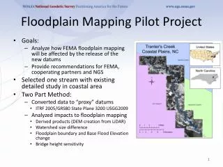
Floodplain Mapping Pilot Project
20 likes | 53 Views
This pilot project analyzes the impact of new datums on FEMA floodplain mapping, provides recommendations, and highlights the need for revised models and clear communication. Conclusions show minimal changes in floodplains but highlight the importance of an implementation plan.

Floodplain Mapping Pilot Project
E N D
Presentation Transcript
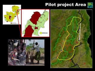
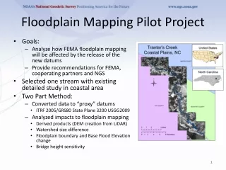
Floodplain Mapping Pilot Project • Goals: • Analyze how FEMA floodplain mapping will be affected by the release of the new datums • Provide recommendations for FEMA, cooperating partners and NGS • Selected one stream with existing detailed study in coastal area • Two Part Method: • Converted data to “proxy” datums • ITRF 2005/GRS80 State Plane 3200 USGG2009 • Analyzed impacts to floodplain mapping • Derived products (DEM creation from LiDAR) • Watershed size difference • Floodplain boundary and Base Flood Elevation change • Bridge height sensitivity
Pilot Project: Conclusions • Significant coordinates shift Horizontal: 2.716 ft/0.828 mVertical: -0.947 ft/-0.289 m • Larger impact on higher accuracy elevation data • DEMs derived from LiDAR can be transformed directly for hydrology, may use same models • Minimal changes in the floodplain, will depend on the location, the mapping method, and engineering judgment • Existing models will need to be revised to use ground data collected in new datums • While this study provides the first look at the expected effects, additional studies are warranted prior to the 2022 modernization • The development of an implementation plan is extremely important for FEMA and other agencies • Important to have a clear message and communication to constituents Full Report: http://www.ngs.noaa.gov/PUBS_LIB/Floodplain_Pilot_Project_Final.pdf