Download
1 / 10
100 likes | 123 Views
This paper discusses building a database for a Management Information System (MIS) focusing on irrigation and drainage schemes, emphasizing the geographic and attributive data required for efficient decision support. It highlights the components, information flow model, and collaboration aspects needed for successful MIS implementation.

E N D
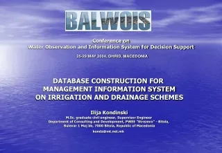
Conference onWater Observation and Information System for Decision Support25-29 MAY 2004, OHRID, MACEDONIA DATABASE CONSTRUCTION FOR MANAGEMENT INFORMATION SYSTEM ON IRRIGATION AND DRAINAGE SCHEMES Ilija Kondinski M.Sc. graduate civil engineer, Supervisor Engineer Department of Consulting and Development, PWEE "Strezevo" - Bitola, Bulevar 1 Maj bb, 7000 Bitola, Republic of Macedonia konda@mt.net.mk
Components of contemporary MIS • Geographic Information System (GIS) • Data (Database) • Hardware of MIS • Software of MIS • Personal (Lifeware) of MIS • Organization (Orgware) of MIS
Geodesical Bureau - Cadastral Data A great part of DB relates to the geographical data, - the topography necessary for preparation of a digital terrain model (DMT) of the IDS catchment and amelioration area, also including the digitalization of the data of cadastral plots. The State, through its authorized Institutions, should organize and assist the processing of: • The database for the Digital Terrain Model (DMT) of the catchment and amelioration area, • The database for keeping records of the cadastre plots (with owners, areas and coordinates of individual plots). • The database for the infrastructural facilities (water supply, sewerage), transportation (highway traffic, railroad transportation, postal), energetics (electric power, gas energy network), etc.
Attributive data for IDS In addition to the geographical part of the DB, also exist, another attributive part, relating to the features of the structures, and some other non-spatial data from legal and financial nature. In this part of the database should be created files, which will contain data essential for the processes taking place within the area comprised by IDS. They are • climatological and meteorological data, • hydrological data, • pedological data, • crop data, • crop-water relation data, • land registry data, etc.
Table 1. Necessary attributive files in the DB for MISIDS - Cont.
Table 1. Necessary attributive files in the DB for MISIDS - Cont. Hydrotechnical and other infrastructure of the interest of MISIDS
CONCLUSIONS • A basic prerequisite for efficient functioning of MISIDS is a construction and current updating of the consistent database, designed to support the decision-making process at different levels: operational, tactic and strategic. • Construction of the database - the most time-consuming step in creating a MIS. • For acceleration of the process of input of information into the database, at first should be collected those data which have been already placed in digital format. • The problems in MISIDS is multidisciplinary and requires team work of skilled staff from various professions and scientific disciplines (hydraulics, hydrology, water engineering, hydrogeology, meteorology, metrology, soil science, agriculture, cybernetics, informatics, electronics, telecommunications and others) • Develop a colaboration between IS on relevant institutions for MIS on IDS, about data supply or exchange • Develop a colaboration between MIS on IDS and water users about exchange and supply of data. • Overpassing a basic problem of financing of the development and maintenance of the fundamental databases and compensations for data utilization by the users. • Open access to data which was and are collecting with Government financial support