Download
1 / 16
230 likes | 788 Views
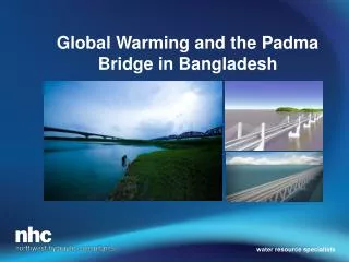
Global Warming and the Padma Bridge in Bangladesh. water resource specialists. The Indian Subcontinrent. Ganga – Brahmaputra – Meghna Rivers. Design Parameters. Bridge design flows Flood discharge - 100 yr flood Water level – 100 yr level Scour depths (elevations) = 100 yr scour

E N D
Global Warming and the Padma Bridge in Bangladesh water resource specialists
Design Parameters • Bridge design flows • Flood discharge - 100 yr flood • Water level – 100 yr level • Scour depths (elevations) = 100 yr scour • Global warming • Rainfall - + 25% by 2100 • Water level rise ? • Sea level rise – 0.5 to 1.0 m • Cyclones • Delta subsidence
Uttar Pradesh, Bihar, West Bengal, Assam and Bangladesh Bangladesh floods due to rainfall in Assam. Ganga does not influence flood levels significantly.
Bridge Pier Scour Hydraulic Model
Northeast Regional Project – Mean Annual Rainfall Range: 8000 mm/yr to 2000 mm/yr
Vanishing Glaciers Biggest Threat to World Food Supply Crops likely hit hardest by flooding, drought, pollution and will cause skyrocketing prices by Lester R. Brown According to the World Bank, it would take only a three-foot rise in sea leel to cover half the rice fields in Bangladesh, a country of nearly 160 million people. Washington Post Leter R. Brown is president of the Earth Policy Intitute an the author of “Plan B4.0: Mobilizing to Save Civilization.” World News Updated 24/7 at Vancoversun.com/world
Projected Areas of Flooding as a Result of Sea-level Change in Bangladesh Two scenarios (low=1m and high=3 m) (modified after Broadus et al./ 1986 Broadus, J., Milliman, J., Edwards, S., Aubrey, D. and Gale, F., 1986, Rising sea level and damming of rivers: possible effects in Egypt and Bangladesh. In J.G. Titus (ed.), Effects of changes in stratospheric ozone and global climate. Washington, DC: United nations Environment Program/U.S. Environmental Protection Agency, 165-89.
Design Parameters • Bridge design flows • Flood discharge - 100 yr flood • Water level – 100 yr level • Scour depths (elevations) = 100 yr scour • Global warming • Rainfall - + 25% by 2100 • Water level rise ? • Sea level rise – 0.5 to 1.0 m • Cyclones • Delta subsidence