Download
1 / 44
440 likes | 468 Views
Explore the geometry, recharge, discharges, and piezometry of the Iullemeden aquifer system, focusing on water balance and effective management strategies using environmental tracers and remote sensing. Discover insights on groundwater balance estimates, age dating with tracers, and potential overexploitation prevention.

E N D
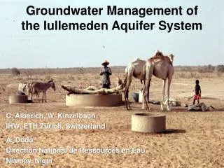
Groundwater Management of the Iullemeden Aquifer System C. Alberich, W. Kinzelbach IHW, ETH Zürich, Switzerland A. Dodo Direction National de Ressources en Eau Niamey, Niger
Contents • Geometry and boundary conditions of model • Recharge estimation • Discharges • Piezometry • Water balance • Conclusions
Geometry and Boundary Conditions Cristallin Rock B Primary Argiles d‘Irhazer Ci -Ch Marin Cretaceous Adrar des Iforas Massif de l‘Aïr Ct Tombouctou Gao Detroit Soudanaise Rift Oriental LAKE TCHAD Niamey Sokoto N‘guru Kano Maiduguri A
(Greigert,1979) Continental Terminal Paleocene - Ypresian Marine and Lacustrine Upper Cretaceous Iullemmeden aquifer system Continental intercalaire - Continental hamadien Argiles d‘Irhazer - Serie Izegouandane West of Massif de l‘Aïr Primary
19 19 18 18 17 17 16 16 15 15 1? 14 14 13 13 12 12 11 11 1 2 3 4 5 6 7 8 9 1 2 3 4 5 6 7 8 9 [Cr6a-5] [Cr6b] [Cr7] Upper Cretaceous Marine and Lacustrine Formations / Paleocene - Ypresian 19 18 17 16 15 14 13 12 11 1 2 3 4 5 6 7 8 9 Calc. à Neobilites Calcaires et argiles Lower sandstones Term I Calc. à Nigecigeras Term IV à Libycoceras ismaeli and mudstones Série Calc. Blancs Argiles sableuses Term II Mosasaurus shales Term V Rima Group Sables à Cocodriliens Série Marnes et Calcaires Upper sandstones TermVI-VII Paleocene Term III and mudstones (Sokoto Group)
Nigeria Niger / Mali Model Gwandu Ct3 Ct3 Ct2 Ct2 Ct1 Gwandu Ct1 Sokoto Terms VI and VII Terms IV and V Rima Terms I to III Lower sedimentary complex [Cr6-5] to [Cr7] Gundumi - Illo Ci -Ch
Radier,1959 Greigert,1961 Greigert and Pougnet,1967 Greigert,1979 Ogilbee andAnderson, 1965/1973 Oteze, 1976 Pallas, 1971 Boundary Conditions Cristallin Rock Primary Argiles d‘Irhazer Ci -Ch Marine Cretaceous Adrar des Iforas Massif de l‘Aïr Ct Anefis Agades Tombouctou Gao Detroit Soudanaise Rift Oriental Taouardeï Zinder LAKE TCHAD Niamey Sokoto N‘guru Kano Maiduguri
Recharge • Single most important figure for sustainable management. • Water balance methods and Darcy formula notoriously inaccurate (factor of 10) • Environmental tracers can often be better (factor of 2-3) • Tracers used: Tritium, Tritium-3He, CFC (Freons), SF6, Chloride • Remote sensing info combined with groundwater flow and transport models allow to test hypotheses on recharge mechanisms (areal and concentrated recharge) • Use of precipitation and evapotranspiration maps obtained with RS methods can help at delineating zones
ATMOSPHERIC CFC CONCENTRATIONS IN THE ATMOSPHERE F12 F11
Principle of Age Dating With Tracers Result: Pore velocity u = L/t delay t With porosity we obtain specific flux q = nu With area we obtain total flux Q = qA L
Evapotranspiration for the 5th March 1992 calculated from NOAA-AVHRR using SEBAL mm/d
Precipitation map from METEOSAT (Example 1-10 June 1995) mm/10d 10° – 20° North 0° – 10° East
Tritium corrected to 1985 related to depth to the water table 0
Population Distribution in the Iullemmeden Estimated water consumption 50 l/person/day Inhabitants/km2 or more
Discharge by Evapotranspiration • Potential ET • 2000 mm/a • Digital terrain model • Extinction depth for evapotranspiration • up to 50 m • Evaporation by vapour transport (Coudrain-Ribstein) • E = 71.7 z -1.49 (E in mm/a, z in m) • in Iullemmeden basin negligible
Groundwater balance (first rough estimate from model) + 70 m3/s - 50 m3/s - 10 m3/s - 10 m3/s
Conclusions 1 • Model concept available due to previous work • Mechanisms of recharge can only be identified in more local studies, generalization to the total area requires related remote sensing data • Distributed input data such as discharges rely heavily on proxi data such as population maps, soil maps and remote sensing data • Accuracy of model fluxes still has to verified. In this task environmental tracers are useful
Conclusions 2 • Presently overexploitation has not yet started • New technology can help to do a better job in resource assessment than has been possible in the past • Besides the donor driven activities in Niger which lead to a large number of new wells a strategic consideration of the whole is necessary