Download
1 / 19
190 likes | 333 Views
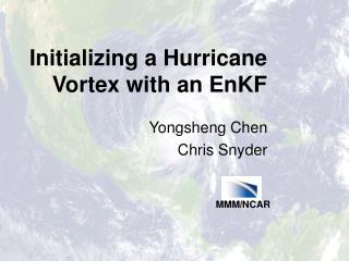
MMM / NCAR. Initializing a Hurricane Vortex with an EnKF. Yongsheng Chen Chris Snyder. Hurricane Prediction. Yearly-average 24-h track forecast error ~ 150 km Initialization --- Challenge Vortex bogusing and relocation 3DVar, 4DVar Ensemble Kalman filter (EnKF)

E N D
MMM/NCAR Initializing a Hurricane Vortex with an EnKF Yongsheng Chen Chris Snyder
Hurricane Prediction • Yearly-average 24-h track forecast error ~ 150 km • Initialization --- Challenge • Vortex bogusing and relocation • 3DVar, 4DVar • Ensemble Kalman filter (EnKF) • Ensemble hurricane forecast • Probabilistic forecast is desirable • Implementing EnKF in an ensemble forecast system is simple • EnKF also provides initial conditions for ensemble forecast
Hurricane Observation Image courtesy of CIMSS/SSEC/WISC
Analysis Forecast Correction Ensemble Kalman Filter • Observation operator H: find vortex position from model state X • Kalman Gain K ~ Cov (X,HX) can be computed directly from the ensemble • Performance • Optimal when position errors are small and Gaussian • Degrades as position errors increase • Other observations such as intensity and shape can extend its effectiveness
80 km A Simple Example
Assimilating center position (sf ~ 20 km) + prior mean center o observed center
Assimilating center position (sf ~ 20 km) + prior mean center o observed center
Assimilating center position (sf ~ 20 km) + prior mean center o observed center dot posterior mean center
Experiments with WRF/DART • Weather Research and Forecasting model (V2.1) and Data Assimilation Research Testbed (pre_iceland) • 36 / 45 km horizontal resolution, 35 vertical levels • 26 / 28 ensemble members • Ensemble initial and boundary conditions are generated by perturbing AVN analysis/forecast with WRF-VAR error statistics • Assimilated observations: • hurricane track (center position and minimum sea level pressure from NHC advisories) • Satellite winds • GPS refractivity • Compare forecasts from the EnKF mean analysis and from the AVN analysis
Hurricane Ivan 2004 • 36-km horizontal resolution, 28 ensemble members • Assimilate position, intensity and satellite winds every 3h for a total of 24h • Compare forecasts initialized from the EnKF analysis and from the GFS analysis
Hurricane Ivan 2004 • 36-km horizontal resolution, 28 ensemble members • Assimilate position, intensity and satellite winds every 3h for a total of 24h • Compare forecasts initialized from the EnKF analysis and from the GFS analysis
Hurricane Ivan 2004 • 36-km horizontal resolution, 28 ensemble members • Assimilate position, intensity and satellite winds every 3h for a total of 24h • Compare forecasts initialized from the EnKF analysis and from the GFS analysis
Hurricane Katrina and Rita 2005 • 36-km horizontal resolution, 26 ensemble members • Assimilate position, intensity, and satellite winds every hour for a total of 12 hours • Compare forecasts initialized from the EnKF analysis and from the AVN forecasts.
Typhoon Dujuan 2003 • 45-km horizontal resolution, 28 ensemble members • Assimilate position, intensity, satellite winds, and GPS refractivity for 1 day or 2.5 days • Compare forecasts initialized from • EnKF analysis • WRF 3DVAR analysis (3DVAR, cycling for 2.5 days) • the GFS analysis (3DVAR-non) Forecast time (day)
Position and intensity Correction RITA at 2005-09-20-23Z
Vortex Spin-up Hurricane Ivan 2004 Surface Pressure Tendency GFS0913 EnKF
Vortex Spin-up Hurricane Ivan 2004 Surface Pressure Tendency GFS0913 EnKF
Vortex Spin-up Hurricane Ivan 2004
Summary • Hurricane track observations can be easily assimilated with an EnKF • Track forecasts initialized from the EnKF analysis are significantly improved • EnKF analysis produces dynamically consistent increments, and reduces spurious transient evolution of initial vortex