Download
1 / 7
70 likes | 194 Views
N A V I G A T I O N . Fatima Salem Alsabosi Maitha Saeed Alkaabi 11-56.

E N D
N A V I G A T I O N Fatima Salem Alsabosi MaithaSaeedAlkaabi 11-56
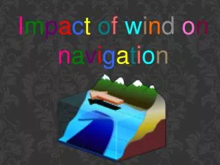
Navigation is the process of monitoring and controlling the movement of a craft or vehicle from one place to another.[1] It is also the term of art used for the specialized knowledge used by navigators to perform navigation tasks. All navigational techniques involve locating the navigator's position compared to known locations or patterns.
Latitude The latitude of a place on the Earth's surface is the angular distance north or south of the equator Latitude is usually expressed in degrees (marked with °) ranging from 0° at the equator to 90° at the North and South poles.The latitude of the North pole is 90° N, and the latitude of the south pole is 90° S.Historically, mariners calculated latitude in the Northern Hemisphere by sighting the North Star Polaris with a sextant and sight reduction tables to take out error for height of eye and atmospheric refraction. Generally, the height of Polaris in degrees of arc above the horizon is the latitude of the observer.
Longitude Similar to latitude, the longitude of a place on the Earth's surface is the angular distance east or west of the prime meridian or Greenwich meridian . Longitude is usually expressed in degrees (marked with °) ranging from 0° at the Greenwich meridian to 180° east and west. Sydney , Australia, for example, has a longitude of about 151 °east . New York city has a longitude of about 74 ° west. For most of history, mariners struggled to determine precise longitude. The problem was solved with the invention of the marine chronometer .Longitude can be calculated if the precise time of a sighting is known.
Most modern navigation relies primarily on positions determined electronically by receivers collecting information from satellites. navigators also often measure distances to objects. On the chart, a distance produces a circle or arc of position .Circles, arcs, and hyperbolae of positions are often referred to as lines of position. If the navigator draws two lines of position, and they intersect he must be at that position .A fix is the intersection of two or more LOPs. If only one line of position is available, this may be evaluated against the dead reckoning position to establish an estimated position . If only one line of position is available, this may be evaluated against the dead reckoning position to establish an estimated position. Modern technique
Lines (or circles) of position can be derived from a variety of sources: • celestial observation (a short segment of the circle of equal altitude, but generally represented as a line) • terrestrial range (natural or man made) when two charted points are observed to be in line with each other • compass bearing to a charted object • radar range to a charted object • on certain coastlines, a depth sounding from echo sounder or hand lead line .
Dead reckoning Further information: DEAD RECKONING Dead reckoning is the process of estimating present position by projecting course and speed from a known past position. It is also used to predict a future position by projecting course and speed from a known present position. The DR position is only an approximate position because it does not allow for the effect of leeway, current, helmsman error, compass error, or any other external influences. • The navigator uses dead reckoning in many ways, such as:[ • * to determine sunrise and sunset, • * to predict landfall, sighting lights and arrival times, • * to evaluate the accuracy of electronic positioning information, • * to predict which celestial bodies will be available for future observation. DEAD ROCKING