Download
1 / 6

E N D
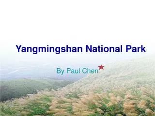
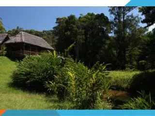
DoiInthanon National Park
DoiInthanonis the highest mountain in Thailand. It is located in Mae Chaem District. The mountain was also known in the past as DoiLuang (meaning big mountain) or DoiAng Ka, meaning the crow's pond top. Near the mountain's base was a pond where many crows gathered. The name DoiInthanon was given in honour of the king Inthawichayanon, one of the last kings of Chiang Mai, who was concerned about the forests in the north and tried to preserve them. He ordered that after his death his remains shall be placed at DoiLuang, which was then renamed.
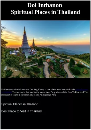
NapamaytanidolChedi • On the main road to the summit of DoiInthanon stand the two NapamaytanidolChedi. These temples were built to honor the 60th birthday of the King and Queen in 1987 and 1992 respectively.
Birdwatching • Birdwatching: Because of its broad altitudinal range and the cool climate of its upper reaches, the park supports the largest number of bird species of any site in Thailand. The Center for Wildlife Research at Mahidol University records a present total of 362 species and expects additions; Many at the summit are migrants from northern Asia. Species restricted to DoiInthanon are Ashy-throated Warbler and an endemic race of the Green tailed Sunbird; the park is the only site where the Chestnut-bellied Rockthrush and the Yellow-bellied Flowerpecker are known to oversummer and probably breed. Over 190 bird species are listed as common to abundant. Bird lists are available at the Visitor Center and at Park Headquarters
The tourist can travel to the park by Private transportation is the recommended way to visit DoiInthanon. The main attractions are spread over a distance of 40 kilometers and only a private vehicle will allow flexibility in planning your itinerary and Motor cycling is the best mode since it allows travel on some of the rough and narrow dirt roads which lead to hill tribe villages. From Chiang Mai, take Highway 108 to Km 57 (just 1 km before the village of Chom Thong). Turn right onto Highway 1009 and continue 8 km to where the road forks. Mae Klang is 300 meters straight ahead. The summit road forks to the right, reaching Park Headquarters near Km 31 and the summit of DoiInthanon at Km 48.
FACILITIES • Accommodations: Adjacent to the Hmong village, Ban KhunKlang, behind Park Headquarters, is a large compound with 11 guest houses available for public rental. Electricity, beds and bedding are provided in all units. Arrangements for guest house rental should be made at Park Headquarters.Campsites are Iocated at the Headquarters area and at the Mae Pan Ranger Station. Two-person tents can be rented at Headquarters. No sleeping bags or mats are available, but a number of blankets are available for rental. Firewood is provided and campfires are permitted throughout the year. Please use caution during the dry season. • Food stalls serving meals and snacks are located at several places in the park (see maps). Stalls at Mae Klang Water fall and in the Headquarters area are open during daylight hours every day. Bottled water is widely available in the park, along with other drinks.