Download
1 / 54
540 likes | 710 Views
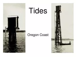
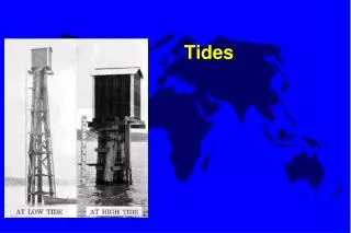
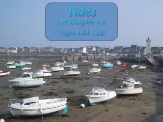
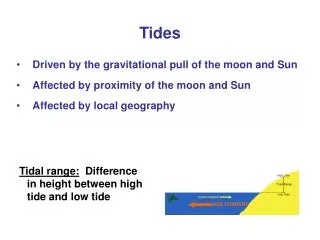
TIDES. Gravitational Forces. What are Tides. Tides are periodic rises and falls of large bodies of water. Tides are caused by the gravitational interaction between the Earth and the Moon as well as the Sun.

E N D
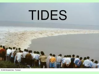
What are Tides • Tides are periodic rises and falls of large bodies of water. • Tides are caused by the gravitational interaction between the Earth and the Moon as well as the Sun. • The gravitational attraction of the moon causes the oceans to bulge out in the direction of the moon. • Another bulge occurs on the opposite side, since the Earth is also being pulled toward the moon (and away from the water on the far side). • Since the earth is rotating while this is happening, in some places two tides occur each day.
What Causes Tides? • Gravity is one major force that creates tides. In 1687, Sir Isaac Newton explained that ocean tides result from the gravitational attraction of the sun and moon on the oceans of the earth
Even more… • Gravity is a major force responsible for creating tides. • Inertia, acts to counterbalance gravity. It is the tendency of moving objects to continue moving in a straight line. • Together, gravity and inertia are responsible for the creation of two major tidal bulges on the Earth
The Earths Tilt • Earths axis tilts relative to the plane of the moons orbit, the two high tides in a given day do not reach the same level. • Tide levels are also a product of coastline formations and ocean currents
The Sun's Interaction with the Tides • Spring tides are especially strong tides (they do not have anything to do with the season Spring).
Proxigean Spring Tides • The Proxigean Spring Tide is a rare, unusually high tide. • This very high tide occurs when the moon is both unusually close to the Earth (at its closest perigee, called the proxigee) and in the New Moon phase (when the Moon is between the Sun and the Earth).
CONT…. • Neap tides are especially weak tides. They occur when the gravitational forces of the Moon and the Sun are perpendicular to one another (with respect to the Earth). Neap tides occur during quarter moons.
TIDES: How to distinguish tidal effects from other earth shape distortions. • Lunar tides have a periodic variation tied to the periodic cycle of the moon's position in the sky (about 24 hours 50 minutes). • The smaller solar tides are linked to the periodic cycle of the sun's position in the sky (24 hours). • In fact, tides also occur at periods half this large (semidiurnal tides).
Tide Cycles • Diurnal tide cycle • An area has a diurnal tidal cycle if it experiences one high and one low tide every lunar day. Many areas in the Gulf of Mexico experience these types of tides.
Tide Cycles Cont.. • Semidiurnal tide cycle • An area has a semidiurnal tidal cycle if it experiences two high and two low tides of approximately equal size every lunar day. • Many areas on the eastern coast of North America experience these tidal cycles.
Tide Cycles Cont.. • Mixed Semidiurnal tide cycle • An area has a mixed semidiurnal tidal cycle if it experiences two high and two low tides of different size every lunar day. • Many areas on the western coast of North America experience these tidal cycles.
Primary Coastline • primary coasts are generally young and are shaped by terrestrial processes, including erosion, river/stream deposition, glaciers, volcanism, and tectonic movements
Cont… • formed by land erosion • during the last glaciations, rivers cut across the land and eroded sediments to form coastal river valleys which then drowned when sea level rose again • glaciers can have the same effect by scouring out steep-sided valleys and carrying sediments that are deposited where the ice melts at glacier's end
Secondary Coastline • secondary coasts are shaped mainly by marine erosion or deposition due to wave action, sediment transport by currents, or building activities of certain organisms (e.g., reefs); generally these coasts are older
Bay of Fundy • These tides (seiche), the highest in the world and five times higher than the Atlantic Coast average, the rising waters cover hundreds of meters of ground in minutes. • Having caused steady erosion over millions of years, the tides historical impact on the terrain is evident (secondary coast). • The waters have carved overhanging sea caves and cliffs, and low tide is a perfect time for fossil hunting.
Currents Cont…. • The major ocean currents are wind-driven currents (land vs. water), though some ocean currents result from density and salinity variations of water. The subtropical high pressure cells are responsible for many of the Earth's great ocean currents.
Coriolis Effect • The effect of the Coriolis force is an apparent deflection of the path of an object that moves within a rotating coordinate system. • The object does not actually deviate from its path, but it appears to do so because of the motion of the coordinate system.
Cont…. • The Coriolis effect is most apparent in the path of an object moving longitudinally. • On the Earth an object that moves along a north-south path, or longitudinal line, will undergo apparent deflection to the right in the Northern Hemisphere and to the left in the Southern Hemisphere.
What is EL NINO? • El Niño is the warming of sea-surface temperatures in the equatorial Pacific Ocean which influences atmospheric circulation, and consequently rainfall and temperature in specific areas around the world.
CONT…. • El Niño - "the boy child" - a reference to the Christ child - to describe the appearance of a warm ocean current off the South American coast around Christmas. • Over the years the term El Niño has come to be reserved for the sequence of changes in the circulation across the Pacific Ocean and Indonesian archipelago when warming is particularly strong.
What is EL NINA? • La Niña is the cooling of sea-surface temperatures in the equatorial Pacific Ocean which influences atmospheric circulation, rainfall and temperature around the world. • La Niña, Spanish for "the girl", is the opposite of El Niño. Pacific waters become cooler than normal, giving rise to the term "cold event".
Thermohaline Circulation • term for the global density-driven circulation of the oceans as opposed to wind-driven currents and tides • sea water density depends on temperature and salinity hence the name: • thermo- means temperature • haline- means salt • Thermohaline currents are not confined to surface water
CONT… • Consist of : • Deep water formation- sinking of water masses (connected to convection which is a vertical mixing process that occurs in water) • Spreading of deep waters • Upwelling of deep waters- aided by the wind • Near-surface currents- which stop the flow from the deep water formation
Cont… • The circulation is driven by high-latitude cooling. This occurs in cold places where the highest surface water densities are reached. • When the high density is achieved, it causes mixing and sinking of water, or the thermohaline circulation
Gulf Stream • Warm ocean current of the North Atlantic Ocean off of Eastern North America. • Originates in Gulf of Mexico and passes through straights of Florida along the Southeastern Coast of the U.S. • Average speed of 4 mph -> slows down as it widens to the North. • Water temperature starts at 80 °F -> decreases as it moves North.
THE ATLANTIC! • Atlantic currents shows warmer surface currents (red) and cold north Atlantic Deep Water (NADW, blue). • The thermohaline circulation heats the North Atlantic and Northern Europe. • It extends right up to the Greenland and Norwegian Seas, pushing back the winter sea ice margin. (From [3].)
Estuary! • Salty sea water also pushes up the estuary, diluted by freshwater runoff as it moves north. • It is a tidal estuary, an arm of the sea where salty sea water meets fresh water running off the land.
River Tides • As a primary coastline, the estuary usually has two high and two low tides in twenty-four hours. • With this rising and falling come changes in the direction of flow. • Generally speaking, a rising tide is accompanied by a flood current flowing north towards and, a falling tide by an ebb current flowing south towards the sea.
How are Tides Measured? • In addition to measuring tidal heights more accurately, the new system also records 11 different oceanographic and meteorological parameters. • These include wind speed and direction, water current speed and direction, air and water temperature, and barometric pressure.
Tidal Variation • Just as the angles of the sun, moon and Earth affect tidal heights over the course of a lunar month, so do their distances to one another
Tide Prediction! • It is not feasible to predict tides purely from a knowledge of the positions and movements of the moon and sun obtained from astronomical tables. • A partially empirical approach based upon actual observations of tides in many areas over an extended period of time is necessary.
March 5th -6th • 2007-03-05 00:37 EST 2.93 feet High Tide • 2007-03-05 06:24 EST Sunrise • 2007-03-05 07:00 EST Moonset • 2007-03-05 07:05 EST -0.10 feet Low Tide • 2007-03-05 12:48 EST 2.89 feet High Tide • 2007-03-05 17:50 EST Sunset • 2007-03-05 19:27 EST -0.13 feet Low Tide • 2007-03-05 19:44 EST Moonrise • 2007-03-06 01:12 EST 2.91 feet High Tide • 2007-03-06 06:23 EST Sunrise • 2007-03-06 07:18 EST Moonset • 2007-03-06 07:42 EST -0.04 feet Low Tide 2007-03-06 13:23 EST 2.76 feet High Tide 2007-03-06 17:52 EST Sunset 2007-03-06 19:58 EST -0.01 feet Low Tide 2007-03-06 20:45 EST Moonrise