Download

1 / 33
330 likes | 426 Views
Join the research seminar at Amherst College to investigate urban history and education policy in Cambridge, Massachusetts. Potential thesis students are encouraged to explore De Jure and De Facto Segregation, and Disguised Segregation in schools. Discover how race, property, and educational opportunities intertwined in Cambridge, addressing community responses. The seminar examines the town-gown relationship between MIT and urban development, along with the effects of racial violence on education. Explore the impact of NASA in Cambridge through a spatial lens and delve into bilingual education challenges from 1978 to 1981. Students can analyze the merger of two high schools and study school choice dynamics in American cities. GIS skills are emphasized for georeferencing historical maps and analyzing urban renewal influences. Presented research includes insights into the Inner Belt Highway dilemma and the evolution of school building influenced by demographic trends in Cambridge. Discover the untold narrative of urban education evolution through geospatial analysis in this engaging seminar.

E N D
Cities, Schools, and Space • Andy Anderson (Academic Technology Services) • Hilary Moss (Departments of Black Studies & History) • Amherst College • A research seminar for juniors • Urban history and education policy • Potential thesis students encouraged! Northeast Arc Users Group Annual Conference — Saratoga Springs 11/13/2011
Many Research Methodologies Cambridge Public Library Archival analysis Oral interviews GIS: integrated into the course
Students and parent atTobin School, Cambridge Web Page (Restricted)
In America, a child’s address, more than any other factor, often determines what kind of public education he or she will receive. Black School in Louisa County, Virginia, ca. 1935(LOC/NAACP) Cambridge, Massachusetts Latin School, 1916 (CHLS Yearbook)
De Jure Segregation • Legal segregation of public schools by race banned nationwide in 1954 — separate, not equal • Unequal educational opportunities still exist for a variety of reasons
De Facto Segregation • Federal policies that expanded suburbs and facilitated “white flight” and job loss: • Mortgage assistance • Investment depreciation • Highway construction • Public housing • Urban renewal
Disguised Segregation • Subtle school segregation can still exist: • Shifting school catchment areas • Building new schools in white/upper-class areas at the expense of existing facilities • Educational tracking of students
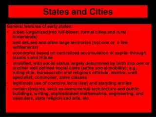
Cambridge, Massachusetts • Home to two major institutions of higher education: Harvard University and the Massachusetts Institute of Technology. Massachusetts Institute of Technology • A progressive city of 110,000 people
Cambridge Demographics • Black and Hispanicpopulations substantially increased in the late 20th century • 1965 state law:One school alreadyracially imbalanced (more follow).
Cambridge & Controlled Choice • The School Committee temporized for more than a decade, while Boston struggled with school bussing. • In 1981 implemented Controlled Choice: • Completely open enrollment, within 10% of average district-wide minority enrollment. • Parents chose top four preferred schools.
Learning GIS: Basic Skills • How does Cambridge compare to nearbycommunities? • Census.gov1990 - 2010 • NHGIS.org≤ 1980
Tobin School Cafeteria, Cambridge Creating GIS Data from Text Web Page
Extracting Map Features • Interstate 695: The “Inner Belt”through eastCambridge • 1967 map ofproperties affected • Stopped in 1971
What Influences Urban Renewal? • Union • Dissolve • Area Calc
Possible Inputs to Urban Renewal Negro Population 1960 • Data from the 1960 census: • Older Housing (Before 1940) • Housing Value • Owner-Occupied Housing • Negro Population • Data requirements: • Not cross-correlated: use Excel’s CORREL • Spatially auto-correlated: use ArcGIS’ Moran’s I
Student Final Projects Cambridgeport School, Cambridge • 20-30 page paper that mustinclude some GIS, and preferably addresses these questions: • How did race, property, and educational opportunity become entangled in Cambridge? • Why and how did this community respond?
Student Final Projects Peabody School, Cambridge MIT, Cambridge, and Urban Development: Examining a Town-Gown Relationship The Blinding Powers of Race: An Examination of the Effects of Racial Violence and Local Politics on Cambridge’s Pursuit for a Quality Education in Its Secondary Institutions Cities, Higher Education Institutions, and Space (and Space): NASA in Kendall Square, Cambridge “The Dilemma of Difference”: The Bifurcation of Racial and Linguistic Integration and its Effects on Bilingual Education in Cambridge, Massachusetts from 1978-1981
Student Project:The Merger of Cambridge Rindge and Latin High Schools — Emily Pawlowski
Student Project:Erasing the Lines: The Story of School Choice and Housing in the American City— Daniel Alter
Responding to the Inner Belt Hwy.— Yinan Zhang • Proximity Analysis • Tract-based • Two characteristics stands out!
Responding to the Inner Belt Hwy.— Yinan Zhang • Final Alternatives: • MIT doesn’t want the highway adjacent to their campus. • The Brookline-Elm neighborhoods don’t want it, either! • End result: neither is built!
What Influenced School Building?— Josie Fisher • During the 1960s and 1970s: • Six new or reconstructed schools • But many schools in worse condition!
What Influenced School Building?— Josie Fisher • Parcel Analysis • Distribute censusinfo by housing type on parcels
Current Work 1960 • New Discovery:Some block-level data — basicdemographics and housing — available for earlier decades. • Active digitization project, led by JF and YZ.
Future Research… • Block-level data reveals why one School Committee member made an accusation of de jure segregation. • Peabody & Agassiz: “Academically Talented”, many Harvard-associated families. • Russell boundary in place since <= 1946.
Thanks! • Cambridge GIS! Jeff Amero, et al. • Cambridge Assessor • Cambridge Historical Society • MIT Archives • National Historical GIS @ U. Minn • Mellon Foundation