1 / 20

Southern Utah Snow Accumulation Forecast | Midway Valley Snowpack Outlook

Stay informed about expected above-average snow accumulation in southern Utah. Explore projections for snowpack levels this spring based on precipitation estimates. Monitoring key sites like Midway Valley and Widtsoe #3 for indicators.

palila
Download Presentation

Southern Utah Snow Accumulation Forecast | Midway Valley Snowpack Outlook

An Image/Link below is provided (as is) to download presentation Download Policy: Content on the Website is provided to you AS IS for your information and personal use and may not be sold / licensed / shared on other websites without getting consent from its author. Content is provided to you AS IS for your information and personal use only. Download presentation by click this link. While downloading, if for some reason you are not able to download a presentation, the publisher may have deleted the file from their server. During download, if you can't get a presentation, the file might be deleted by the publisher.

E N D

Presentation Transcript


  1. 16 foot shelter at Midway Valley

  2. Precipitation outlook for March, April and May – southern Utah has some probability of above average accumulation.

  3. In the next slides, assuming above average precipitation and snow accumulations – look to the dark green or blue lines for an estimate of where snowpacks may end up this spring.

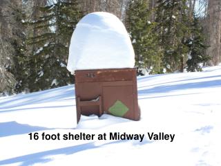
  4. Midway Valley – 57 inches of SWE, previous max was 52 inches

  5. Widtsoe #3 – 33 inches of SWE, Previous max was 26 inches

  6. Long Valley Junction

  7. Harris Flat

  8. Castle Valley

  9. Agua Canyon

  10. Gutz Peak Precip and Snow - almost 55 inches of precipitation this water year, more than any other site in Utah!

More Related