Download
1 / 12
130 likes | 398 Views
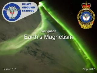
Navigation Earth’s Magnetism. Reference. From the Ground Up Chapter 7.2: The Earth’s Magnetism Pages 179 - 185. Introduction. Most navigation is based on the Earth’s magnetic field. Compasses use the field to determine where north and south are.

E N D
Reference From the Ground Up Chapter 7.2: The Earth’s Magnetism Pages 179 - 185
Introduction • Most navigation is based on the Earth’s magnetic field. Compasses use the field to determine where north and south are. • Pilots need to know how to use a compass and how to use it with a map to be able to properly plan a flight.
Outline • Earth’s Magnetism • Variation and Deviation • Conversions • Compass Errors
Earth’s Magnetism • Earth is a giant magnet • True North • Direction towards geographic north pole • Magnetic North • Direction compass will point (not considering compass deviation) • Magnetic north pole is not in a fixed position, changes over years, it roughly orbits around true north
Heading • True Heading • Heading in relation to true north • Magnetic Heading • Heading in relation to magnetic north • Compass Heading • Direction that needle in compass is pointing
Variation and Deviation • Variation (AKA Magnetic Declination) • Angle between true heading and magnetic heading (or true meridian/north and magnetic meridian/north) • Deviation • Angle between compass heading and magnetic heading • Caused by magnetic fields generated from metal and electronics in aircraft
Conversions • Conversion • True Heading +Variation =Magnetic Heading +Deviation =Compass Heading • West is best (+), East is least (-) • Examples: • TH 100° + V 11°W = MH 111° • MH 180° + D 10°E = CH 170° • CH 200° - D 20°W = MH 180°
Isogonic Lines • Lines on a map joining places of equal variation • AKA Isogonals • Numbered as degrees east or west of true north (example: 11° W) • Agonic Lines are lines on a map joining places of zero variation (0° Isogonals)
Compass Errors • Compass most accurate when flying straight and level; Heading Indicator should normally be used • Deviation • Caused by magnetic fields generated from metal and electronics in aircraft • Can cause compass to be several degrees off • Magnetic Dip • Earth’s magnetic lines become vertical near north and south poles • Cause compass to start trying to point towards ground
Compass Errors • Northerly Turning Error • Compass misreads during banked attitudes • Most apparent on north or south headings • On turns from the north, compass lags • On turns from the south, compass leads • Acceleration Error • Acceleration causes small turning moment in compass • Most apparent on east or west headings • Acceleration causes compass to show small turn to north • Deceleration causes compass to show small turn to south
Next Lesson 5.3 – Navigation Aeronautical Charts From the Ground Up Chapter 7.4: Aeronautical Charts Pages 186 - 196