Download
1 / 36
360 likes | 547 Views
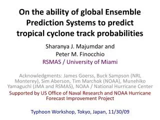
On the ability of global Ensemble Prediction Systems to predict tropical cyclone track probabilities. Sharanya J. Majumdar and Peter M. Finocchio RSMAS / University of Miami

E N D
On the ability of global Ensemble Prediction Systems to predict tropical cyclone track probabilities Sharanya J. Majumdar and Peter M. Finocchio RSMAS / University of Miami Acknowledgments: James Goerss, Buck Sampson (NRL Monterey), SimAberson, Tim Marchok (NOAA), Munehiko Yamaguchi (JMA and RSMAS), NOAA / National Hurricane Center Supported by US Office of Naval Research and NOAA Hurricane Forecast Improvement Project Typhoon Workshop, Tokyo, Japan, 11/30/09
Motivation Seek to provide accurate, situation-dependent, probabilistic track forecasts. More accurate watches and warnings, timely evacuations, emergency management preparation. Hope to reduce “overwarning”.
Ensemble Prediction Systems (EPS) • Many centers emphasize the use of EPS for probabilistic TC track prediction. • The TIGGE CXML database offers the opportunity for creation and evaluation of new TC track products with multiple EPS. • Our first step: probability circles. • Majumdar & Finocchio 2009, Wea. Forecasting, in press.
Outline • Case illustration: Hurricane Ike • Evaluation of ensemble mean in 2008 season • ECMWF / UKMET / EC+UK: mean + circles • ECMWF and GPCE: ranges of circle radii • ECMWF and GPCE: Atlantic and western North Pacific Basins
EPS vs GPCE vs NHC • For EPS, we only use ensemble spread. • Define X% circle radius as that which encloses X% of the ensemble members, centered on mean. • Goerss Predicted Consensus Error (GPCE) uses a combination of predictors: spread of deterministic models (no EPS), initial and forecast TC position and intensity, number of consensus models. Importantly, it includes information on historical errors. Used at JTWC and NHC. • NHC uses the 67th percentile of all track errors in the previous 5 years to define its circle radius (i.e. STATIC). 1
Hurricane Ike: 2008090900 ECMWF EPS 1
Hurricane Ike: 2008090900 ECMWF EPS 1
Hurricane Ike: 2008090900 GPCE 1
Conclusions 1 • EPS may add new information to deterministic model consensus • ECMWF EPS 67% probability circle appears qualitatively reasonable • ECMWF EPS circle is smaller than GPCE and NHC in this example 1
Track errors: ECMWF ensemble mean vs deterministic 2008 season average: only TS strength and higher 2
Conclusions 2 • ECMWF ensemble mean is superior to all models except deterministic ECMWF. • Comparable to ensemble mean of deterministic models (TVCN). 2
Multi-model ensembles ECMWF UKMET NCEP 3
Ensemble mean errors: ECMWF / UKMET / E+U UKMET ECMWF 3
Conclusions 3 • ECMWF ensemble mean superior to UKMET ensemble mean. • Mean of combined ECMWF+UKMET ensemble generally not improved over ECMWF. • Addition of UKMET ensemble does produce more low-error forecasts. • Best track falls within circles more often for storms in straight-line motion than recurvers. • Circle sizes well correlated with error for ECMWF, not so for UKMET. 3
Conclusions 4 • ECMWF circles are generally smaller than GPCE circles, although the range is wider. • A 20-member ECMWF ensemble possessed similar results to a 50-member ensemble. 4
Conclusions 5 • GPCE over-dispersive in Atlantic in 2008 • Western North Pacific forecasts were much less skillful than Atlantic forecasts in 2008 • CONW lower skill than ECMWF ensemble mean • ECMWF and GPCE failed to capture the best track an adequate number of times in W. North Pacific 5
Remarks • ECMWF EPS performed well in Atlantic in 2008. • Accurate ensemble mean is necessary. • For ensemble mean and simple circles, 20 members may be enough. • Some EPS tend to be under-dispersive. • Combine with static information to avoid forecast-to-forecast fluctuations? • Ensemble perturbation technique is important.
Future Work • Combine more EPS: NOGAPS, JMA, NCEP etc for active 2009 western North Pacific season. • Detailed investigation of characteristics of ensemble perturbations (Yamaguchi). • Along- and cross-track errors: “probability ellipses” using EPS.