Download
1 / 13
130 likes | 231 Views
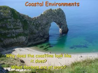
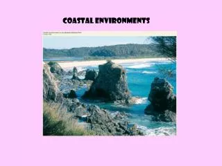
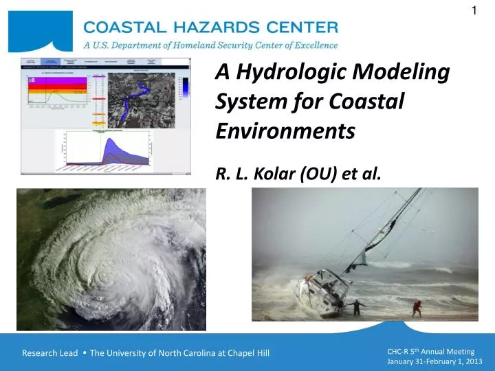
A Hydrologic Modeling System for Coastal Environments R. L. Kolar (OU) et al. . Project Overview. Develop comprehensive, physics-based model for coastal flooding that incorporates the dominant physical processes: wind, waves, tides, surge, rainfall/runoff (“total water level”).

E N D
A Hydrologic Modeling System for Coastal Environments R. L. Kolar (OU) et al.
Project Overview • Develop comprehensive, physics-basedmodel for coastal flooding that incorporates the dominant physical processes: wind, waves, tides, surge, rainfall/runoff (“total water level”). • Our work focuses on hydrologic modeling and coupling to ADCIRC. • High spatial and temporal resolution. • Modes of use: Forecasting & Planning. • Research Partners: NOAA-NSSL, NRL-Stennis
Relevance to DHS S&T Mission • 50% of the U.S. population lives within 50 miles of a coastline. • Coastal flooding due to natural hazards is a serious economic and social threat (exacerbated with sea level rise), e.g., Sandy. • DHS Mission 5, “Ensuring Resilience to Disasters,” and its four goals - mitigation, preparedness, emergency response, and recovery – specifically targets this threat. • Coastal inundation models are effective tools for coastal planning and disaster mitigation/recovery.
Progress: Year 5 – Pearl River • Hydrology - RDHM: • Data sets (soil, DEM, land use, channels) • Calibration/validation data • Running (as of last week!)
Hydraulics - ADCIRC: • ISAAC ASGS grid • Tie in Pearl River Grid • Handoff points
Summary of Year 5 Progress Year Milestones Progress to Date (Previous slides) Code complete; debugging and testing. Data collected, parametric model identified. • Port STORM modeling system to Pearl River basin • Partial-wet element algorithm for ADCIRC • Synthetic storms
Leveraging Resources • Four Pending Proposals: • $3M NSF Hazards SEES (UD, UNC, SUNY, OU) • $5.1M NOAA Sandy Supplemental Appropriation (NSSL, CIMMS, OU, NWS, OHD) • $535K NSF Computational and Data-Enabled Science and Engineering (OU) • $30K CIMMS Student Fellowship (OU)
Translation/End Users/Collaborators Dr. Suzanne Van Cooten Hydrologist in Charge Lower Mississippi RFC “We do not produce hydrologic guidance for locations south of Pearl River as we have not implemented the hydrodynamic models necessary to simulate tidal circulation and storm surge, which impact water levels in the Pearl River estuary. This service gap means we cannot provide WFO New Orleans/Baton Rouge water level simulations to support their network of decision makers responsible for eastern St. Tammany Parish communities, (i.e. Slidell), critical regional infrastructure (i.e. Stennis Space Center), and/or evacuation routes.” Dr. Elizabeth Smythe Regulatory Manager St. Tammany Parish Government
Products • Web portals: CERA, CI-FLOW • Papers: Irene (Cont. Shelf Research), River BC’s (Estuarine and Coastal Modeling), Partial-wet cells in GWCE (IJNMF) • Professional presentations: ECM, CMWR, AMS, ADCIRC Workshop, NOAA Briefings
Looking Forward • Calibration, validation, and skill assessment (ISAAC) of STORM for Pearl River/Northern Gulf • STORM Model sensitivity studies • Translate to end-users/partners • Adjust output products based on end-user feedback • Algorithmic improvements • Skill assessment of synthetic rainfall