Download
1 / 14
140 likes | 272 Views
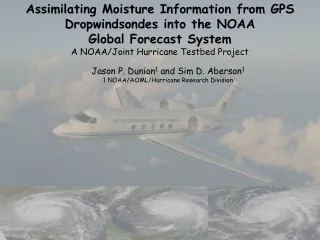
Assimilating Moisture Information from GPS Dropwindsondes into the NOAA Global Forecast System A NOAA/Joint Hurricane Testbed Project. Jason P. Dunion 1 and Sim D. Aberson 1 1 NOAA/AOML/Hurricane Research Division. Motivation

E N D
Assimilating Moisture Information from GPS Dropwindsondes into the NOAA Global Forecast System A NOAA/Joint Hurricane Testbed Project Jason P. Dunion1 and Sim D. Aberson1 1 NOAA/AOML/Hurricane Research Division
Motivation Assessing atmospheric moisture and predicting its affect on TC intensity…no easy task. …GPS dropsonde humidity was not being assimilated into the GFS model
Project Objectives Year 1: “995. DATACARDS - IBM Jobs GFS_PREP, GDAS_PREP. (Keyser, NP22). This program PREPOBS_PREPDATA prepares observational data for subsequent quality control programs and for subsequent analysis in all forecast networks, using data card switches in the input parm cards to control processing based on the forecast network. The input parm cards for the GFS and GDAS networks, prepobs_prepdata.gfs.parm and prepobs_prepdata.gdas.parm, respectively, are being modified to no longer flag Gulf Stream dropwindsonde moisture data.These data, on all levels, will now be assimilated by the Global SSI analysis. USAF dropwindsonde moisture will continue to be flagged and not assimilated in all networks, as will Gulf Stream dropwindsonde moisture in the NAM, NDAS and RUC networks.” • Perform parallel runs of the GFS model that assimilate dropsonde moisture information from NOAA G-IV missions • Begin assessing the impact of this data on GFS forecasts of TC track and intensity Year 2: • Perform detailed assessments of the impact of GPS dropsonde humidity data on GFS TC forecasts of track & intensity • Assess how effectively the GFS is able to represent dry layers such as the Saharan Air Layer • Assess the feasibility of performing targeted observations of humidity to improve GFS forecasts
Project Challenges Barbados • “Old dog new trick” syndrome: teaching a satellite guy how to run a global model • Issues with the conversion to “haze” at NCEP: • -HPSS and mirroring with other computer systems was not available for more than a month after “haze” was installed. These data are necessary for the parallel runs. • -The GFS was not available on haze for weeks after the above difficulties were overcome • -The NCEP cyclone tracker (and GFDL model) were only installed on “haze” within the last two weeks. • -The parallel cycle now works and runs will be completed soon. • Harsh working conditions
G-IV SALEX Mission 060915n (15 September 2006) 200-750 mb shear: GPS Sonde: 36 kt GFS: 7 kt 200-850 mb shear: GPS Sonde: 25 kt GFS: 5 kt SHIPS: 02 kt 3oC Temp Inv Drop #24 Drop #23 Drop #25 Drop #24 Drop #23 Drop #25
P-3/G-IV SALEX Mission 060918n 18 September 2006 Drop #17 Drop #16 Drop #15 Drop #22
Saharan Air Layer Experiment (SALEX) G-IV Mission 050807n Polar 1 10 15 SAL 3 SAL 2 5 1 SAL 1 Irene 20 AEW 1 25
Getting Dry Air in to the TC Circulation 25N Saharan Air Layer 20N 665 km 400 nm 600 360 320 530 465 280 400 240 200 330 265 160 200 120 15N 130 80 65 40 Storm Motion 10N 5N 65W 60W 55W 50W 45W 35W 40W Saharan Air Layer
GFS Analyses vs GPS Dropsondes (2006 SALEX) SAL drops: 79; non-SAL drops 27
GFS Analyses vs GPS Dropsondes (2006 SALEX) SAL drops: 79 SAL
Summary of Findings • As of August 2006, G-IV GPS dropsonde humidity data is being assimilated into the GFS model (not from P-3s or C-130s) • GFS analysis fields appear to overestimate the SAL’s mid-level moisture and underestimate its mid-level easterly jet • Targeting humidity observations (GPS dropsondes) shows promise
Future Work • Continue parallel runs (w/o GPS sondes) for 2006 G-IV TC cases • Continue assessing targeted observing strategies for optimizing GPS dropsonde humidity impacts on the GFS • Assess feasibility of operationally assimilating humidity data from the NOAA P-3s and AF C-130s GPS dropsondes • Begin similar moisture studies with higher resolution models (e.g. HWRF; GFDL)