Download

1 / 33
330 likes | 475 Views
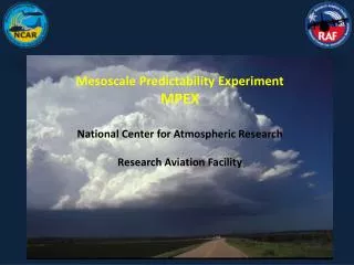
Mesoscale Predictability Experiment MPEX National Center for Atmospheric Research Research Aviation Facility. MPEX Overview. 15 May – 15 Jun 2013 ≈ 12 Flights 7 hrs duration High Altitude FL 400 – FL 410 Early Morning Operations 0900 – 1600Z ≈ 30 Drop Sondes Each Flight

E N D
Mesoscale Predictability Experiment MPEX National Center for Atmospheric Research Research Aviation Facility
MPEX Overview • 15 May – 15 Jun 2013 • ≈ 12 Flights 7 hrs duration • High Altitude FL 400 – FL 410 • Early Morning Operations • 0900 – 1600Z • ≈ 30 Drop Sondes Each Flight • Predefined Drop Points
MPEX Research Aircraft N677F • Single Aircraft • RVSM Certified • Research Speed Mach .80
MPEXGeneral Science Objective • Improved forecast of the timing and location of convection initiation and the development of severe thunderstorms or storm complexes to the lee of the Rocky Mountains onto the High Plains within the MPEX domain
MPEX Measurement Strategy • Use numerical models and observations to forecast a region within MPEX domain that would benefit from added soundings through the atmosphere • Select subset (30-40) of available pre-defined drop points and fly late night N677F missions • Launch 30-40 dropsonde from aircraft to measure winds, temperature and moisture • Send these data to National Weather Service and researchers in real-time for use in operational and research models and by forecasters • Evaluate improvement in severe weather forecasts within the MPEX domain
Drop Sonde System Airborne Vertical Atmospheric Profiling System (AVAPS)
FAR Applicability • No Specific “Drop Sonde” Guidance but…….. • Subchapter F Subpart A: General Applicability Unmanned Aerial balloons • 101.1 Carries a payload package that weighs more than four pounds and has a weight/size ratio of more than 3 oz per square inchon any surface of the package, determined by dividing the total weight in oz of the payload package by the area in square inches of its smallest surface.
Sonde Evolution AVAPS
Data From NASA Global Hawk(Distribution of horizontal distance traveled by sondes from drop point)
Weather Balloon Contrast NWS Weather Balloon “Upsonde””
UpsondeComparison • Similar Weight as AVAPS Dropsonde • Ascends to Approx 100,000 ft • Balloon Bursts Allowing Sonde to Descend via parachute • Similar Descent Rate as AVAPS Drop Sonde • 180 NM Drift vs AVAPS 26 NM Max Drift • Over 6,000 Upsondesper Month Launched in USA • Only 300 AVAPS Sondes During MPEX
Overall Drop Points • 102 Total Points • Defined by Intersection or Radial/DME
FAR 91.15 “No pilot in command of a civil aircraft may allow any object to be dropped from that aircraft in flight that creates a hazard to persons or property. However, this section does not prohibit the dropping of any object if reasonable precautions are taken to avoid injury or damage to persons or property.”
Reasonable Precautions • Utilize ITT Exelis Symphony Air Traffic Management System
ITT Exelis • Near “Real-Time” Web Based Application • Accessible Onboard the Aircraft • Dedicated Operator During Flight
Reasonable Precautions (cont.) • Aircraft TCAS • Strategic Drop Point Placement (Deconfliction) • Major Airports • Approach Facilities and Corridors • Cities • Sensitive Ground Areas (e.g. Indian Reservations)
Reasonable Precautions (cont) • ATC • Normal Traffic Advisories • Miniaturized Drop Sonde Design • Drop Time of Day • Early Morning (3 AM – 9 AM)
Operations • Responsibility Rests With the Pilot in Command and NCAR • Not Seeking Drop “Clearance” from Any Controller • Will Cease Operations Anytime When Directed by ATC • Will Immediately Follow ATC Instructions
Coordination Procedures • Flt plans Normally Filed NLT 2 hrs prior • Flight Plan Remarks • Briefing Books for All Centers • Drop Points – Intersections, Radial DME and Coordinates • Will Always File with Intersection or Radial/DME
Letter of No Objection • Preflight Telephone Coordination? • Required Timelines • Finalized Flight Plan Drop Points • Required Timelines • NOTAMS? • Required Timelines • Required Radio Calls?
Contact Information Scotty McClain 720-234-2696 ncar-pilots@eol.ucar.edu Jim Moore jmoore@ucar.edu
Questions? Discussion