Download
1 / 12
130 likes | 344 Views
Contours and Topographic Maps. . Types of MapsTopographic map: representation of the terrain configuration on Earth's surface

E N D
1.
Contours and Topographic Maps
Feb 2nd and 3rd, 2005
2. Contours and Topographic Maps
3. Contours and Topographic Maps Isolines
Defined: Line on the map connecting points that have the same quality or intensity of a given phenomenon
Contour: Lines joining points of equal elevation
Isobar: Lines joining points of equal atmosphere
Isotherm: Lines joining points of equal temperature
4. Contours and Topographic Maps Characteristics of Isolines
Always closed lines
Never touch or cross one another
Numerical difference b/t two isolines called intervals
Isolines close together: steep gradient (rapid change)
Isolines far apart: gentle gradient
5. Contours and Topographic Maps Contour Lines
The changes between highest and lowest point on a map, known as relief, is indicated by the use of elevation contour lines
A contour line connects all points at the same elevation.
6. Contours and Topographic Maps Contour Lines
The contour interval is the difference in elevation between two contour lines next to one another.
Given a large enough map, contour lines always form an irregular circle although on a smaller map contour lines may run off the margin.
Contour lines will never cross each other.
7. Contours and Topographic Maps Contour lines spaced closer together depict a steeper slope; and a wider spacing of contour lines depict a gentler slope.
8. Contours and Topographic Maps Contour lines form an upstream-pointing V-shaped pattern when they cross a stream.
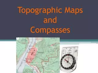
9. Contours and Topographic Maps Topographic Map
representation of the terrain configuration on Earth�s surface � shows detailed physical features
Relief: change in elevation b/t highest and lowest points on map
10. Contours and Topographic Maps Topographic Profile
A topographic profile is a graphic representation of graduated elevations along a line segment drawn on a topographic map.
The topographic profile gives a side view of the landscape.
11. Contours and Topographic Maps Topographic Map Information
Upper right corner: Map name, state name and 15-minute or 7.5 series designation
Lower right corner: Name of the quadrant, geographic index number, and the year of the map
Upper left corner: Primary government agency
Lower left margin: More complete credit line and map preparation history
12. Contours and Topographic Maps Topographic Map Information (cont.)
Names of adjoining topographic maps are at each corner and along the sides of the map
Latitude and Longitude can be found at each corner of the map
The map scale and contour interval is shown in the lower center margin of the map