Download
1 / 39
390 likes | 408 Views
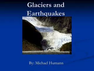
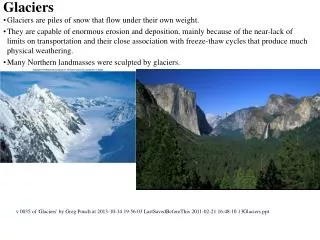
This study focuses on the Southeast Alaska ice region, specifically the Sheridan and Sherman Glaciers in the Chugach Mountains and the South Sawyer Glacier. The analysis combines Landsat Thematic Mapper (TM) bands, near-infrared and thermal infrared data, and a digital elevation model (DEM) to examine changes in ice, vegetation, and rock/soil. The study investigates glacier retreat, snow accumulation and melting zones, glacial terminus changes, and other features such as ogives and hanging glaciers. The research also explores the impact of earthquakes and rockfall on glacier terminus and pro-glacial lakes. The findings provide valuable insights into the dynamics of Alaskan glaciers.

E N D
SOUTHEAST ALASKA ICE VEGETATION ROCK/SOIL
near infrared thermal infrared Landsat Thematic Mapper (TM) bands computer display: blue green red
SOUTHEAST ALASKA ICE Juneau Icefield VEGETATION ROCK/SOIL
Digital elevation model (DEM) meters sea level
Juneau Icefield Landsat Thematic Mapper image superimposed on digital elevation model
Juneau Icefield Region of the Mendenhall Glacier
South Sawyer Glacier- 1999 trim line- 1988 calving terminus
Lemon Creek Glacier last winter’s snow: accumulation zone melting ice: ablation zone snowline
Juneau Icefield Region of the Taku Glacier
accumulation zone Taku Glacier ablation zone
terminus of Taku Glacier outwash terminus
Juneau Icefield Region of the Gilkey Glacier
Vaughn Lewis Icefall Gilkey Glacier
Vaughn Lewis Icefall Clouds and cloud shadows ogives
Vaughn Lewis ice fall ogives
Un-named glacier tributary to Gilkey Vaughn Lewis icefall
Vaughn Lewis icefall: severe extensional deformation producing open cracks, increasing surface area
medial moraines ogives
hanging glaciers valley glacier
cirque glacier terminus
horn arete ridge cirque hanging glacier ogive
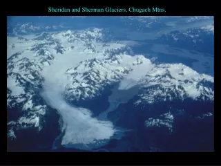
Sheridan and Sherman Glaciers, Chugach Mtns. snowlines Earthquake triggered Rockfall covering terminus of glacier terminus pro-glacial lake
SOUTHEAST ALASKA ICE VEGETATION Glacier Bay ROCK/SOIL
Record of Glacier Bay Terminus Changes 1986 Landsat MSS image 1980 1907 1860 10 km 1794 1780