Download
1 / 14
140 likes | 353 Views
Laser Ranging Contributions to Earth Rotation Studies. Richard S. Gross Jet Propulsion Laboratory California Institute of Technology Pasadena, CA 91109–8099, USA 16th International Workshop on Laser Ranging October 13–17, 2008 Pozna n , Poland. Introduction.

E N D
Laser Ranging ContributionstoEarth Rotation Studies Richard S. GrossJet Propulsion LaboratoryCalifornia Institute of TechnologyPasadena, CA 91109–8099, USA 16th International Workshop on Laser Ranging October 13–17, 2008 Poznan, Poland
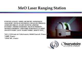
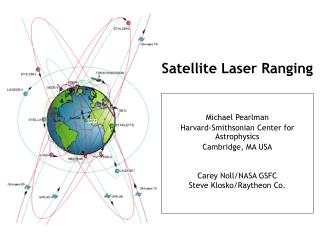
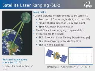
Introduction • Laser ranging has been used to routinely determine EOPs for more than 3 decades • Lunar laser ranging measurements since 1970 • Satellite laser ranging measurements since 1976 • Laser ranging-derived EOPs span longer time interval than do those from any other space- geodetic technique • Required for investigating long-period variations • Provides backbone for EOP combinations • Lunar laser ranging measurements determine UT0 • If rapidly processed could contribute to near-real-time UT1 determination
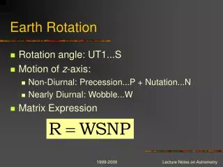
Combining EOP Series (1/3) • Individual Earth orientation series are determined within a particular realization of some terrestrial, body-fixed reference frame (such as ITRF2005) • TRF defined operationally by specifying positions and linear motions of a set of ground-based observing stations • Different realizations of the same TRF may differ by being offset from each other, and/or by drifting (rotating) with respect to each other • Different realizations of the reference frame are based upon different subsets of the defining stations • The different station subsets are likely to be located on different subsets of the tectonic plates • Errors in modeling tectonic plate motions, and hence motions of stations located on them, cause the different station subsets to drift with respect to each other
Combining EOP Series (2/3) • Thus, individual Earth orientation series determined within different realizations of the terrestrial reference frame can be expected to drift with respect to each other • Changes in the Earth's orientation are degenerate with rotations of the terrestrial reference frame • These drift (rate) differences exhibited by individual Earth orientation series must be accounted for prior to their combination
Combining EOP Series (3/3) • Determining bias-rate corrections • Accomplished by comparing individual series to a reference • Reference series should be internally consistent and of long duration • Internally consistent so that bias-rate corrections are unaffected by inconsistencies in the reference series • Long duration so that all the other series can be corrected using the same reference and hence be placed within the same realization of the terrestrial reference frame • These two criteria (internal consistency and long duration) are met by the SLR series • SLR series forms the backbone to which shorter duration series are attached when generating combined EOP series
Earth Orientation Data • Sources of available EOP data • Inertial sources • Very long baseline interferometry (Intensive UT1 – acquired daily, 2-day latency) • Very long baseline interferometry (Multibaseline – few times/wk, 2-week latency) • Lunar laser ranging (acquired irregularly, subdaily latency) • Non-inertial sources • Satellite laser ranging (ILRS Combined – acquired daily, 1-week latency) • Global positioning system (IGS Rapids – acquired daily, subdaily latency) • Global positioning system (IGS Finals – acquired daily, 2-week latency) • Proxy length of day (UT1 rate) data • Atmospheric angular momentum analyses (acquired daily, subdaily latency) • Atmospheric angular momentum dynamical forecasts (daily, 5 days into future)
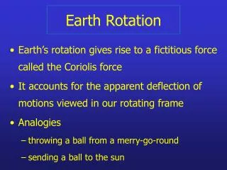
Real-Time Earth Orientation (1/2) • Earth’s orientation varies rapidly and unpredictably • UT1 variations are particularly difficult to predict • Rapid UT1 variations caused mainly by changes in angular momentum of winds • Predicting UT1 is as challenging as predicting the weather • EOP prediction accuracy controlled by timeliness and accuracy of most recent measurement • UT1 varies rapidly and randomly • UT1 uncertainty grows from epoch of last measurement: as t3/2 if last measurement is of UT1 and UT1-rate (length-of-day) more rapidly than t3/2 if last measurement is of UT1 only • Measurements of UT1 and polar motion must be taken frequently and processed rapidly to maintain a real-time knowledge of the Earth’s orientation
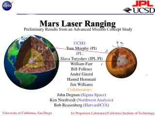
Real-Time Earth Orientation (2/2) • Accurate navigation of interplanetary spacecraft requires accurate knowledge of Earth’s orientation • Must know Earth’s orientation in space to know spacecraft’s position in space from Earth-based tracking measurements • Uncertainty in Earth’s orientation can be a major, if not the dominant, source of error in spacecraft navigation and tracking (Estefan and Folkner, 1995) • Error in UT1 of 0.1 ms (4.6 cm) produces an error of 7 nrad in spacecraft right ascension, corresponding to a position error at Mars of 1.6 km • Accurate prediction of satellite orbits requires accurate predictions of Earth’s orientation • GNSS satellites
Near-Real-Time UT1 from LLR • Lunar laser ranging observations • Can be processed rapidly • Small size of observation files rapid dissemination to analysis centers • Analysis centers can rapidly reduce observations for EOPs • LLR has potential of providing near-real-time UT0 • Within hours of data acquisition • LLR has potential of providing near-real-time UT1 • LLR near-real-time UT0 can be transformed to UT1 • Using near-real-time polar motion from GPS
Summary • Laser ranging has been used to routinely determine EOPs for more than 3 decades • Lunar laser ranging measurements since 1970 • Satellite laser ranging measurements since 1976 • Laser ranging-derived EOPs span longer time interval than do those from any other space- geodetic technique • Required for investigating long-period variations • Provides backbone for EOP combinations • Lunar laser ranging measurements determine UT0 • If rapidly processed could contribute to near-real-time UT1 determination