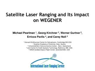
Satellite Laser Ranging
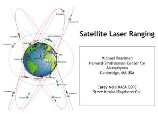
Satellite Laser Ranging. Michael Pearlman Harvard-Smithsonian Center for Astrophysics Cambridge, MA USA Carey Noll/NASA GSFC Steve Klosko/Raytheon Co. Satellite Laser Ranging Technique.

Satellite Laser Ranging
E N D
Presentation Transcript
Satellite Laser Ranging Michael Pearlman Harvard-Smithsonian Center for Astrophysics Cambridge, MA USA Carey Noll/NASA GSFC Steve Klosko/Raytheon Co.
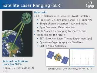
Satellite Laser Ranging Technique Precise range measurement between an SLR ground station and a retroreflector- equipped satellite using ultrashort laser pulses corrected for refraction, satellite center of mass, and the internal delay of the ranging machine. • Simple range measurement • Space segment is passive • Simple refraction model • Night / Day Operation • Near real-time global data availability • Satellite altitudes from 400 km to 20,000 km (e.g. GPS/GLONASS), and the Moon • Cm. satellite Orbit Accuracy • Able to see small changes by looking at long time series • Unambiguous centimeter accuracy orbits • Long-term stable time series
Terrestrial Reference Frame Time varying Earth Center of Mass Scale (GM) Static and time-varying coefficients of the Earth's gravity field Measure of the total Earth mass distribution Earth Orientation Parameters (EOP) ): polar motion, length of day Accurate satellite ephemerides: POD calibration and validation of altimetry missions Special Missions - Tether Dynamics, etc. Backup Precise Orbit Determination (POD) Science and Applications
Sample of SLR Satellite Constellation(Geodetic Satellites) Stella Ajisai GFZ-1 Starlette LAGEOS-I LAGEOS-II Etalon-I & -II
Sample of SLR Satellite Constellation(POD Support) GLONASS CHAMP TOPEX ERS-1 ERS-2 GPS Meteor-3M Jason-1 Envisat GRACE GP-B
Example Satellite Configurations GRACE (courtesy of U. TX/CSR) TOPEX/Poseidon
Established in 1998 as a service under the International Association of Geodesy (IAG) ILRS collects, merges, analyzes, archives and distributes satellite and lunar laser ranging data to satisfy a variety of scientific, engineering, and operational needs and encourages the application of new technologies to enhance the quality, quantity, and cost effectiveness of its data products Components Tracking Stations and Subnetworks Operations Centers Global and Regional Data Centers Analysis and Associate Analysis Centers Central Bureau ILRS produces standard products for the scientific and applications communities. International Laser Ranging Service (ILRS)
Space Geodesy GPS SLR VLBI DORIS
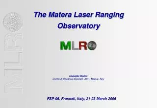
Space Geodesy GNSS station in Thule, Greenland (photo courtesy of F.B. Madsen, DNSC) MLRO SLR facility at Matera, Italy (photo courtesy of G. Bianco/ASI) DORIS antenna in Tahiti, Fr. Polynesia (photo courtesy of H. Fagard, IGN) 32-meter VLBI antenna in Tskuba, Japan (photo courtesy of K. Takashima, GSI
Established by the International Association of Geodesy (IAG) in 2004; Work with the measurement techniques (SLR, GPS, VLBI, DORIS, gravity field) through their IAG Services to: coordinate geodetic research in support of scientific applications and disciplines; integrate different geodetic techniques, models and approaches to provide more consistent,more reliable geodetic products (geodetic, geodynamic, and global change processes;) ensure the robustness of their products of geodesy: geometry and kinematics, Earth orientation, and static and time-varying gravity field. establish a global network of stations with co-located techniques to provide the strongest reference frames to support programs ensure the stability and ready access to the geometric and gravimetric reference frames by establishing uninterrupted time series of state-of-the-art global observations. Global Geodetic Observing System (GGOS)
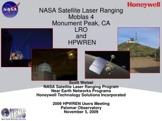
NASA SLR Systems SLR 2000 Prototype, GGAO, Greenbelt, MD MOBLAS-4, Monument Peak, CA
Selected SLR Stations Around the World Zimmerwald, Switzerland Shanghai, China Matera, Italy SLR2000, Greenbelt, MD USA MLRS, TX USA Kashima, Japan Riyadh, Saudi Arabia TROS, China Wettzell, Germany Tahiti, French Polynesia TIGO, Concepcion, Chile Yarragadee, Australia Hartebeesthoek, South Africa