Download
1 / 49
490 likes | 644 Views
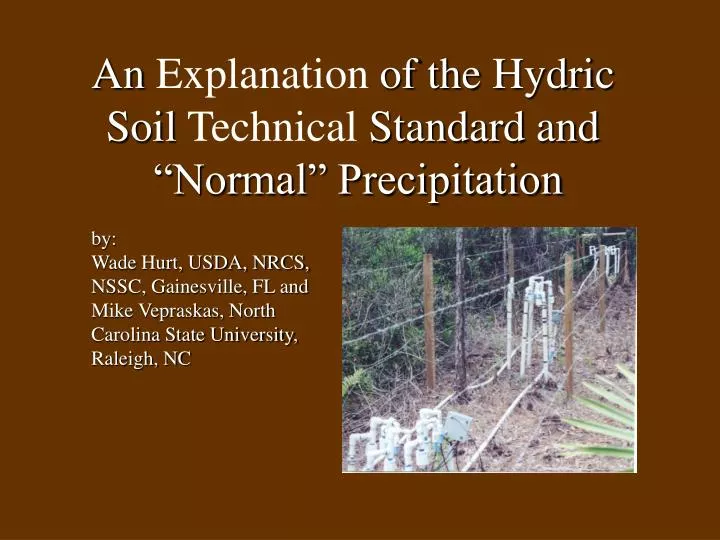
An Explanation of the Hydric Soil Technical Standard and “Normal” Precipitation. by: Wade Hurt, USDA, NRCS, NSSC, Gainesville, FL and Mike Vepraskas, North Carolina State University, Raleigh, NC. Introduction.

E N D
An Explanation of the Hydric Soil Technical Standard and “Normal” Precipitation by: Wade Hurt, USDA, NRCS, NSSC, Gainesville, FL and Mike Vepraskas, North Carolina State University, Raleigh, NC
Introduction You are currently aware there are two methods that a soil can be termed a hydric soil (1) it has a hydric soil indicator and (2) it meets Hydric Soil Criteria 3 (ponding) or 4 (flooding). This lecture explains the third method; meeting the Hydric Soil Technical Standard (HSTS). The concepts of Anaerobic Conditions and Saturated Conditions and the reasons in situ pH and on site precipitation data are needed to apply the HSTS. are explained. The concept of and problems with “Normal” precipitation is also explained.
NTCHS Recommendation for Application of the HSTS The NTCHS recommends that the HSTS be used to: a. evaluate the function of wetland restoration, mitigation, creation, and construction, b. evaluate onsite the current functional hydric status of a soil, and c. with appropriate regional data modify, validate, eliminate, or adopt hydric soil field indicators for the region.
Uses for HSTS: a. Evaluate the hydric status of restoration, mitigation, creation, and construction projects
Uses for HSTS: b. Site Specific: Hydric or Nonhydric c. Indicator Specific: Valid, Invalid, or Revise, or Add
Uses for Standard According to NTCHS, the Hydric Soil Technical Standard (HSTS) can be used 1.) To evaluate weather wetland restoration, mitigation, creation, and construction projects are successful or not, or 2.) Determine onsite the hydric status of a soil, or 3.) To validate, invalidate, revise, or add hydric soil indicators regionally. If the soil meets an indicator, the HSTS cannot be used to exclude the soil from being considered a hydric soil on a site specific basis on hydrologically altered sites.
Standard Requirements The standard requires that two conditions be met: 1. Anaerobic Conditions and 2. Saturated Conditions There are several sub-requirements for each.
1: Anaerobic Conditions • Confirmed by Redox Potential (Eh) data (Platinum Electrode data), or • Confirmed by IRIS tube data (PVC pipe coated with iron hydroxide paint), or • C. Confirmed by Reduced Iron (FE ++) data (alpha-alpha-Dipyridyl) • D. In-situ pH data are also needed and • E. On-site precipitation data needed.
1A: Anaerobic Conditions 5 electrodes are installed at 25 cm in most loamy and clayey soils, 12.5 cm in sandy soils, 10 cm in soils that inundate but do not saturate to a significant depth. Electrodes are installed at the appropriate (25, 12.5 or 10 cm) depth measured from muck or mineral surface (with some exceptions as explained later).
1B: Anaerobic Conditions 5 IRIS tubes are installed vertically so that at least 30 cm of the hydroxide painted portion is in contact with undisturbed soil. IRIS tubes should be inspected during periods the soil is saturated, ponded, or flooded. Inspection must be frequent enough to quantify the amount of iron removal that occurred during a single continuous period of saturation, ponding, or flooding.
1C: Anaerobic Conditions 3 replicate samples within electrode installation depth (exact depths and thickness requirements are explained below) are tested by colorimetric dye such as Alpha-Alpha-Dipyridyl . One soil pH measurement is taken in-situ at the time Eh is recorded.
1A: Interpreting for Anaerobic Conditions For a soil to meet the Anaerobic Conditions part of the standard, Eh measurements of < 175 mv at pH 7 must exist. Eh requirements are adjusted for pH on a line with a slope of negative 60. This Eh-pH line is used for soils with pH values of 3-9. It was not developed for any specific mineral species and is actually somewhere between Iron and Manganese reduction.
Eh/pH Line The Eh/pH Line defined in the previous slide may seem confusing to understand, however, the next two slides should made the definition clear. The first is the actual graft of the line. The second is the definition explained in table format with the minimum Eh (energy in millivolts) values requires for a soil to have anaerobic conditions at specific pHs (Hydrogen ion concentration)
1A: Eh/pH Line for Determining Aerobic or Anaerobic Conditions Aerobic Conditions Exist Eh = 595 - 60 (pH) Anaerobic Conditions Exist
1A: Minimum Eh Values for Anaerobic Conditions at Specific pHs Eh (energy in mv)pHs (H ion concentration) 415 3.0 385 3.5 355 4.0 325 4.5 295 5.0 265 5.5 235 6.0 205 6.5 175 7.0 145 7.5 115 8.0 85 8.5 55 9.0
Iron and Oxygen Reduction Lines VS Anaerobic Conditions Line • The next slide shows the relationships of Anaerobic Conditions to the reduction of Iron (green line) and Oxygen (red line); slide 27 of redox chemistry lecture. • Anaerobic Conditions (blue line) on the reduction scale is between Iron and Oxygen.
Iron and Oxygen Reduction Lines VS Anaerobic Conditions Line Oxygen is not reduced Oxygen is reduced Eh Iron is not reduced Iron is reduced pH4 pH5 pH6 pH7 pH8
Aerobic or Anaerobic? 5 Electrodes installed at 12.5 cm in sands (would be at 25 cm or 10 cm for other soil conditions).
1A: In-situ pH Data Since soils, as they become saturated, tend to have pH values that move toward neutral (pH 7), in-situ pH value are used to locate the precise point on the Eh/pH line. pH is measured on a saturated paste in-situ. Water pH can be used if it is shown similar results are obtained.
1B: Interpreting for Anaerobic Conditions: Saturated, ponded, or flooded soils: For a soil to meet the Anaerobic Conditions part of the standard when at least 3 of 5 IRIS tubes have iron removed from 30% of a zone 15 cm long. Top of zone of iron removal must be within 15 cm of the soil surface for all soils.
These IRIS tubes were removed from a upland to wetland transect 21 days after installation. The two tubes on the right meet the Anaerobic Conditions part of the HSTS based on iron removal. The two on the left fail to meet the Anaerobic Conditions part of the HSTS based on iron removal.
1C: Interpreting for Anaerobic Conditions: Part II For a soil to meet the Anaerobic Conditions part of the standard a positive reaction to alpha-alpha-Dipyridyl is the dominant (60% or more) condition of a specific layer (at least10 cm of the upper 30 cm, at least 1/2 of the upper 12.5 cm, or at least 1/2 of the upper 10 cm) for at least 2 of the 3 required samples.
1C: Positive Reaction to alpha- alpha-Dipyridyl A positive reaction to alpha-alpha-Dipyridyl is required for at least10 cm of the upper 30 cm for most loamy/clayey soil material if the material is not sandy to a depth of 12.5 cm. The positive reaction is requires for at least1/2 of the upper 12.5 cm in sandy soils. Soils that require a positive reaction for at least 1/2 of the upper 10 cm are mainly Vertisols and Vertic subgroups, occupy specific landforms such as Vernal Pools, or have a specific indicator (F8, Redox Depression).
A positive reaction to alpha-alpha-Dipyridyl is indicated by a pink/red color.
Growing Season The classical concepts of “Growing Season” is not considered (28 degrees, leaf buds, etc.). NTCHS considers that Anaerobic Conditions (as confirmed by Eh and pH data) occur only when soil microbes are active (for wet soils this is throughout the year for most of the U.S.).
2: Saturated Conditions A. Confirmed by piezometer data. B. NTCHS recommends that the piezometer data be verified by open well data. C. On-site precipitation data are needed.
2: Saturation Measurements For Vertisols in Louisiana and Texas, 3 piezometers at 25 cm and 3 piezometers at 100 cm are installed. All are measured at least weekly. For all other soils, one open well to 2 m (preferably auto-recording), 2 piezometers at 25 and, 2 piezometers at 100 cm are installed. All are measured at least weekly.
2: Interpreting for Saturated Conditions For a soil to meet the Saturated Conditions part of the standard, free water has to exist within both of the shallowest piezometers (25 cm).
Saturated or Unsaturated? 2 Piezometers at 25 cm 2 Piezometers at 100 cm Open well to a depth of 2 meters
Measurement Period • Recommended measurement period is one year. • Minimum measurement period captures a dry (moist)-wet-dry (moist) cycle. Dry-wet-dry cycles vary. For example: • For most of the southeast this would be November - June. • For peninsular Florida this would be May - November. • For much of California this would be December - May.
Duration For at least 14 consecutive days, Anaerobic Conditions (confirmed by voltage readings below the Eh/pH line or iron removal from IRIS tubes or positive Dipyridyl reaction) and Saturation Conditions must exist for a soil to be considered hydric. For Vertisols in Texas and Louisiana the minimum time period is 7 consecutive days for a total of 28 annual days.
Frequency Frequency must be more than 50% (more than 1 out of 2 years). The frequency requirement is assumed to have been met if data are collected during a 30-70 percentile precipitation probability. 30-70 percentile precipitation probability data are available for thousands of locations nationwide at the NRCS, National Water and Climate Center(http://www.wcc.nrcs.usda.gov/water/ wetlands.html)
On Site Precipitation Data On site precipitation data for the monitoring period (of Eh, dye, and saturation) is required. These data are required in order to determine if the data (of Eh, dye, and saturation) were collected during a “Normal” precipitation period. If precipitation is below or above normal the of Eh, dye, and saturation data do not reflect normal circumstances and are unusable. For the purposes of applying the HSTS the definition of “Normal” precipitation is the average monthly precipitation (50%) + 20%. This would be the 30-70% probability of occurrence. Another way to express this range is that during any given 10 years of precipitation data collection on the average for any given month 4 of 10 years would have precipitation within this range for that month; 3 would have lower and 3 would have higher precipitation for that or any month.
On Site Precipitation Data • If one were trying to prove a site nonhydric, in order to be able to apply data collected (Eh, dye, IRIS, and saturation data) to the HSTS on-site precipitation have to fall within or above the 30-70% range during the dry-wet-dry cycle for the area. • If one were trying to prove a site hydric, in order to be able to apply data collected (Eh, dye, IRIS, and saturation data) to the HSTS on-site precipitation have to fall within or below the 30-70% range during the dry-wet-dry cycle for the area.
Where in this soil would platinum electrodes be installed to determine whether Anaerobic Conditions are met or not? pH data are collected at the same depth. Would there be differences if the soil material was sandy or loamy/clayey? 12.5 cm sand loam/clay
Platinum Electrodes Where? • The soil in the previous slide has, at the location indicated by the upper bar, about 8 cm of mucky peat underlain by about 8 cm of muck (lower bar). As depicted in the slide, the underlying mineral soil material may be sandy or loamy/clayey. • The two upper arrows on the left (beneath the scale arrow) indicate where the electrodes would be located if a person was trying to prove the hydric status of the soil and the soil material was sandy and • mucky peat was a concern (upper of the two arrows) or • mucky peat was not a concern (the lower of the two arrows). • The two lower arrows indicate where the electrodes would be located if a person was trying to prove the hydric status of the soil and the soil material was loamy/clayey and • mucky peat was a concern (upper of the two arrows) or • mucky peat was not a concern (the lower of the two arrows). • The location of electrodes is dependant upon the texture of the soil.
Where in this soil would piezometers be installed to determine whether Saturated Conditions are met or not? Would there be differences if the soil material was sandy or loamy/clayey? 25 cm
Piezometers Where? The soil in the previous slide has, at the location indicated by the bar and scale, about 15 cm of fill material all soil material is sandy or organic (mucky peat). The upper arrow on the left indicates where the piezometer would be located if a person was trying to prove the hydric status of the new soil (taking into account the fill material) the depth would be 25 cm from the surface of the new soil. The middle arrow indicates where the piezometer would be located if a person was trying to prove the hydric status of the soil and mucky peat was a concern. The depth would be 25 cm from the surface of the mucky peat. The lower arrow indicates where the piezometer would be located if a person was trying to prove the hydric status of the soil and mucky peat was not a concern (most of the US). The depth would be 25 cm from the surface of the mineral soil. The location of piezometers is not dependant upon the texture of the soil.
Additional Use of IRIS Tubes Overview: NRCHS recommends that IRIS tubes be used, without measurements of saturation, to assess the likelihood that soils in remote locations will meet the HSTS. This assessment is intended as a guide to whether full evaluation of the soils via the HSTS is warranted.
Additional Use of IRIS Tubes • Procedure: 1. Insert 5 tubes per plot. 2. Estimate the percentage of iron removal at a convenient interval of time which can range from 1 to 3 months between visits. 3. If at the end of an evaluation period the percentage of iron removal over the appropriate depth and area of pipe (as required for Anaerobic Conditions above) is: • 30% or more: Hydric conditions may exist and retesting via the HSTS is recommended. • 10% or less: Hydric conditions are not likely. • 10 to30%: Hydric conditions may or may not exist; a longer test period is recommended.
IRIS Tubes Availability IRIS tubes available from: Byron Jenkinson 5224 West 350 North West Lafayette, IN 47906 bjenkins@purdue.edu
Normal Precipitation: Does it Exist? Much emphasis has been placed on “Normal” precipitation. Is “Normal” really normal? Review the next slide. It is precipitation data from Gainesville, FL for the years of 1996-2000 compared with "Normal” (30-70% probability). Horizontal bars have been placed at the normal range (30 and 70%) to show that for 5 years of data no year had a normal monthly precipitation for April; July had two years with normal (1998 and 2000); September and November had one year with normal (1999 and 2000 respectively). The dry-wet-dry cycle for Gainesville, FL is May-November. If a site near Gainesville has been monitored (Eh, dye, and saturation) for the period 1996-2000 none of the data could be used because no year had normal monthly precipitation. These results (departure from normal) are not atypical, if fact, they represent what is typical throughout much of the US. Since “normal” rarely exists, it is doubtful many changes will be made to Field indicators of hydric soils in the United States (Hurt, et al. 2002).
(30%) (70%)
Summary You are now aware there are three methods that a soil can be termed a hydric soil (1) it has a hydric soil indicator and (2) it meets Hydric Soil Criteria 3 (ponding) or 4 (flooding), and (3) it meets the Hydric Soil Technical Standard (HSTS). Although the low probability of any given site have normal climatic conditions limits the applicability of the HSTS, a technically correct method to update field indicators of hydric soils in the United States (Hurt, et al. 2002) had to be developed This method is available for use.
Literature Cited Hurt, G.W., L.M. Vasilas ( Eds.). In press. Field indicators of hydric soils in the United States (Version 6.0), USDA, NRCS, Fort Worth, TX. http://soils.usda.gov/soil_use/hydric/field_ind.pdf National Technical Committee for Hydric Soils. 2001. Hydric Soil Technical Standard (Technical Note 11). http://soils.usda.gov/soil_use/hydric/hstn.htm NRCS, National Water and Climate Center. http://www.wcc.nrcs.usda.gov/water/climate/ NOAA. National Climate Data Center. http://www5.ncdc.noaa.gov/climatenormal/clim85