Download
1 / 31
310 likes | 459 Views
Overview of ESA GMES activities and interactions with the EC. Informationstag zu GMES und Satcom im 6. EU-Forschungsrahmenprogramm 29 April 2005, Bonn. Agenda. ESA – EC Coordination GMES Advisory Committee GMES Programme Office ESA activities on GMES GMES Service Elements

E N D
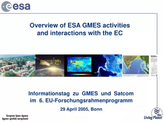
Overview of ESA GMES activities and interactions with the EC Informationstag zu GMES und Satcomim 6. EU-Forschungsrahmenprogramm 29 April 2005, Bonn
Agenda ESA – EC Coordination • GMES Advisory Committee • GMES Programme Office ESA activities on GMES • GMES Service Elements • Charter: a precursor • GMES Preparatory Activities • GMES Space Component Programme
GMES Co-ordination Bodies Advisory Committee GAC(2004)1 A way of maintaining and strengthening the “political ownership” of GMES, Provide strategic advice and policy orientation on: • GMES long-term implementation, including possible funding mechanisms and encouraging a “GMES partnership”. • to optimise the use of existing and future GMES infrastructures, • assessing the overall strategic and socio-economic benefits of GMES Membership: • EC, ESA and related Member States, interested in making significant contributions to GMES Meeting: • twice a year, next on 1st June 2005
GMES Co-ordination Bodies Programme Office GAC(2004)2 Implement, in its early stages, the operational management of GMES Membership: • Co-chaired by: • EC - Head of Unit for GMES, • ESA - Head of ESA GMES Unit, • DG-Environment,Joint Research Centre, Research, Enterprise & Industry • ESA Earth Observation Programmes Directorate • EEA , EUMETSAT,EU Satellite Center Meeting: • twice a month
Actions MANAGEMENT • Assessment of Socio-Economic Impact of GMES GAC(2004)5 - July 2004. IMPLEMENTATION • Initial services implementationGAC(2004)4 – July 2004 • Development of the Space Observation componentGAC(2004)7 – July 2004 • In situ component, GAC(2004)6 – July 2004 • Data integration and information management (INSPIRE) • Data policy framework • Security and dual-use, GAC(2004)17 – Nov. 2004 • Definition of follow-up management structure • Funding mechanisms • International cooperation policies • Proposal for Long-Term Implementation of GMES
GMES Preparatory activities Development of Initial Services: GSE Program Socio-economic analysis Architecture studies Space Component Sentinels Coordination with national programs and Eumetsat Ground Segment Oxygen Phase 2 (O2 – “open and operational”)
GMES Service Element (GSE) GSE is a key element and critical milestone for GMES. It is in the middle of its successful implementation phase. Prime objectives: • Maximum use of EO in support of European policies on environment and security • Basis for future EO operational systems for the benefits of Europe’s citizens GSE services must fulfill: • Availability • Reliability • Affordability
GSE Initial Services in consolidation CoastWatch Real-time Ocean ICEMON Northern View Risk fire & flood Forest Monitoring Soil & Water Land Motion Urban Services Humanitarian Aid Atmosphere Food Security
User Organizations in GSE Total: 210 User orgs 190 from 33 countries & 20 international
Providers CLS Meteo-Fr Mercator IFREMER DNV NERSC NCMR Telespazio Real-time Ocean Monitoring Services Users CEDRE IFREMER NDF NSF IMR NCD P of Barcelona Puertos Estados Min. Fomento Galicia CMC CPMM Catalunya Met P of Gijon UKEA MCGA CEFAS Min Mer. Marine HCMR Services - Algae Bloom Monitoring - Oil Spill Monitoring & Impact Assessment Policies INT: IMO Marine Pollution (MARPOL) EU: Water Framework Directive EU: ICZM recommendations EU: 6th EAP - protect nature & biodiversity EU: 6th EAP - address environment & health
Oil spill information (using C-band SAR) Service examples Algae Bloom detection (using Ocean-colour / Meris) Routine Monitoring & alert Impact Assessment & Evolution forecasting
In 2002 about 200 M€ loss of mussel cultures in the River Scheldt area. Predicting of risk based on EO-Chlorophyll and wave data. In 2004 decision support for closing dams to keep Harmful algae blooms outside the estuary. Benefits example: Algae bloom monitoring
PROMOTE Services Atmospheric information to support protocol monitoring Users JRC-IES NILU EPA UBA-A UBA-D BVDD LUA WMO ECMWF DEFRA London RIVM SYKE ADEME L’Oreal Meteo Fr EMPA ARPA APAT VITO/VMM Services Stratospheric Ozone UV Radiation: Air Quality: - past, present, forecast Greenhouse gas emissions, concentrations Providers KNMI DLR DWD RIU U Bremen CERC Prev’Air ACRI-ST FMI Policies - Vienna convention - Montreal Protocol • UN Convention on Long-Range Transboundary Air Pollution • UNFCCCC • EU: Clean Air for Europe (CAFÉ)
PROMOTE Services on UV Radiation www.gse-promote.org
Providers GAF SFMC Metria VTT Geoapikonisis Joanneum Forest Monitoring Services Services - Forest Monitoring - Mapping and Monitoring of Disturbances - Sub-National Forest Information Service - Land Use and Forest Indicator Service Users Min Agr FEA Thuringa IFGF NOA NBF Stora Enso Min Agr FEA FS of IGSNR Policies INT: UNFCCC & Kyoto Protocol INT: UN Convention on Biodiversity EU: Water Framework Directive EU: Soils & Forest Strategies EU: 6th EAP - protect nature & biodiversity EU: 6th EAP - address environment & health EU: 6th EAP - tackling climate change EU: 6th EAP - preserve nat. resources
Core Users: BMVEL - Germany; NOA - Greece; MAPAAR - France Responsible for UNFCCC and Kyoto Protocol reporting (Art. 3.3, 3.4) IN-SITU DATA Forest inventory field data (sample plots) Biomass Expansion and Carbon Extension Models Carbon estimates per sample plot New Interested Users: CSIR, South Africa Poland EO STRATIFICATION NRSC, Namibia ERSI, Zimbabwe Forest type & land use derived from optical and SAR data Germany Greece French Guiana Change Detection CARBON BUDGET Forest area & Carbon Stock • Average estimate • Minimum reliable estimate National Greenhouse Gas Reporting Services: Maps and Statistics for Land Use, Land Use Change and Forestry (LULUCF) Spatially explicit information on forest area and changes versus 1990 Carbon Stock and annual changes Error Budget and Minimum reliable estimate Compliance with COP decisions and LULUCF Good Practice Guidance Guidelines
Charter: a precursor The International Charter on Space and Major Disasters • Initiated by CNES and ESA, joined by CSA, NOAA, ISRO, CONAE & JAXA • Unified system of space data acquisition / delivery in case of natural or human-made disasters • Data delivery to civil protection agencies, emergency & rescue services; UN cooperating body since 2003 • Operational since 2000: 24 hrs on-duty-operator, data resources from all Charter members • RecentExamples of Charter Activation: • Bam Earthquake 2003 • Darfur Crisis 2004 • Tsunami Catastrophe 2004/2005
GMES Preparatory Activities Studies Socio Economic Benefits Study User requirements / service segment GMES Service Evolution Long-term Scenario Study Concept G/S Architecture Definition Requirements & Assumptions Sentinel Definition Studies Heterog. mission Accessibility (inter-operab.) Concepts Space Missions Evolution Space Segment Arch Commonality Development approach 2005 - 2015 2005 - 2030
Socio-Economic benefits Objectives • Impact assessment for all significant new investment • Support member states in investment decision • Better understand how GMES will impact on key stakeholders to support future discussions and priority setting – key groups include: • Public sector legally mandated organisations • The citizen (directly and indirectly) • European industry (eg competitiveness, pollution control effectiveness) • Politicians • Regional and global monitoring programmes • Promote benefits from GMES implementation to wider audience
What will be delivered? Key benefits to be expected arising from GMES implementation A political and strategic view of the benefits and impacts due to GMES implementation Benefits evaluated against cost envelopes from an economic perspective Variation in benefit resulting from different implementation levels for GMES Schedule Kick-Off meeting March 2005 First versions of analysis by June/July 2005 Final versions of analyses by November 2005 Outcome and schedule
GMES Architecture Studies Interoperability Interoperability USERS Service Component Socio-economic data Data Integration & Information Management Ground Segment In-Situ Data Access EO Data Access IntegrationLayer PGS PGS PGS In-situ Airborne Other non-space Systems Existing In-situ networks (EIOnet, INSPIRE) FOS FOS FOS Space Segment EUMETSAT National Cooperative Missions ESA In Situ Component Space Component / EO Component
Space Observations The GMES Sentinels Sentinel 1 – SAR imaging All weather, day/night applications, interferometry Sentinel 2 – Superspectral imaging Continuity of Landsat, SPOT & Vegetation-type data Sentinel 3 – Ocean monitoring Wide-swath ocean color and surface temperature sensors, altimeter Sentinel 4 – Geostationary atmospheric Atmospheric composition monitoring, trans-boundary pollution Sentinel 5 – Low-orbit atmospheric Atmospheric composition monitoring
Detailed definition of Sentinels and of its operations concept. Establish the mission and system concept, Demonstrate the feasibility Provide the design Validate in System Requirements Review (SRR) as per ECSS-M-30A Analysis of mission and system functions and requirements for all mission elements, Programmatic: system engineering approach, model concept, development planning, schedule and cost estimates, Sentinel-2 and Sentinel-3 include also the analysis of the accommodation of the 3-band payload defined in the Fuegosat Sentinel (1-2-3) Definition Studies
Objectives Define and design the multi-mission PDS architecture and operational concept to be applied to the GMES Sentinel (i.e.: 1, 2 and 3 series), building over current and past mission PDGS gained experience Specifying the: multi-mission and mission-specific PDS modules and their interfaces, and providing an implementation plan including the costs, schedule and risks. Scope All PDGS functions Including the interface to the EO data access layer GMES Sentinels Payload Ground Segment
Objectives Define, standardize and prototype harmonized interface for the GMES Service Users with the different EO data providers, to allow an easy and cost-effective access to heterogeneous EO mission data Scope GMES EO products and its format (*) EO products quality certification, including methods and criteria and across-mission calibration and validation standards (*) Interface for ordering/programming, catalogue access, and on-line data access. user management and administration EO data supply agreements (common GMES data policy and Service Level Agreement) to be adhered by the GMES satellite data providers. (**) Heterogeneous missions accessibility (inter-operability)
GMES Space Component Programme … addresses the following elements • Space observations: • Sentinels • National missions, Eumetsat and TPM • GMES ground segment required to manage space data • Integration of new space data into GMES services Not addressed in the GMES proposal are … • In-situ observations • Policy & regulatory framework • Institutional structure to govern, finance and operate GMES
GMES Global Monitoring for Environment and Security (GMES) “GMES is a joint initiative of ESA and the EC to respond to the need to establish, by 2008, a European Capacity for Global Monitoring of Environment and Security to support the public policy maker’s need for global access to reliable, accurate and up-to-date information on issues of environment and security” EC Communication COM(2001)264, 15 April 2001 Needs Public Policy EO Solutions