Download
1 / 12
120 likes | 283 Views
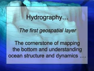
Hydrography… The first geospatial layer The cornerstone of mapping the bottom and understanding ocean structure and dynamics …. Why Hydrography?. Efficient and Safe Maritime transit Coastal Zone Management Utilization of Marine resources Environmental Protection and Management

E N D
Hydrography…The first geospatial layerThe cornerstone of mapping the bottom and understanding ocean structure and dynamics ….
Why Hydrography? • Efficient and Safe Maritime transit • Coastal Zone Management • Utilization of Marine resources • Environmental Protection and Management • National Data Bases • Maritime Boundary delimitation • National Defense • Tourism and recreation • Mitigating coastal hazards
Efficiency and Economy of Navigation • Excluding Mexico and Canada, 95% of U.S overseas trade by tonnage is carried on the sea. • Maritime commerce is the basic element for a nation's economy • UKC and shorter transits underscore the value hydrographers’ passages • $590B through US Ports 1996 (Year of the Ocean) • Charting must be brought up to world-class standards
Safety of Navigation • Chapter V Regulation 9 of SOLAS Convention • Hydrographic Services must provide: • Hydrographic surveying adequate for local navigation requirements • Issue nautical charts and other pertinent documents which satisfy the need for safe navigation • Promulgate Notice to Mariners (NTM) • Data management to provide for these services • Standardized charting • Coordination to ensure the dissemination of data and information on a world wide basis
Coastal Zone Management • New Port Construction • Maintenance and development of existing port facilities • Dredging operations for depth maintenance • Monitoring and improving channels • Dumping grounds for waste • Utilization of mineral deposits • Aquaculture • Public works activities • Marine Protected Areas
Utilization of Marine Resources • Hydrocarbon exploration depends on bathymetry data • Fishing industry depends on depth information for safe deployment of equipment and detection of fishing banks • Charts can help determine patterns in geomorphology and unknown resources
Environmental Protection and Management • Pollution Control • Hazardous spill control • Scientific research such as Global Tidal and circulation models which require quality Bathymetric data for validity • Monitoring programs using in situ instrumentation
National Data Bases • Well managed geospatial data are essential for commercial, economic development, and environmental protection • Bathymetry is an important part of a national data base infrastructure which includes topography, geodesy, geophysics, and meteorology
Maritime Boundary Delimitation • UNCLOS - Signatory nations can submit claims for boundary extensions beyond 200 NM based on bathy (2500 meter), change in shelf slope and geology. There is only one way to determine the slope. • Nautical charts provide the only accurate and officially recognized source of this information
National Maritime Defense • Navies and Coast Guards are major users of charting products. • Transportation of conventional and nuclear munitions make safe navigation essential. • Surface, sub-surface, mining, anti submarine, air-sea operations depend on nautical charts and products
Tourism and Recreational Boating • Cruise ships depend on safe navigation and potential growth in this area is staggering • Digital charts will bring the recreational boater into concert with other navigators.
Tourism and Recreational Boating • Cruise ships depend on safe navigation and potential growth in this area is staggering • Digital charts will bring the recreational boater into concert with other navigators.