Download
1 / 23
230 likes | 251 Views
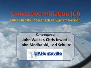
Developers: John Walker, Chris Jewett, John Mecikalski, Lori Schultz. Convective Initiation (CI) UAH SATCAST “Strength of Signal” Version. Cloud-top Glaciation. 1. Cloud-top growth. 2. Cloud height, relative to mid-troposphere (Ackerman, 1996; Schmetz et al, 1997). CI Interest Fields:

E N D
Developers:John Walker, Chris Jewett, John Mecikalski, Lori Schultz Convective Initiation (CI) UAH SATCAST “Strength of Signal” Version
Cloud-top Glaciation 1 Cloud-top growth 2 Cloud height, relative to mid-troposphere (Ackerman, 1996; Schmetz et al, 1997) CI Interest Fields: Original Usage With Critical Value Thresholds 3 4 Cloud height (Inoue, 1997; Prata, 1989; Ellrod, 2004) 5 6 Cloud-top height changes Table from Mecikalski and Bedka 2006
For the new version of SATCAST, the same general set of Interest Fields are employed, but WITHOUT the use of the “critical thresholds”, which were originally used to provide “Yes/No” forecasts of near-future CI. Now, the same information from each field (regardless of the Interest Field magnitudes) is all combined to produce a single “Strength of Signal” value. 1 2 CI Interest Fields: Now Used Without Thresholds 3 4 5 6 Table from Mecikalski and Bedka 2006
The “Strength of Signal” index is a direct result of forecaster feedback from the 2011 HWT SPC Spring Experiment and is the first step toward providing true probabilistic forecasts of near-future CI for individually tracked cloud objects. Because the previous versions of SATCAST used a set of “one size fits all” thresholds to make “YES/NO” CI forecasts, there was not enough information provided for a forecaster to add his/her own knowledge and experience in situations to make decisions about the true likelihood of near-future CI. A database of “CI” and “Non-CI” events has been (and is continuing to be) developed using the above-mentioned Interest Fields in order to statistically compare the cloud-top characteristics of convective form clouds that go on to produce CI with those that do not produce CI. This information is used to train the algorithm to combine the Interest Field information from new cloud objects and produce an index on a scale from 0-100 that gives an indication of how “strong” the satellite-derived signal is for future convective development and CI. Explanation of the “Strength of Signal” Index
It is important to note that this is not yet a fully geared “probabilistic” product. That is because this version of SATCAST is still using information derived almost exclusively from the geostationary satellite with very little information about the local atmospheric environment. For example, a newly developing towering cumulus cloud may exhibit a very strong Strength of Signal early on at low levels…. However, there may be a strong capping inversion at mid-levels or, perhaps, intense shearing higher up that will ultimately prevent the developing cloud from maturing and producing CI (defined as the first occurrence of a ≥35 dBZ radar echo at -10⁰C). For now, it is up to the forecasters to bring in their own knowledge of a local environment when considering the Strength of Signal SATCAST output. Research and database development is currently underway to account for such local atmospheric environment information, using a fusion of data from satellite and Numerical Weather Prediction models. The end goal will be a true probabilistic CI forecast product, which will be available in the near future. In the mean time, the current Strength of Signal product brings us one step closer to that goal. Explanation of the “Strength of Signal” Index
Previous Version of SATCAST Newest Version of SATCAST Example Comparison of “Original” -vs- “Strength of Signal” Null (No) Forecasts Positive (Yes) Forecasts 0 100 Strength of Signal (SS)
Note from the previous example that the four highlighted cloud object forecasts over the Alabama/Florida/Georgia region were divided into two “null” and two “positive” CI forecasts in the original version of SATCAST. However, in the new Strength of Signal version, more information from the combination of Interest Fields is passed on to the user, which is now showing us that all four cloud objects are actually right in the “middle” of the spectrum and should be given about the same amount of consideration in terms of potential for future CI. And, furthermore, even more consideration should be given to the cloud objects with the highest Strength of Signal values. Figure Discussion
Initial Development of CI Zoom-In View of SATCAST (Colorado) Output from 04/24/2012 1715 UTC Radar Valid 04/24/2012 1808 UTC
Output from: 04/24/2012 1702 UTC Zoom-In View of SATCAST (Colorado)
Output from: 04/24/2012 1715 UTC Zoom-In View of SATCAST (Colorado)
Output from: 04/24/2012 1732 UTC Zoom-In View of SATCAST (Colorado)
Output from: 04/24/2012 1745 UTC Zoom-In View of SATCAST (Colorado)
From the previous sequence of SATCAST output (zoomed in over Colorado), one can observe the evolution of cloud growth and corresponding Strength of Signal index values. Keep in mind that each new set of output forecasts is completely independent of prior forecasts, so if the signal of a given cloud object seems to start on the low end of the index and increase, a forecaster may (in many situations) find it prudent to increase confidence that CI is likely. Other times, a cloud object’s signal strength may increase significantly as a cloud develops and then appear to drop off rapidly before the forecast “disappears” over a fully developed cumulonimbus . This is very common and usually indicates that the cloud is nearing or has reached the Equilibrium Level, slowing or ending its vertical development in the mature phase of its life cycle. Yet, at other times, a cloud object’s sequence of SATCAST output could exhibit similar trends early on with a rapid drop off in forecast CI signal strength as a cloud encounters a strong capping inversion or a layer of strong shear, effectively stunting its vertical development far before maturity and ending the possibility of CI. For this reason, it is usually helpful to view the SATCAST Strength of Signal output along with the corresponding satellite imagery itself. Overlaying the forecasts onto Visible/IR imagery is a useful way to accomplish this in most cases. Figure Discussion
Another thing to consider when using the Strength of Signal SATCAST product is how to actually evaluate and use the output values. Because the output is no longer composed of “YES/NO” forecasts based on rigid thresholds that cannot account for the local atmospheric environment or mode of convection, the forecaster is now given more information and, with that, the opportunity to add his/her own knowledge of the environment. In most regions of instability and the general possibility of convective development, it is safe to assume that only those clouds with higher forecast CI signal strengths will lead to CI. However, it has been found that in some environments (small CAPE and weak/no capping inversion), a Strength of Signal of only ’50’ or ‘60’ is enough to lead to weak/marginal CI events. In this way, a forecaster with knowledge of the local atmospheric environment can “self-calibrate” the Strength of Signal output and very quickly learn how to use it optimally in a variety of synoptic set-ups. Further Discussion
Regarding synoptic environments with capping inversions… From the 2011 SPC Spring Experiment, many forecasters noted that persistent False Alarms in the previous version of SATCAST was sometimes a precursor of CI in moderate to strongly capped environments… giving an indication of an eroding cap as clouds in the unstable environment below the inversion continued to quickly develop upward and penetrate the lower portions of it. During this erosion period, none of the initial vertically developing clouds led to CI, but once the inversion was eroded enough, the positive CI forecasts were mostly correct. See the following example from the Indiana/Illinois region from May 24, 2011 and corresponding 12z sounding from Lincoln, IL. Further Discussion
Sounding from Lincoln, IL May 24, 2011 12 UTC **Weak capping inversion** denoted by black circle
1630 UTC 1602 UTC 1602 UTC 1645 UTC 1615 UTC 1615 UTC 1700 UTC 1632 UTC 1632 UTC 1645 UTC 1645 UTC 1715 UTC 1730 UTC 1702 UTC 1702 UTC 1715 UTC 1715 UTC 1745 UTC 1800 UTC 1732 UTC 1732 UTC 1815 UTC 1745 UTC 1745 UTC
Regarding synoptic environments with capping inversions… Though the Strength of Signal version of the algorithm can no longer be evaluated in strict sense of “100% Right” or “100% Wrong”, it is likely that in similar synoptic environments, the forecast CI signals will behave in a similar manner. The signal strengths may be very high for rapidly developing clouds beneath a capping inversion, even if CI does not result. Remember that the forecast output is generated largely from trends in satellite data alone with no “knowledge” of the environment. Future versions of the algorithm can remedy this issue, yet, at the present time, this can be utilized as a strength of the algorithm, giving forecasters a head’s up on when/if the cap will break. Further Discussion
Many of the same limitations of the original SATCAST still exist within the new version, many of them having to do with the fundamental limitations of the current GOES satellite instrument. Some of the more common limitations include: 1) Cirrus Contamination 2) False signals of vertical development from newly forming clouds 3) Night time processing is still hindered by a decreased quality cloud mask Known Limitations
Try saying that 10x really fast! No Processing Where Cirrus is Detected Known Limitations: (Serious Cirrus Issues) (Top):Currently, we avoid processing in areas of detected thin cirrus, though we are working on a more robust algorithm that will soon be able to forecast CI in such regions using derived Cloud Optical Depth properties. (Bottom): Undetected thin cirrus contamination can cause false signals of vertical cloud growth, artificially inflating Strength of Signal values.
The new Strength of Signal version of SATCAST generated by UAHuntsville is intended to be a bridge between the old thresholding approach, which produced absolute forecasts of “YES/NO”, and the future direction of the algorithm in which satellite data will be fused with NWP data to produce true probabilistic forecasts of CI. The output of the upcoming probabilistic versions will have the same look as the Strength of Signal, but will be even “smarter”, taking into account the local atmospheric environments. Even so, as we continue to build in information from our growing “CI -vs- No CI” database in the coming weeks and months, the current Strength of Signal version will also become smarter throughout this season. Closing Notes
The developers of the SATCAST product at UAHuntsville would like to extend a sincere note of gratitude to the forecasters/users of this experimental product. It is our goal to listen to your feedback, which is invaluable, and to continue to enhance and refine our algorithm to meet your needs and standards. Thank you for your time and consideration as we continue this partnership between the research and the operational meteorological communities. Feel free to continue viewing and using this new version of the product at the following web links…. For best results, copy and paste into the Firefox browser. (Note: “m1”,” m2”, etc., give images of prior forecasts): http://www.nsstc.uah.edu/~jwalker/UAH_SATCASTv2_CI_VIS.png http://www.nsstc.uah.edu/~jwalker/UAH_SATCASTv2_CI_VIS_m1.png http://www.nsstc.uah.edu/~jwalker/UAH_SATCASTv2_CI_VIS_m2.png http://www.nsstc.uah.edu/~jwalker/UAH_SATCASTv2_CI_VIS_m3.png http://www.nsstc.uah.edu/~jwalker/UAH_SATCASTv2_CI_VIS_m4.png Closing Notes