Download

1 / 43
430 likes | 1.02k Views
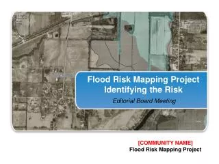
FLOOD MAPPING. Menaxhimi i rezikut te permbytjeve. Objektivat Gjenerale. General Objectives. Protect people and goods Preserve river capacity and flood plants Conserve ecological equilibrium To reach these objectives, a regulation of land use in the floodplain is necessary:

E N D
FLOOD MAPPING Menaxhimi i rezikut te permbytjeve ObjektivatGjenerale
General Objectives • Protect people and goods • Preserve river capacity and flood plants • Conserve ecological equilibrium To reach these objectives, a regulation of land use in the floodplain is necessary: • Forbidding new construction in high risk areas, • Controlling urban extension in floodplain, • Limiting embankment to minimum.
Example of flood risk mapping • Zone 1 - Little / no risk • Zone 2 - Low to Medium risk (light blue) • Zone 3 - High risk (dark blue)
Principe of flood risk analysis • Flood hazard assessment: three hydraulic parameters considered • Water depth, • Flow velocity, • Duration of inundation
Flood risks analysis Flood hazard classification
Flood risk assessment • Vulnerability mapping Vulnerability classification by distinguishing urban / non urban areas Flood risk mapping • Flood hazard + vulnerability,
Methodology Flood
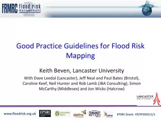
Flood Hazard / Flood Risk • Different scales • Preliminary flood risk assessment • Drini River Basin • Local flood risk map • Pilot area : Skenderaj
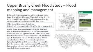
Preliminary flood risk assessmentDATA GATHERING AND PROCESSING • Topographical and hydrological data • SRTM 90 DEM • Contour lines (10m) • Historic floods etc. • Problems and accuracy • SRTM DEM : 90m x 90m, dZ~10m • Shifting between different maps
DEM from contour lines SRTM DEM
Improving preliminary delineation of flood areas • Send questionnaires for the most sensitive towns • Process with available satellite imagery • For sensitive areas assess flood hazard with simplified hydraulic calculations and fields visits • Georeferencing all data
Local flood risk mapPilot area: Skenderaj • Work completed: • Field visits • Questionnaire prepared • TOR for topographic survey • Next steps • Hydraulic modelling • Flood risk mapping • Discussing about a pilot flood risk management plan
Hydraulic model Hydrology Flow discharge Water surface profiles Geometric data Parameters Schematic ArcGIS Hydrology Hydraulic ArcGIS Floodplain Mapping Approach
Hydrology Hydraulic ArcGIS Floodplain Mapping Approach ArcGIS Input Data DEM ArcGIS Flood plain maps Geometric data Parameters Schematic Flow discharge Hydraulic Water surface profiles Hydrology Flood discharge
Hydrology Hydrology
Hydrology Hydraulic ArcGIS Digital Terrain Model: DTM • Observed points • and • break lines for • constructing • a • triangular irregular • network (TIN).
DTM - Hydrology Hydraulic ArcGIS Triangular Irregular Network : TIN • TIN components: • - nodes • - edges • - triangles
Hydrology Hydraulic ArcGIS DTM – TIN 3 D display of topography • 3D display • of a TIN.
Hydraulic Hydrology ArcGIS DTM – TINDisplay of buildings • Embedding Buildings • into the TIN.
Hydrology Hydraulic ArcGIS Topographic survey: Cross Sections • Stream centerline. • Banks. • Flow paths. • Cross sections.
Hydrology Hydraulic ArcGIS Hydraulic Modelling • Cross-sections extracted from the TIN. • stream geometry.
Hydrology Hydraulic ArcGIS Hydraulic Modelling • Water surface elevations.
Hydrology Hydraulic ArcGIS Floodplain Mapping • Floodplain
Hydrology Hydraulic ArcGIS Floodplain Mapping • 2-D floodplain animation.
Floodplain Mapping • 3-D floodplain animation.