Comprehensive Beach Safety Resources for Hawaii: Hazards, Ratings, and Public Awareness
200 likes | 314 Views
The Ocean Safety and Lifeguard Services Division presents a standardized, scientific resource for Hawaii's beaches, detailing physical characteristics, access points, facilities, and public risk levels under varying ocean conditions. Collaborating with local authorities, expert groups, and universities, data collection employs field surveys, aerial imagery, and GIS layers. This initiative aims to enhance public awareness and safety by providing detailed beach hazard ratings and information access through a user-friendly website. The project seeks to incorporate live weather updates and further develop resources for O’ahu and Maui residents and visitors.

Comprehensive Beach Safety Resources for Hawaii: Hazards, Ratings, and Public Awareness
E N D
Presentation Transcript
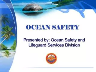
OCEAN SAFETY Presented by: Ocean Safety and Lifeguard Services Division
Develop a comprehensive, standardized and scientific beach information resource for Hawaii beaches Location Physical characteristics Access Facilities Usage Rescues Physical Hazards Biological hazards Level of public risk under various wave, tide and weather conditions Goals
Goals • increase public awareness • residents and visitors • information accessible via internet • additional CDs distributed
Who is involved? • City and County of Honolulu, Hawaii • Ocean Safety and Lifeguard Services Division • Hawaiian Lifeguard Association • Coastal Geology Group (CGG), University of Hawaii • Professor Andrew D. Short, University of Sydney, AU
Methodology: Data Collection • Data on each beach is acquired from a range of interrelated sources: • Field Survey – Professor Short. • Imagery – Coastal Geology Group • GIS layers – City and County of Honolulu • GIS layers – State of Hawaii • Beach conditions – Hawaiian Lifeguard Association
Methodology: Data Collection • Field survey conducted • New ground photography and oblique photography acquired • Between 2003 and 2004 • Cessna plane at 2000 ft with window open
Data Analysis • Beach hazard rating values developed by Professor Short • used Excel spreadsheet • based on first appraisal from field trip • Physical descriptions and beach hazards written by Professor Short • Oahu and Maui shorelines • Beach hazards described using method developed by the Australian Beach Safety & Management Program (ABSAMP)
Beach Hazards • Also include local hazard such as rocks, reefs, headlands, and inlets. Definition: elements of beach environment that expose the public to danger or harm • water depth (deep and shallow), • breaking waves, • variable surf zone topography, • surf zone currents (rip currents)
Beach Hazard Rating • Rates beach according to the hazards associated with its shape and natural wave and current conditions. • To provide an effective method of scientifically rating both the average and prevailing hazards on each beach, for the range of conditions that each beach may experience.
Beach Hazard Rating • Rating range • 1 = least hazardous • 10 = extremely hazardous • Two types of ratings assigned: • Shoreline Rating extending across beach to 150 feet offshore • Outer Rating referring to conditions further than 150 feet from shore, usually out on the reef or reef breaks
Beach Hazard Rating • Rating determined by a wave height and shoreline type matrix • Individually adjusted using local factors • Particularly nature of associated fringing/barrier reefs: • Factors increasing rating - higher local waves, more channels and rips through reef • Factors decreasing rating - lower local waves, continuous or deeper reef (no rips)
Assessment of Hazards- Coastal Geology Group (CGG) • Submission of Professor Short’s information to CGG • Beach descriptions • Shoreline data • Digital images • Processing by CGG • Generation of GIS layers • Assessment of hazards • Data distribution
Assessment of Hazards by Coastal Geology Group (CGG) • Additional information provided by Hawaiian Lifeguard Association • Beach park locations • GIS layers • Surf and rip • Current data • Maps • Presence of lifeguards • Ease of accessibility • Availability of parking and facilities
Beach Hazard Map - City and County Beach Park Aerial photography as base, depicting park boundaries, and other coastal features: • Locations of major rip currents and surf breaks • Other natural and cultural features relevant to water safety • Adjacent shoreline features included
Data Distribution • available for download and printing in high-resolution format through internet and CDs. • A description for every beach on O’ahu • Each beach provided with associated information • individual beach description • high-resolution image • beach data table
Summary • Developed beach information resource for O’ahu and Maui • Comprehensive and standardized • Scientific basis • Generation of user-friendly website making information accessible to public • Beach descriptions • Hazard summaries • High resolution images
Further Goals • Incorporate other counties • Provide increasingly detailed information on most popular beaches • Integrate live weather and surf information into Beach Hazard Ratings • Develop dynamic maps, beach data, beach hazard ratings and beach images via the web.
For more information • Project Website:www.soest.hawaii.edu/coasts/OceanSafety/ • Ocean Safety and Lifeguard Services Division:http://www.co.honolulu.hi.us/esd/oceansafety/index.htm • Coastal Geology Group:http://www.soest.hawaii.edu/coasts/cgg_main.html • Hawaiian Lifeguard Association:http://www.aloha.com/%7Elifeguards/hla.html • Australian Beach Safety & Management Programhttp://www.slsa.asn.au/doc_display.asp?document_id=102