Download
1 / 27
270 likes | 630 Views
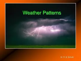
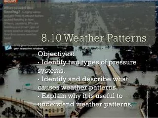
Weather Patterns Lab 6-5 Pages 241 - 252. AIM Understand how the variables we have learned about so far work together to create weather systems. OBJECTIVE Construct field maps and learn to identify patterns than can be used to predict weather. Weather Patterns. Vocab.

E N D
Weather Patterns Lab 6-5 Pages 241 - 252
AIM Understand how the variables we have learned about so far work together to create weather systems. OBJECTIVE Construct field maps and learn to identify patterns than can be used to predict weather. Weather Patterns
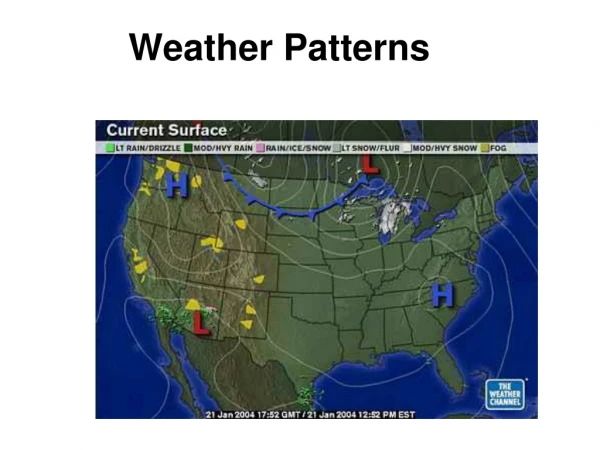
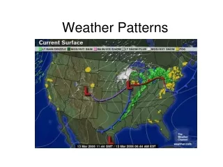
Vocab • Synoptic Weather Map: A map that represents all the atmospheric variables in an area.
Isotherm: Lines on a map connecting points of equal temperature; generally run parallel with the equator as temperatures decrease with increasing distance from the equator.
Barometric Pressure: The weight of the air in the atmosphere • High Pressure; nice weather • Low Pressure; bad/rainy weather
Isobar: Lines on a map connecting points of equal barometric pressure.
Convergence: Wind blowing toward the center (cyclone) • Divergence: Wind blowing away from the center (anticyclone)
Cyclone: Low pressure system with air moving inward toward the center. • Anticyclone: High pressure system with air moving away and outward from the center.
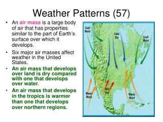
Air Mass: A large body of air with similar pressure, temperature and moisture. Acquired from a source region.
Source Region: An area of Earth’s surface over which an air mass forms and acquires its characteristics.
Front: The boundary between two air masses of different characteristics.
Gradient is the rate of change between two points and is calculated by dividing the difference between two points by the distance. For example: If Galveston, TX and Kansas City, KS are 700 miles apart and the temperature in Galveston is 60º and the temperature in Kansas City is 50º then . . . 60º - 50º = 10º (That’s your difference) Distance = 700 miles 10º/700 = .014º/Mile Gradient = .014º/Mile Calculating Gradient
Map A: Isotherms • Connect points of equal value • Use an interval of 10°F • Stop your lines when they go off the coast.
Map B: Isobars • Write the following in an empty space on the map:
Map B: Isobars- Continued • Draw isobars • Use an interval of 4mb. • Label the highest pressure with an • Label the lowest pressure with an H L
Map D:Precipitation Patterns • Draw a line encompassing the entire area where rain is falling. • Lightly shade it in with pencil. • Label the Air Masses.
Handy Dandy Earth Science Reference Tables, pg 13 • An Air Mass is a large region of air that has the same temperature and humidity. • It gets its properties from hanging out in the same region for a while.
For example: • If the source region is the gulf of Mexico and the air comes to Long Island… • It will feel warm and moist to us: maritime tropical (mT). • If it comes from central Canada… • It will feel cold and dry to us: continental polar (cP)
What type of air mass? mP Cool & moist: mP Cool & Dry: cP mP cT mT mT Warm & Moist: mT
Make the Synoptic Map • Use Instruction #1 as a check list of things to put on the map. • Add the fronts.