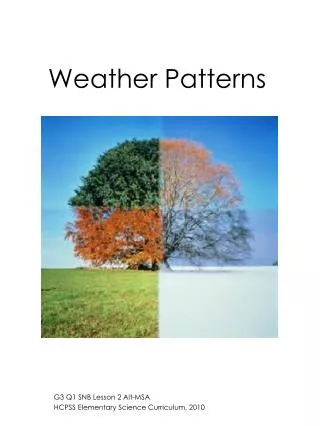
Global Weather Patterns
Global Weather Patterns. November 6 or 7, 2012. Convection. The mixing motion of liquids or gases that are different temperatures Warm liquids or gases rise, while cool liquids or gases sink Happens because of the uneven heating of the earth (remember rotation and tilt of the earth)

Global Weather Patterns
E N D
Presentation Transcript
Global Weather Patterns November 6 or 7, 2012
Convection • The mixing motion of liquids or gases that are different temperatures • Warm liquids or gases rise, while cool liquids or gases sink • Happens because of the uneven heating of the earth (remember rotation and tilt of the earth) • Causes wind in the atmosphere • Causes currents in the ocean
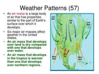
Types of Winds • Polar Easterlies • Prevailing Westerlies • Trade Winds • Doldrums
Jet Stream Fast flowing air found about 7.5 miles (12km) above the earth. Located between Polar Easterlies and Prevailing Westerlies Forms at edges of adjacent cold and warm air masses Constantly changes position Flows west to east because of the Earth’s rotation
El Niño • Trade winds do not blow as heavily as normal in the western and central Pacific Ocean. • Ocean Currents are warmer than normal. • Occurs ever 3 to 7 years • Countries in the western Pacific have droughts, while countries in the eastern Pacific have heavier rains.
Effects of El Niño on the U.S. • Southern Rocky Mountains and the Southeast have increased precipitation in the winter. • Upper Midwest and Northeast have a warmer than average winter. • Gulf Coast tends to be cooler than normal during the winter.
La Niña • Trade winds blow more heavily than normal. • Ocean currents are cooler than normal. • Occurs every 3 to 7 years • Global climate patterns are opposite of those in El Niño.
Currents • Affected by the wind on the surface of the ocean • Flow toward the equator – cooler water • Flow away from the equator – warmer water
Gulf Stream • 40-50 mile wide current that runs through the Atlantic Ocean • Carries warm water from near the equator up to the North Atlantic • Is found near the Eastern Seaboard, traveling up the coast of FL, GA, SC, NC, and points north • Winds blowing across the Gulf Stream warm up, and allows Great Britain to have mild winters.
Hurricanes (Tropical Cyclone) • Powerful, rotating storm that forms near the Equator and fueled by warm water • Winds rotate counterclockwise around a central, calm eye. • Winds of 75 mph or greater • Huge amount of rain • Low air pressure • Thunder and lightning