Download

1 / 31
310 likes | 407 Views
Explore the impact of microscale meteorology in improving tactical forecast grids and decision support systems for more accurate short-term predictions. Research findings and implications for NWS services discussed.

E N D
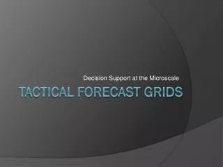
Decision Support at the Microscale Tactical Forecast Grids
How good is “good enough?” • Research conducted in microscale meteorology suggest variations of 20 F and tens of knots are not uncommon at spatial scales less than 1 mile.
Crosstimbers Micronet See: ams.confex.com/ams/pdfpapers/103127.pdf by M.J. Haugland
Temperature(comparison between Micronet and nearby Mesonet sites) Note the cold anomaly mid-way between two Mesonet sites spaced 20 miles apart! MATT HAUGLAND Pasture-Level Influences
Why does it matter? Medicine Creek (~1500 ft) Mount Scott (~2400 ft)
Trains, Trucks, and Mountains Trucks (~1230 ft) Trains (~750 ft)
What if… • We could accurately forecast with 2500 times more detail? • Account for local mesoscale circulations? • What if we could account for land use and urbanization? • Update the forecast each hour? • Produce tailored decision support forecast content?
Tactical Forecast Grids • 100 m grid spacing • 50 X 50 km moveable tactical domain • Updated hourly • Hourly forecast to 8 hours • Time of request to forecast product ~15 minutes
How do we do that? Tactical Forecast Grids
Tactical Grid Forecast Process RUC13 QC, SA Alternative Topo 30m Forecaster Expertise Tactical model configuration, domain grid selection QC, Smart Tools, Decision Support Expert
They look pretty, but are they any good? Tactical Forecast Grids
The Fort Cobb Project • ARS Ft. Cobb Micronet • 5 min T,Td • 15 stations • Compared T, Td between NDFD and TFG at stations • Jan 9 – Feb 28, 2009 • Around clock
Results • 12240 temperature forecast pairs • TFG improved over NDFD 75% of the time • MAE was about 40% improved in TFG (about 1.3 deg F) • MAE improvement was consistent night and day • MAE slightly larger at night
Future Work • Explore techniques to improve WRF initialization • Refine Smart-Init • Expand domains • Run farther in time • Develop GIS compatible formats
What are the implications for NWS services? Tactical Forecast Grids
Implications – Services • More accurate short-term forecasts • Fire weather, dispersion, HAZMAT, special event support, simulating local effects for forecast decisions (e.g. freeze warnings) • The tactical forecast
TTAA00 KOUN 061612 TACOUN TACTICAL DECISION SUPPORT FORECAST NATIONAL WEATHER SERVICE NORMAN OK 1012 AM CST FRI MAR 6 2009 .INCIDENT...DEWEY CO WILDFIRE .FORECAST... TIME (CST) 1000 1100 1200 1300 1400 1500 1600 1700 WIND SPEED (KT) 4 G5 5 G9 7 G11 10 G16 11 G18 12 G19 WIND DIR (DEG) 129 166 195 199 207 209 SKY (%) 60 60 60 60 60 60 TEMPERATURE (F) 59 62 67 70 74 76 STABILITY CLASS C C C C D D REL. HUMIDITY (%) 18 20 21 22 21 21 DEWPOINT (F) 16 21 26 29 32 33 1KFT WIND (MPH) S 4 S 6 S 11 S 14 SW 15 SW 18 2KFT WIND (MPH) SW 11 SW 14 SW 20 SW 24 SW 20 SW 20 3KFT WIND (MPH) W 17 SW 17 SW 21 SW 25 SW 27 SW 26 MIXING HGT (FT) 1023 1496 2176 2564 3178 3754 TRANS WIND (KT) SW 5 S 7 S 10 S 15 SW 15 SW 18 N/A N/A HEAT INDEX WIND CHILL 59 62 67 70 74 76 .LAT/LON...36.03/-98.96 $$ Tactical Forecast • Generated by Tactical GFE formatter • Includes ALOHA parameters • Disseminated via email to event-specific customer list.
Tactical Forecast • Georeferenced formats • GeoTiff • Shapefiles • Highlight areas using thresholds important to decision-making • Regions and times below freezing • Regions and times of poor dispersion • Regions and times of dangerous wildfire spread index • And so on
Implications - Operations • Redefines the role of the forecaster and the forecast process • Too detailed and rapid-paced for hand edits • Forecaster becomes an advisor to decision makers • Forecaster needs to be expert in mesoscale and microscale meteorology • Easily transportable throughout NWS field • Can be customized to meet local needs • Expertise to implement already exists in many offices