Download

1 / 38
380 likes | 527 Views
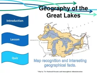
Improving Ocean Literacy By Teaching the Geology of the Great Lakes. David P. Lusch , Ph.D., GISP Dept. of Geography Michigan State University Online Workshop through the College of Exploration January-February, 2008. OCEAN LITERACY - ESSENTIAL PRINCIPLES

E N D
Improving Ocean Literacy By Teaching the Geology of the Great Lakes David P. Lusch, Ph.D., GISP Dept. of Geography Michigan State University Online Workshop through the College of Exploration January-February, 2008
OCEAN LITERACY - ESSENTIAL PRINCIPLES • The Earth has one big ocean with many features • The ocean and life in the ocean shape the features of the Earth • The ocean is a major influence on weather and climate • The ocean makes Earth habitable • The ocean supports a great diversity of life and ecosystems • The ocean and humans are inextricably interconnected • The ocean is largely unexplored
OCEAN LITERACY – FUNDAMENTAL CONCEPTS 2. The ocean and life in the ocean shape the features of the earth 2.1 Some landforms we see today were once underwater • 2.1.1 Forces underneath landmasses and the sea • floor (tectonics) can change the shape of the earth’s surface • 2.1.2 Changes in sea level shape the earth’s surface • 2.1.3 Some rocks found on land were formed in the ocean • 2.2 Movement of water erodes and deposits materials(sediments) • 2.2.1 Rivers carry sediments downstream to the oceans (clastic • sediments) • 2.2.2 The facies concept explains lateral variations in the • lithologic characteristics of sediments of the same geological age
Largest: 209,800 km2 Deepest: 406 m max, 147 m avg area: 193,700 km2 depth:229 m max, 59 m avg Smallest: 82,990 km2 depth: 244 m max, 86 m avg area: 175,800 km2 depth:282 m max, 85 m avg One lake, surface elev: 176 m area: 103,700 km2 Shallowest:64 m max, 19 m avg 20% of all the freshwater on Earth!
Everything yellow, brown, red or black is below sea level! (except in Lake Erie)
Retention Times 191 years 22 years 6 years 99 years 2.6 years
Origin of the Great Lakes • Distal causes • For Lake Superior - plate tectonics and rifting • For the lower Great Lakes - development of the Michigan sedimentary basin • Proximal causes • Glacial sculpting of bedrock, mediated by differences in resistance to erosion • Isostatic uplift of the region shifting the watershed outlet
Canadian Shield Mid-continent rift Michigan Sedimentary Basin Rock Types in the Great Lakes Region
The Mid-continent Rift of North America • Extends > 2000 km; trough >150 km wide • Rift occurred about 1.1 Ga (billion years ago). The rift filled with lavas which became basalts • Along the rift edges, non-volcanic sediments were deposited, perhaps by rivers flowing into the rift • Likely cause of the rift was a geophysical hot spot that domed the crust and cracked it • A "triple junction" plate break occurred under what is now Lake Superior
Wisconsin Dome Pelee Is Thornton, IL Kelleys Is Marblehead Toledo Freemont Great Lakes Structural Geology
Michigan Structural Basin • Michigan Basin was inundated numerous times by oceans during the Paleozoic Period, which eventually filled it with thick sedimentary deposits. • Four general sedimentary rock types fill the Michigan Basin: • Sandstones • Carbonates (limestone and dolostone) • Shales • Evaporites (halite and gypsum)
Michigan Structural Basin • Younger rocks (542 – 145 million years old) • All sedimentary (mostly marine deposits) • Variably resistant to physical erosion • Sandstone and carbonates resist physical erosion • Shale is soft, thinly bedded and easily eroded
Cambrian 500 Ma N Equator X
What a difference 20 million years makes! N N Mississippian 345 Ma Mississippian 325 Ma Equator Equator
No wave energy - no clastics non-clastic sediments settle out No wave energy - fine clastic sediments settle out Wave energy keeps fine clastic sediments in suspension Near-shore zone Off-shore clastic zone Off-shore non-clastic zone Becomes limestone/ dolostone Becomes sandstone Becomes shale Facies Concept • Lateral variations in the lithologic characteristics of a volume of sediments of the same geologic age
Michigan Sedimentary Basin • Structural basin – like nested bowls • Oldest rocks at the bottom, youngest at the top
Differential erosion • Sedimentary rock types are of unequal resistance to physical erosion: • Sandstones and Carbonates are stronger and tend to support highlands • Shales are weaker and tend to underlie lowlands
Niagaran Escarpment • The major resistant-rock (dolomite) landform in the Michigan Structural Basin
Rock Island , Wisconsin Niagaran Escarpment
Fayette State Park, Michigan Niagaran Escarpment
Bruce Peninsula, Ontario Dip slope Scarp slope N Niagaran Escarpment
Kelso & Hilton Falls Conservation Areas, Ontario Hwy 401 N Niagaran Escarpment
Niagara Falls Hwy 401 Lewiston, NY Niagaran Escarpment
Bathymetry of the Lake Huron Basin
The whole of the Great Lakes Watershed was covered by continental glaciers as recently as 17,800 years ago.
Ice Sheet Proglacial Lake The Glacial Great Lakes • Beginning about 14,300 years ago, the melting Ice Sheet began uncovering portions of the Great Lakes Basin that sloped toward the ice margins. • Trapped between the glacier and the higher deglaciated terrain, meltwaters formed a series of proglacial lakes that occupied parts of the basins of every Great Lake.
The Glacial Great Lakes • The earliest proglacial lakes to form were Glacial Lake Chicago (Lake Michigan basin) and Glacial Lake Maumee (Lake Erie basin). • Over the next 4,300 years, glacial lake levels in the Great Lakes Basin progressively fell as the ice margin waxed and waned and as new drainage outlets were uncovered and down-cut by flowing water. • Eventually, the water levels in the Michigan - Huron Basin reached their lowest elevation when drainage shifted to the final outlet at North Bay, Ontario, which flowed eastward along the Ottawa River Valley.
Whittlesey Glacial Lakes in the Huron and Erie Basins Arkona Warren Maumee Post-Algonquin Early Algonquin Nippissing Algoma Modern Grassmere Lundy (Elkton) Main Algonquin Ypsilanti Low-Water Phase Kirkfield Low-Water Phase Stanley and Hough Twocreekan Interstade Greatlakean Stade Mackinaw Interstade Port Huron Stade Port Bruce Stade Glacial Lake Stages
ISOSTATIC REBOUND • With glacial melting, the tremendous weight of the ice was lifted from the North American Plate and the land surface, noticeably depressed during the glacial maximum, begins to rebound upward. This process continues today at a rate of about 7.5 cm per century.
Algonquin 11,000 C14 yrs 184.4 m Nipissing 4500 C14 yrs 184.4 m Algonquin wave cliffs 51.8 m rise in 6500 yrs. Nipissing wave cliff Nipissing wave cliff Isostatic rebound evidence
The End http://www.rsgis.msu.edu/