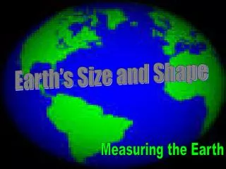
Measuring Earth: Earth’s Size and Shape
600 likes | 1.33k Views
Unit 1. Measuring Earth: Earth’s Size and Shape. Study Guide. Earth’s Shape. What is the true shape of the Earth? . OBLATE SPHEROID. flat at the poles and bulging at the center. Earth’s Shape. Which of the following models is the correct scale model of the Earth? . OR. ?.

Measuring Earth: Earth’s Size and Shape
E N D
Presentation Transcript
Unit 1 Measuring Earth: Earth’s Size and Shape Study Guide
Earth’s Shape What is the true shape of the Earth? OBLATE SPHEROID flat at the poles and bulging at the center
Earth’s Shape Which of the following models is the correct scale model of the Earth? OR ?
Smoothness of the Earth Which is smoother –the Earth or a classroom globe? the Earth the relief of a classroom globe is exaggerated
What is the formula for circumference? Eratosthenes Formula Angle = distance 360 Circumference
Latitude lines are parallel. They NEVER meet
Longitude lines are meridians and meet at the poles. Looks like a peeled orange.
Latitude & Longitude Lines of latitude measure South North and of the equator
180 150 120 90 60 30 0 30 60 90 120 150 180 165 135 105 75 45 15 15 45 75 105 135 165 90 80 70 E 60 50 40 30 F 20 10 0 10 G 20 30 40 50 60 H 70 80 90 North Equator South
How many degrees of latitude are there? 90 degrees
What is the latitude of the equator? 0 degrees What is the latitude of the North Pole? 90 degrees
LATITUDE ALTITUDE OF POLARIS = Demo
POLARIS CAN ONLY BE SEEN IN THE HEMISPHERE NORTHERN
Polaris=North Star=LATITUDE For Drawing: See location of North Star on next slide
If the North Star is 50 degrees above the horizon- 50 degrees North! What is your latitude?
How is Longtiude Measured? Longitude is measured and from the West East Prime Meridian
180 150 120 90 60 30 0 30 60 90 120 150 180 165 135 105 75 45 15 15 45 75 105 135 165 90 80 70 E 60 50 40 30 F 20 10 0 10 G 20 30 40 50 60 H 70 80 90 Longitude How is longitude measured? To get to the next line of longitude, you must move in which of two directions? Prime Meridian
180 150 120 90 60 30 0 30 60 90 120 150 180 165 135 105 75 45 15 15 45 75 105 135 165 90 80 70 E 60 50 40 30 F 20 10 0 10 G 20 30 40 50 60 H 70 80 90 East West Prime Meridian
LONGITUDE IS BASED ON EARTH’S ROTATION
LONGITUDE EACH HOUR THE EARTH ROTATES 15° (360°/24hrs)
People on the same line of longitude have the same Local Time
Later Earlier HOW MANY TIME ZONES?
HOW MANY TIME ZONES? 24 TIME ZONES 15° APART
Example: Two students record a difference in local time of two hours. How many degrees of longitude apart are they? 15° x 2 hours = 30°
What is the latitude and longitude of POINT B? 40 N, 120 W Practice
What is the latitude and longitude of POINT G? Practice 45 S, 80 E
What is the latitude and longitude of POINT D? 10 S, 40 W Practice
What is the purpose? To see the shape and elevation of the land
What is the Contour Interval? 25 The change in elevation between 2 contour lines.
Contour Interval? 20 Elevation of "A"? 540 Elevation of "B"? 580
Why??? If there was another line it would be 620 so the highest value before is 619 feet. Highest possible elevation? 619
What do hachured lines show? areas of depression
What are the rules concerning hachured lines? first hachured line has same elevation as previous contour line then drops by the contour interval
How you can determine which way a river flows on a topographic map? (1) Contour lines point to the source of a river (upstream) (2) The river flows opposite the “V ‘s”.
If north is at the top of the page, what direction is this river flowing? south
What is a topographic profile ? A three dimensional graph of a contour map
What is gradient? gradient = change in elevation distance the slope or steepness of the land
Answer the following based on the map. Note: Hill B has Hachure Lines
Answer the following based on the map. • What is the contour interval of this map? • What is the elevation of POINT E? • What is the elevation of POINT F? • What is the elevation of POINT D? • What is the elevation of POINT A? • What is the elevation of POINT G? • What is the elevation of POINT C? • What is the elevation of POINT B? • Which side of HILL C is the steepest? • Which way is the Cinder River Flowing? 20 meters 0 meters 30 meters 60 meters 139 meters 40 meters 60 meters 40 meters south northwest Try on your own first then check your answers
If the distance between the two circled cities is 400 km, calculate the temperature gradient to the nearesthundredth? Show all work. gradient = change in temperature distance = 80-60 400 = 20 400 = 0.05 °F/km
Answer the following Using your ESRT (1) What is the most abundant element in the earth’s crust by volume? (2) What is the latitude of Slide Mountain? (3) What is the temperature at the boundary of the earth’s mantle and outer core? (4) What layer of the atmosphere contains the most water vapor? oxygen 42 degrees 5000 degrees C troposphere Try on your own first.