Download

1 / 1
10 likes | 34 Views
This study examines the historical landscape of Montalto, part of Thomas Jefferson's plantation, through the use of dendrochronology and GIS analysis. It analyzes tree ages, early photographs, drawings, and historical land surveys to interpret the landscape history, specifically questioning whether Montalto was in field or forest during Jefferson's tenure.

E N D
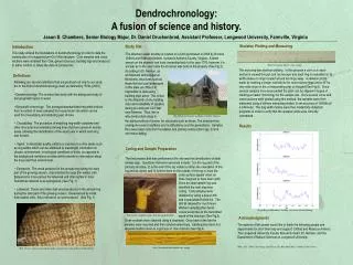
Interpreting Landscape History of Thomas Jefferson’s Plantation Rachel A. Young and Dr. Daniel L. Druckenbrod, Longwood University, Farmville, Virginia Montalto Monticello Montalto Montalto Monticello Monticello Fig. 10 - ArcScene Image with 1937 aerial. The legend represents the trees that we cored. We crossdated the tree rings to determine ages. Fig. 9 – 1934 Oblique Photograph Intersection with Montalto Montalto Monticello 19° Fig. 4 – 1856 Lithograph Fig. 6 - ArcScene Image. The legend represents the trees that we cored. We crossdated the tree rings and determined the ages. Abstract Part of Thomas Jefferson’s historical plantation in the piedmont of Virginia, Montalto, is situated across from Jefferson’s residence at Monticello Mountain. Montalto rises 410 feet above Monticello and forms part of the viewshed. The Thomas Jefferson Foundation recently acquired Montalto with the goal of interpreting and potentially reconstructing this landscape to the view present during Jefferson’s tenure. Currently a field exists on the north-facing slope and summit on Montalto, but the date of this field clearing is unknown. Specifically, we question whether Montalto was in field or forest during Jefferson’s tenure. Using dendrochronology and GIS analyses within ArcScene, we analyzed tree ages, early photographs and drawings, and historical land surveys to interpret the landscape history. We extracted and crossdated core samples to determine tree ages around the current field. Repeat photography also provided an interpretation of historical documents and imagery. Three Jefferson–era trees were located near the current field boundary suggesting that a portion of Montalto has remained forested since the 1800s. A spatial analysis of Jefferson’s writings and surveys also indicates that at least a portion of Montalto was forested and does not depict a field. The earliest evidence of a field in this location is from an 1844 drawing, after the sale of Montalto by Jefferson’s heirs. These analyses show no evidence of a field on Montalto during Jefferson’s tenure; however, they do show evidence of intense land use after Jefferson’s death, increasing the difficulty of dating the field using tree rings. Historical Evidence 4: 1844 Russell Smith Drawing Historical Evidence 2: 1902 Photo along the ‘Old Monticello Road’ Fig. 8 - ArcScene Image with 1937 aerial photograph. The legend represents the trees that we cored. We crossdated the tree rings to determine ages. Fig. 7 – 1844 Russell Smith Drawing Interpretation: The 1844 Russell Smith Drawing shows an open field on Montalto and is the earliest evidence of a field clearing on Montalto after Jefferson death in 1826. We created an ArcScene image with the current field boundary on Montalto to match the Lithograph. Comparing the two, the field boundary portrayed in the Lithograph appears wider than the current field boundary. From our tree ring analyses, we determined that Montalto’s forest had been logged during the last century. The ArcScene image shows the forest on the right side encroaching on the field. While the 1844 Russell Smith drawing does not show a forest on the right side of the field. Fig. 2 – 1902 Photo along the ‘Old Monticello Road’ Fig. 3 – 2008 Photo along the modern Monticello Road Interpretation: This photograph from a 1902 USDA Bulletin is titled “Spout Spring and watering trough on Old Monticello Road.” The photograph shows a young, heavily disturbed forest along the Old Monticello Road which extends along the gap between Monticello and Montalto. The forest in the background is adjacent to the current field boundary and suggests intense land use in the last decades of the 1800s. The modern photographs are in the location labeled as the “Spout Spring”; however, the slope appears steeper and no evidence of the house is present currently on the landscape. Assuming this location is correct, this slope adjacent to the Montalto field contains trees approximately 100 years of age, which agrees with the ages shown in the 1902 photographs and suggest intense forest clearing prior to that time. Methods We used ArcScene (version 9.2) to reconstruct historical views of Monticello Mountain and Montalto. We uploaded digital elevation models (DEM) which are elevation data that creates the foundation for the three dimensional displays (Kennelly 2003). These three dimensional images display changes to the field boundary and adjacent forests on Montalto over time using 1930s aerial photography, drawings and lithographs. Aerial photographs were also georeferenced (Rumsey and Williams 2002) and placed on top of the current field boundary layer to discern changes. In order to determine the age of the field boundary, we cored trees and took GPS points of each tree cored. Tree rings were crossdated (Stokes and Smiley 1968) and verified with COFECHA (Holmes 1983) to produce point values showing the earliest ring on each tree. ArcScene allowed us to see the aerial views of the trees cored as well as the surrounding land around Montalto. Creating three dimensional views of old photographs have also allowed us to interpret historical quotations, drawings, and paintings. Historical Evidence 5: Aerial View of Monticello Mountain and Montalto Historical Evidence 3: 1856 Lithograph Historical Evidence 1: Thomas Jefferson Quotation Montalto Monticello Interpretation: We constructed an ArcScene image to recreate the oblique photograph that was taken in 1934, the earliest aerial photograph of Monticello and Montalto. This ArcScene analysis shows the trees we recorded were well behind the field boundary in 1934 overlaid with the 1937 aerial. As a result, the few trees that we found dating to Jefferson’s life (1743 – 1826) were not near the field boundary in 1934. Fig. 5 – Current photo of Monticello Mountain and Montalto from the University of Virginia campus References Holmes, R. L. 1983. Computer-assisted quality control in tree-ring dating and measurement. Tree-Ring Bulletin 44: 69-75. Kennelly, P. J. 2003. Creating Three-Dimensional Displays With ArcScene. ArcUser 6: 58-60. Rumsey, D. and M. Williams. 2002. Historical Maps in GIS. In A. K. Knowles (ed.), Past Time, Past Place: GIS for History (pp. 1-18). Redlands: ESRI Press. Stokes, M. A. and T. L. Smiley. 1968. An Introduction to Tree-Ring Dating. Chicago, University of Chicago Press. U.S. Department of Agriculture, Office of Public Roads. 1902. Proceedings of the Jefferson Memorial and Interstate Good Road Convention, held at Charlottesville, VA, April 2-4, 1902. Office of Public Road Inquiries Bulletin 25. Washington, DC: GPO, 1902. Fig. 1 - ArcScene Image with a 1994 orthophotograph. The legend shows age ranges of trees cored with red corresponding to trees during Jefferson’s life (1743 – 1826). We crossdated the tree rings to determine ages. “Placing the Theodolite on the top of the house, the Eastern spur of the High mountain intersects the Horizon 19º. westward of Willis’s mountain. note the observation was made on the intersection of the ground (not the trees) with the horizon” ~ Thomas Jefferson November 12, 1778 Interpretation: Our task was to determine whether Thomas Jefferson was referring to Montalto (High Mountain) as being 19º difference in elevation with Willis Mountain or whether Montalto is 19º from Willis Mountain. We found that the Willis Mountain Jefferson refers to the Willis Mountain in Buckingham County. We know that Jefferson was standing on top of Monticello Mountain when using the theodolite to measure the 19º difference. Using ArcScene we uploaded the Digital Elevation Models (DEM) for Monticello, Montalto and Willis Mountains. We determined that Willis Mountain is 19º along the horizon from Montalto’s eastern flank. Unfortunately, this angle intersects Montalto at a location east of the field boundary and does not allow us to interpret whether the field was present during Jefferson’s life. Interpretation: This 1856 lithograph shows the University of Virginia’s Rotunda in the foreground and Monticello Mountain and Montalto in the background. In the drawing, the Rotunda shown is not the current Rotunda of the University of Virginia. The Rotunda shown in the painting burnt in a fire and the current Rotunda was built in its place. We tried to replicate this drawing using ArcScene. We uploaded the Digital Elevation Models (DEM) of Monticello Mountain, Montalto and the University of Virginia Campus. We realized that the mountains in the ArcScene image are at a different perspective than the drawing. We took a modern photo from the University of Virginia to determine where this painting was produced. We believe that the artist drew the Rotunda first and then possibly changed positions in order to draw the mountains in the background. This idea is possible evidence for the mountains to be at different angles in the Lithograph and in the ArcScene image. Another reason the mountains are at different angles could be because the position on the ArcScene image is not in the same place as the original. Acknowledgements The authors would like to thank William Beiswanger, Fraser Neiman, Leah Stearns, and Derek Wheeler for their assistance. This research was supported by the Thomas Jefferson Foundation and Longwood University. The images uses in the analyses were provided by the Jefferson Library of the Thomas Jefferson Foundation. Thanks to Dr. Daniel Druckenbrod for allowing me the opportunity to help him with this independent study for the Thomas Jefferson Foundation. I would also like to thank Dr. Druckenbrod for all of his guidance and time spent teaching me different field techniques to aid us with this project.