Download
1 / 48
480 likes | 608 Views
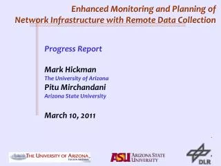
Enhanced Monitoring and Planning of Network Infrastructure with Remote Data Collection. Presentation to Technical Advisory Board by the Research Team: The University of Arizona Arizona State University German Aerospace Research Center (DLR) April 27, 2010. Outline.

E N D
Enhanced Monitoring and Planning ofNetwork Infrastructure with Remote Data Collection Presentation to Technical Advisory Boardby the Research Team:The University of ArizonaArizona State UniversityGerman Aerospace Research Center (DLR)April 27, 2010
Outline • Brief Scope of Proposed Project • Background and Review of Experience • Details of Proposed Tasks – Task 1 • Details of Proposed Tasks – Task 2 • Details of Proposed Tasks – Task 3 • Role of partners and collaborators
Brief Scope of Project Brief Scope Background Task 1 Task 2 Task 3 Role of Partners Three Major Tasks: • Data fusion of simultaneous data collected from airborne and ground sensors for infrastructure monitoring • Use of remotely collected data for developing better models for network planning and emergency operations • Develop tools and enhance “enabling” technologies for airborne data collection. Will give details shortly!
Key Investigators Brief Scope Background Task 1 Task 2 Task 3 Role of Partners • University of Arizona • Mark Hickman (PI) (PhD, MIT) Associate professor in transportation engineering in the Department of Civil Engineering and Engineering Mechanics (CEEM). • Yi-Chang Chiu (PhD, U. Texas). Assistant professor in transportation engineering in CEEM. Research: Use of airborne imaging technologies to analyze traffic flows, both for level-of-service analysis and for detailed vehicle trajectory data. Research: Traffic Modeling and Simulation • Arizona State University • Pitu Mirchandani (Sc.D., MIT). Professor in the Department of Computation, Informatics, and Decision Sciences (CIDS). • Ron Askin (PhD, Georgia Tech). Professor and Department Head on CIDS.. Research: Remote sensing of traffic. Theories, models and algorithms for decision making in transportation and traffic systems. Research: Applied Statistics • German Aerospace • Martin Ruhé(Dipl.-Ing, Stuttgart) Associate Head, Institute of Transportation Research, DLR • Reinhart Kühne(Ph.D. in Physics, University of Stuttgart), Director and Head of the Institute for Transportation Studies, DLR Research: Automated image analysis for traffic data collection and pollution measurement. Research: Traffic flow theory. Transportation engineering.
Potential Benefits of Research Brief Scope Background Task 1 Task 2 Task 3 Role of Partners Better calibration of infrastructure planning models: weaving, estimating queue lengths, traffic impacts of development, bottleneck analysis, etc. Availability of affordable technologies to do the above for routine and commercial applications. Real-time estimation of network conditions using multiple data sources including airborne sensors Logistics for airborne systems for real-time monitoring and incident/disaster management.
Background and Review of Experience Brief Scope Background Task 1 Task 2 Task 3 Role of Partners Past RITA/USDOT sponsored research • Mark Hickman and Pitu Mirchandani were part of the NCRST-F team, where they (1) developed preliminary algorithms for stabilizing images from moving platforms, (2) automatically tracked vehicles, (3) computed vehicle speeds and queues from these tracked vehicles, (4) developed approaches to compute measures of traffic performance on freeways and arterials, … • Hickman-Mirchandani were also part of the CRESTA consortium where we used remote sensing to study queues and delays at border crossings Will discuss some results shortly!
Background and Review of Experience Brief Scope Background Task 1 Task 2 Task 3 Role of Partners • Hickman-Mirchandani-Chiu have been developing and studying evacuation models and scenarios, with support from Arizona DOT and NSF, where they (1) developed simulation models, (2) developed strategies for mass evacuation, and (3) analyzed hypothetical scenarios in the Phoenix area • Mirchandani and colleagues at the ATLAS center have data fusion approaches for real-time prediction of travel times on arterials, and developed a web-based interface
Background and Review of Experience RITA- USDOT Data Collection Technologies
Background and Review of Experience RITA- USDOT Brief Scope Background Task 1 Task 2 Task 3 Role of Partners NCRST-F: Traffic performance measures and studies • Traffic flow, density, speed, travel time • Intersection delay • Freeway level of service • Origin-destination flows
Background and Review of Experience RITA- USDOT Brief Scope Background Task 1 Task 2 Task 3 Role of Partners NCRST-F: Tracking individual vehicles • Travel times on urban arterials • Trajectories of vehicles • Estimating speeds
Background and Review of Experience Density Platoon Dispersion Distance Headway Time Headway Flow RITA- USDOT Brief Scope Background Task 1 Task 2 Task 3 Role of Partners NCRST-F: Tracking individual vehicles • Travel times on urban arterials • Trajectories of vehicles
Background and Review of Experience Brief Scope Background Task 1 Task 2 Task 3 Role of Partners NCRST-F: Tracking individual vehicles • Travel times on urban arterials • Trajectories of vehicles • Estimating speeds
Background and Review of Experience RITA- USDOT Brief Scope Background Task 1 Task 2 Task 3 Role of Partners NCRST-F: Tracking individual vehicles • Travel times on urban arterials • Trajectories of vehicles • Estimating speeds Georeferencing
Background and Review of Experience RITA- USDOT Brief Scope Background Task 1 Task 2 Task 3 Role of Partners NCRST-F: Technology Development of TRAVIS Vehicle Tracking Software
Background and Review of Experience RITA- USDOT Brief Scope Background Task 1 Task 2 Task 3 Role of Partners Current TRAVIS User Interface for off-line Tracking
Arterial Video Background and Review of Experience Brief Scope Background Task 1 Task 2 Task 3 Role of Partners Unregistered Video orig_tuc.avi Registered Video tuc_int_340.avi Registered Video with Tracking track_cars_cc.avi
Background and Review of Experience Brief Scope Background Task 1 Task 2 Task 3 Role of Partners DLR: ANTAR and TrafficFinder
Background and Review of Experience Brief Scope Background Task 1 Task 2 Task 3 Role of Partners • DLR’s TrafficFinder’s outputs (real-time)
Background and Review of Experience Brief Scope Background Task 1 Task 2 Task 3 Role of Partners • DLR TrafficFinder’s predicted trajectories
Background and Review of Experience RITA- USDOT Brief Scope Background Task 1 Task 2 Task 3 Role of Partners As members of the CRESTA consortium, Hickman and Mirchandani used remote-sensing technologies for investigating queues and delays at border crossings Composite Photo Feb. 27, 2008 2:00 pm
Background and Review of Experience RITA- USDOT Brief Scope Background Task 1 Task 2 Task 3 Role of Partners Mariposa Port of Entry Operations 1: Pre-screening stations 2: Primary inspection 3: Secondary inspection 4: X-ray inspection 5: Arizona DOT inspection 6: Last weight check station
Background and Review of Experience RITA- USDOT Brief Scope Background Task 1 Task 2 Task 3 Role of Partners Results from simulation modeling and calibration
Background and Review of Experience RITA- USDOT Brief Scope Background Task 1 Task 2 Task 3 Role of Partners Queuing Analysis at Stations
Background and Review of Experience RITA- USDOT Image Analysis for Queue Lengths
Background and Review of Experience RITA- USDOT Brief Scope Background Task 1 Task 2 Task 3 Role of Partners CRESTA Project : Using DLR TrafficFinder for tracking vehicles
Background and Review of Experience RITA- USDOT Brief Scope Background Task 1 Task 2 Task 3 Role of Partners CRESTA Project : Using DLR TrafficFinder for tracking vehicles
Background and Review of Experience Evacuation Destination Nodes Evacuation Hypothetical Origin Nodes Sink Node Evacuation Zones Intermediate Nodes Intermediate Zones Chiu-Hickman-Mirchandani have also done extensive simulation and traffic management for evacuations Safe zone Need a fast WAY OUT from evacuation zones to safe zones
Background and Review of Experience Evacuation Destination Nodes Evacuation Hypothetical Origin Nodes Sink Node Fixed and Mobile Sensors measurements Model-based Estimation of System State Model-based Optimization of Traffic Flow Sensor media Feedback & Actions Safe zone Management and control decisions Evacuation Zones Objective: e.g. min evacuation. time Intermediate Nodes Intermediate Zones Brief Scope Background Task 1 Task 2 Task 3 Role of Partners
Background and Review of Experience Brief Scope Background Task 1 Task 2 Task 3 Role of Partners Simulation plays major role in the systematic evaluation • For tactical/operational planning– off-line “what if” scenario analysis • For analysis of operations decisions– used as testing real-time strategies (since strategies cannot be easily tested during real events) The research team is developing MALTA simulation software for this purpose.
Background and Review of Experience Brief Scope Background Task 1 Task 2 Task 3 Role of Partners MALTA (Multi-resolution assignment and loading of traffic activities)simulation architecture
Background and Review of Experience Brief Scope Background Task 1 Task 2 Task 3 Role of Partners Procedure for simulation-based analysis • collect network and traffic data • develop network model • calibrate model with available data • develop evacuation scenarios • develop evacuation strategies • study strategies based on simulation model outputs • as case studies: Feedback control for management of evacuating traffic during floods (short-notice) Operational and tactical planning for no-notice bomb threat at a Phoenix Cardinals game
Background and Review of Experience Brief Scope Background Task 1 Task 2 Task 3 Role of Partners SPARTA : System for prediction and analysis of real-time traffic on arterials: real-time data collection, real-time arterial monitoring (travel times, queues, turn ratios,…), and traffic images on the web. Data fusion plays a major role in computing arterial performance measures. Also can get real-time images on the web.
Background and Review of Experience Video Detectors Grant Traffic Cabinets Euclid Park Mountain Elm Country Club Cherry Tucson Speedway RHODES Communications Cabinet Fiber & Wireless 3rd Garage ATLAS Brief Scope Background Task 1 Task 2 Task 3 Role of Partners SPARTA uses the Living Laboratory at UA (supported by Tucson) Campbell
Task 1:Near Real-Time Traffic Monitoring with Ground-based and Remotely Sensed Data Problem Motivation and Existing Literature Real-Time Tracking Problem definition Problem P1 Problem P2 Problem P3 Conclusions and Further Steps Major focus on Data Collection and Data Fusion. • Existing data sources. • 1-sec loop data from City of Tucson, City of Tempe, Maricopa County DOT • Video data from Living Laboratory (City of Tucson) • Historical travel times on freeways and major arterials from probe vehicles, from MAG and PAG congestion studies • Historical traffic volumes on freeways and major arterials, from MAG and PAG count programs • Probe vehicle data from buses, from Sun Tran (City of Tucson) and Valley Metro (City of Tempe) • New Data Collection. • 20 hours of flight time (10 hours per year) for airborne surveillance on Speedway and I-10 in Tucson and in Tempe and US 60 in Phoenix • Ground-based video Need significant cooperation and support from public agencies
Task 1: Near Real-Time Traffic Monitoring with Ground-based and Remotely Sensed Data Brief Scope Background Task 1 Task 2 Task 3 Role of Partners • Develop Model-based Statistical Approaches to estimate • Flows • Speeds • Queue lengths on arterials • Densities on freeways. • Calibrate model with ground truth • More Data Collection (year 2) • to validate model (for use in real-time data fusion) Develop software tool based on data fusion approach
Task 1: Near Real-Time Traffic Monitoring with Ground-based and Remotely Sensed Data Brief Scope Background Task 1 Task 2 Task 3 Role of Partners Develop routing and scheduling logistics for mobile platforms • With current fixed sensors • With new fixed sensors • (include location decisions • in logistics model)
Task 1: Near Real-Time Traffic Monitoring with Ground-based and Remotely Sensed Data Brief Scope Background Task 1 Task 2 Task 3 Role of Partners • Subtask 1.5: Mobile platform routing and scheduling logistics • This subtask focuses on the real-time routing and scheduling of airborne platforms, such as helicopters, airplanes or UAVs, to collect meaningful real-time traffic data in a roadway network. Both the roadway networks in Tucson and Phoenix metro area will be used as case studies to evaluate these heuristics. • Optimization models development for determining the logistics of mobile data collection • Methods development to solve these very complicated problems. Off-line study: for planning monitoring activities On-line scheduling: for real-time monitoring
Task 2: Use of Airborne Sensors for Enhanced Network Planning and Emergency Operations Brief Scope Background Task 1 Task 2 Task 3 Role of Partners Currently we calibrate MALTA with census and ground data. In this task (2.1) we will also use data from remote sensors – airborne imagery and vehicles with GPS locations
Task 2: Use of Airborne Sensors for Enhanced Network Planning and Emergency Operations Brief Scope Background Task 1 Task 2 Task 3 Role of Partners Task 2.2 will include arterial contra-flow and signal metering at intersections for evacuation.
Task 2: Use of Airborne Sensors for Enhanced Network Planning and Emergency Operations Brief Scope Background Task 1 Task 2 Task 3 Role of Partners Task 2.3 will allow us to simulate data collection from airborne sensors for performance measurement.
Task 2: Use of Airborne Sensors for Enhanced Network Planning and Emergency Operations Brief Scope Background Task 1 Task 2 Task 3 Role of Partners It is essential that one monitors the unfolding evacuating scenario in developing evacuation strategies. Task 2.4 will allow us to test different sensor configurations during emergencies, e.g., strategies with only ground-based sensor data, with only airborne sensor data, and a some intermediate levels of both sensor types .
Task 3: Enhancement of Software Tools for Individual Vehicle Tracking and Simulation Brief Scope Background Task 1 Task 2 Task 3 Role of Partners The goal of Task 3 is to develop affordable technologies to monitor traffic performance for routine and commercial applications. Effectively this will enhance TRAVIS so that it is more user friendly and can be used for real-time applications. Subtask 3.1: Enhancement of GUI and manual tracking features We will improve the interface for manual tracking, so that a user may be allowed to identify existing vehicles and vehicles subsequently entering the field of view, so that they are tracked by the software.
Task 3: Enhancement of Software Tools for Individual Vehicle Tracking and Simulation Brief Scope Background Task 1 Task 2 Task 3 Role of Partners Subtask 3.2: Development and testing of road mask concepts Exact identification of vehicle positions from airborne imagery, to better locate vehicles within specific lanes, requires the clear identification of roadways. Road masks will allow us to do this in real-time since it will decrease image size for processing. We will work with DLR to research and develop a real-time approach.
Task 3: Enhancement of Software Tools for Individual Vehicle Tracking and Simulation Brief Scope Background Task 1 Task 2 Task 3 Role of Partners Subtask 3.3: Investigation of remote sensing for monitoring vehicle emissions DLR is investigating remote sensors for monitoring emissions and integrating emissions sensing in ANTAR. The UA-ASU-DLR research team will study the incorporation of remote emission sensing also in TRAVIS.
Role of Partners The public agencies can provide data and can work with us on the calibration of models. Brief Scope Background Task 1 Task 2 Task 3 Role of Partners • City of Tucson / Living Laboratory: loop detector data, probe vehicle data from buses, intersection camera imagery • City of Tempe: loop detector data, probe vehicle data from buses • Arizona Department of Transportation: freeway detector data, ramp meter data • Maricopa Association of Governments: historical traffic volumes, probe vehicle data, still imagery • Pima Association of Governments: historical traffic volumes and probe vehicle data • Maricopa County Department of Transportation: loop detector data
Summary Brief Scope Background Task 1 Task 2 Task 3 Role of Partners • The proposed project consisting of 3 major tasks: • Data fusion for traffic and infrastructure monitoring • Use of remotely collected data for developing better models for network planning and emergency operations • Develop “enabling” technologies for airborne data collection • The anticipated benefits are: • Better calibration of infrastructure planning models • Real-time estimation of network conditions in emergency and disaster conditions • Development of affordable technologies for airborne traffic • monitoring for routine, emergency and commercial applications
Conclusion Brief Scope Background Task 1 Task 2 Task 3 Role of Partners End of Presentation! Any questions?