Download
1 / 16
160 likes | 341 Views
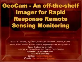
GeoCam - An off-the-shelf Imager for Rapid Response Remote Sensing Monitoring. Franky De La Garza, Jay Gerber, Sara Guest, Raymond Mendoza, Ramon Rivera, Karen Villatoro, Pamela Withrow, Angelo Bianchini, Randy Doolittle Space Engineering Institute

E N D
GeoCam - An off-the-shelf Imager for Rapid Response Remote Sensing Monitoring Franky De La Garza, Jay Gerber, Sara Guest, Raymond Mendoza, Ramon Rivera, Karen Villatoro, Pamela Withrow, Angelo Bianchini, Randy Doolittle Space Engineering Institute John Yezak, Ramon Rivera, Igor Carron, Pedro Davalos Spacecraft Technology Center Texas A&M University Contact: i-carron@tamu.edu Website: http://sei.tamu.edu/geocam/
Outline • Motivation • Necessary Equipment • Comparison to Satellite Imagery • Benefits of our System • Raw Data • Producing Maps • Final Result – Remote Sensing Cartography • Map Details • Katrina Case Study – Proof of Concept • Conclusion • Acknowledgements and References
Motivation • In disasters of enormous proportion such as Hurricane Katrina, the Asian Tsunami, large swaths of terrain are suddenly rendered inaccessible or impossible to image. • Satellite access time to these areas means not having access to imagery for periods of time ranging from hours to days. • The delay in access time to imagery is critical at the level of first time responders • It is becoming obvious that the general population (including affected areas) want similar information.
Motivation • High altitude balloons or UAVs can be deployed in a matter of hours and provide first responder's situational awareness and give adequate trajectories to rescuers. • Diffusion of imagery to a large segment of the population looking for information is also possible thereby reducing the strain on the telecommunication systems of the affected area.
Equipment Description All essentially “off the shelf” • Canon PowerShot S3 IS • 6 Megapixel Resolution • 10x Optical Zoom • 4GB SD Memory Card • Total Cost $500 • Minimal Power Electronic and Communication Circuitry • Few Servomotors for Actuation • Total payload 1kg
Comparison to Satellite Imagery 2nd most fine level of Google Maps™ Digital Globe Map data GeoCam with no satellite positioning And off the shelf components
Benefits of Our System • Low cost ~$500, compared to millions for a satellite or satellite time • Readily flexible to rapidly evolving technology • Improved technology easy to integrate • No need for GPS or IMUs • Rapid dissemination of data - hours instead of days • Free of platform, UAV, Balloon, Aircraft, Rotorcraft all suitable
Producing Maps • Automatic Stitching algorithms were evaluated with the HeoCam-HASP data • An algorithm developed by Matthew Brown does this automatically through the use of SIFT points and a RANSAC algorithm determining good fit • A concept software is available at the AutoStitch web page but we eventually used the Autopano Pro software to produce large maps • Large JPEGs or TIFF were then processed through the Zoomify software in order to allow for browsing of the very large maps on the internet
Map Details • Images taken at 112,000ft (~36km) • 4GB of Total Data Gathered • 2GB of Data Usable (due to TS John cloud cover) • Automatically “stitched” together 1600 images • At a similar level to the 2nd finest resolution of Google Maps™ • ~200 miles imaged in 9 hours of flight • One pixel approximately 3.3ft • Primary expense (camera) retrieved from HASP • Wider area of land could be captured, camera at 20° from nadir
Post Katrina images from USGS Using Autopano to automatically stitch together images
Example of Technology usingHurricane Katrina images from USGS • You can stitch together just a few images as seen to the left • Or you can stitch together a whole area, such as New Orleans below
Conclusions • High resolution maps can be put together in a matter of hours after acquisition through either UAVs or Stratospheric ballons using off-the-shelf technology • Imagery can be shared with all stakeholders including general citizenry in the same timeframe • Our team will continue on perfecting these techniques and others (3d photogrammetry, other types of sensors) by testing payloads on balloons in Spring 2007
Acknowledgements and References • The GeoCam team would like to recognize a few people for their continued support and help throughout the project.Al Luginbill, Spacecraft Technology Center Erin Bishop, Space Engineering Institute Jan Rinehart, Space Engineering Institute Olivier Godard, Spacecraft Technology Center • We also would like to thank Greg Guzik and his staff at LSU as well as the staff at the Columbia Scientific Balloon Facility. • We would also like to acknowledge both LaSpace and NASA for providing the HASP flight opportunity. • Finally, a special thanks to Alexandre Jenny from Autopano (www.autopano.net) who tirelessly improve his software to help us produce these giant panoramas. Autopano software:http://www.autopano.net Zoomify: http://www.zoomify.com GeoCam website: http://sei.tamu.edu/geocam GeoCamblog: http://hasp-geocam.blogspot.com NOAA Katrina images: http://ngs.woc.noaa.gov/katrina/