Southeast Region
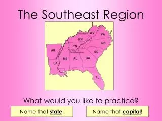
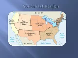
Southeast Region. Latitude and Longitude. Climate. Key. Barrier Island. The Fall Line. 0-90 degrees. latitude. The lines north and south of the Equator are called lines of latitude. The Equator is at the 0 degree point. . longitude.


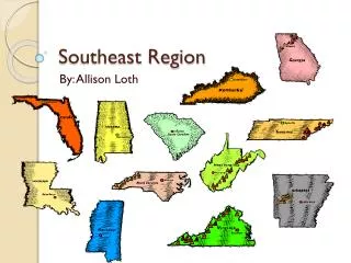
Southeast Region
E N D
Presentation Transcript
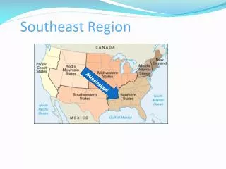
Southeast Region
Latitude and Longitude Climate Key Barrier Island The Fall Line
0-90 degrees latitude The lines north and south of the Equator are called lines of latitude. The Equator is at the 0 degree point. longitude The lines of longitude run east and west of the Prime Meridian (Greenich, England). The Prime Meridian is at the 0 degree point of longitude. 0 – 180 degrees
Fall Line The Fall Line is located in the eastern edge of the Piedmont Plateau. It marks the point where waterfalls on the rivers flow into the coast. Rivers change from streams to slowly moving rivers. Many important cities have been located on the Fall Line.
Barrier Islands Barrier islands are sandy strips of land that protect the mainland from the sea.
Water Physical Features Mountains Landforms
Lake Okeechobee, Seminole for "big water", covers about 700 mi2. It is the second largest freshwater lake contained entirely within the lower 48 states. Lake Okeechobee is a shallow water body with average depths of about 10 feet and maximum depths less than 20 feet. Recharge of the lake comes from rainfall and the Kissimmee River to the north. • The Gulf provides 40 percent of the entire US commercial fisheries harvest. • The Gulf provides 40 percent of the entire US commercial fisheries harvest. Gulf of Mexico • The Gulf provides 40 percent of the entire US commercial fisheries harvest.
Ohio River : 1,310 miles long There are about 250 tributaries of the Mississippi, which drain a total area of more than 1,247,000 square miles--one third of the nation's landmass! 2,340 miles long Mississippi River Ohio River
Appalachian Mountains The Appalachian Mountains are the oldest mountain chain in North America.
Landforms Cape Canaveral: nation’s rocket launching center Cape Hatteras
The Everglades is the largest subtropical wilderness in the contiguous United States. Everglades: Wildlife refuge Saint Augustine: oldest city in the United States
Fort Sumter National Monument: First shots of the Civil War were fired here. Williamsburg
tidewater swamp A lowland region saturated with water. The dictionary defines Tidewater as the coastal area whose streams are affected by the rise and fall of ocean and bay tides and whose water, consequently, is brackish. Brackish conditions occur in estuarine zones where freshwater and saltwater mix
Important Crops: Cotton, soybeans, peanuts, TOBACCO Citrus fruits
seafood Natural gas clay Natural Resources COAL sand stone